Uncovering Earth’s History: The Power of Stratigraphy
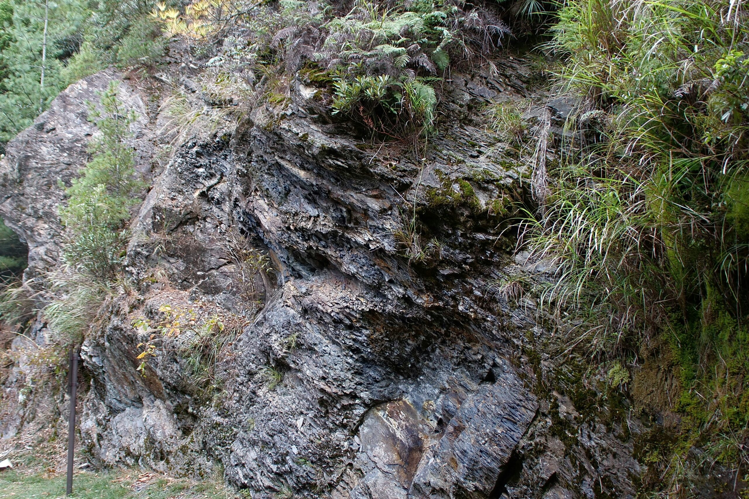
The Earth is a vast repository of time, a silent witness to billions of years of geological change, evolutionary leaps, and catastrophic events. To decipher this epic narrative, geologists turn to a fundamental principle known as stratigraphy. This scientific discipline focuses on the study of rock layers, or strata, which act as pages in the planet’s immense autobiography. By meticulously examining these layers – their composition, sequence, and relationships – scientists can reconstruct the history of Earth, understand ancient environments, and even predict future geological processes. Stratigraphy offers a powerful lens through which to view the deep past, providing tangible evidence of a world vastly different from our own.
The very ground beneath your feet is a testament to this layered history. Imagine a colossal cake, each layer representing a distinct period in Earth’s formation and evolution. Stratigraphy is the art of reading these slices, understanding what events and conditions produced each one. It is a detective story played out across geological timescales, where each rock bed is a clue, and the entire sequence forms the solution.
The bedrock of stratigraphical understanding lies in a simple yet profound principle: the Law of Superposition. This law, first articulated by Nicolaus Steno in the 17th century, states that in any undisturbed sequence of sedimentary rock layers, the oldest layers will be found at the bottom, and the youngest layers will be at the top. This principle is as fundamental to geology as gravity is to physics. It provides the initial framework for determining the relative chronological order of rock formations.
Steno’s Revolutionary Observations
Nicolaus Steno, a Danish physician and anatomist, made his groundbreaking observations while studying rock formations in Tuscany, Italy. He noticed that certain objects found within the rocks, such as fossils, were oriented in ways that suggested they had been deposited as sediments. His meticulous study led him to formulate his three laws of stratigraphy: the Law of Superposition, the Law of Original Horizontality, and the Law of Lateral Continuity. While superposition is the most widely applied today, the other laws also provide crucial context for interpreting rock sequences. The Law of Original Horizontality posits that sediment layers are deposited horizontally, meaning any tilting or folding indicates subsequent geological forces. The Law of Lateral Continuity suggests that sediment layers originally extend laterally in all directions until they thin out or encounter a barrier.
Unraveling Relative Time
The Law of Superposition allows geologists to establish a relative timeline for rock layers. Without needing to assign absolute numerical ages (which came much later with radiometric dating), one can definitively say that a layer of sandstone found below a layer of shale is older than the shale. This is crucial for understanding the sequence of events, such as the deposition of vast desert sands preceding the formation of ancient seabeds. It’s like lining up photographs in chronological order before you know the exact date each was taken. The Law of Superposition provides this essential ordering.
Distinguishing from Other Geological Principles
While the Law of Superposition is paramount, it is often used in conjunction with other stratigraphical principles. For instance, the Principle of Cross-Cutting Relationships, which states that geological features that cut across rock layers are younger than the layers they cut, is vital. A fault that displaces a series of rock layers must have occurred after the layers were in place. Similarly, an igneous intrusion that bakes or melts the surrounding rock is younger than that rock. These principles, layered together like geological strata themselves, build a robust understanding of Earth’s history.
Stratigraphy is a crucial field in geology that studies rock layers and layering, providing insights into Earth’s history and the processes that shaped it. For those interested in exploring more about the various aspects of stratigraphy and its applications in understanding geological time and environmental changes, a related article can be found at Freaky Science. This resource delves into the significance of stratigraphic studies and their impact on fields such as paleontology and archaeology.
The Lithological Clues: What Rocks Tell Us
The physical characteristics of rock layers, collectively known as lithology, provide a wealth of information about the environments in which they formed. The type of rock, its grain size, color, and texture all serve as fingerprints of ancient depositional settings and processes. By examining these lithological clues, geologists can reconstruct the landscapes and conditions of the past with remarkable precision.
Sedimentary Rocks as Nature’s Archives
Sedimentary rocks are the primary focus of stratigraphy, as they are formed from the accumulation and cementation of sediments. These sediments can originate from the weathering and erosion of pre-existing rocks, volcanic ash, or the remains of organisms. The nature of these sediments, and how they are transported and deposited, dictates the type of sedimentary rock that forms.
Sandstones: Echoes of Deserts and Rivers
Sandstones, composed primarily of sand-sized grains, are often indicative of environments where flowing water or wind could transport and deposit sand. Large-scale cross-bedding within sandstones can suggest ancient sand dunes, pointing to arid desert conditions. River channel deposits, characterized by coarser grains and specific sedimentary structures, reveal the pathways of ancient fluvial systems. The color of sandstone can also provide clues: red sandstones often indicate the presence of iron oxides, suggesting deposition in oxygen-rich, terrestrial environments for extended periods.
Shales and Mudstones: Depths of Ancient Seas and Lakes
Shales and mudstones, formed from fine-grained clay and silt particles, typically form in low-energy environments where fine particles can settle out of suspension. These include deep marine settings, tranquil lake bottoms, or quiet estuarine environments. The presence of finely laminated shale can indicate periods of steady deposition, perhaps in a calm sea with seasonal variations. Fossils preserved within these fine-grained rocks can offer invaluable insights into the life forms that inhabited these ancient aquatic worlds.
Limestones: The Legacy of Marine Life
Limestones are predominantly composed of calcium carbonate and are often formed from the accumulation of shells, skeletal fragments, and the secretions of marine organisms. Their presence strongly suggests a marine or brackish water environment, often in shallow, warm waters where calcifying organisms could thrive. Fossiliferous limestones, packed with the remains of corals, brachiopods, and other marine invertebrates, are particularly informative about the biodiversity and ecological conditions of ancient oceans.
Conglomerates and Breccias: Power of Turbulent Waters
Conglomerates, composed of rounded pebbles and cobbles, and breccias, containing angular rock fragments, indicate deposition by energetic processes. Conglomerates can form in high-energy river environments, along coastlines bombarded by waves, or in glacial outwash. The rounded nature of the clasts in conglomerates suggests they have been transported over some distance, with friction smoothing their edges. Breccias, with their sharp, angular fragments, typically form closer to the source of the debris, such as in fault zones or scree slopes.
Beyond Sedimentary: Igneous and Metamorphic Clues
While sedimentary rocks are the primary focus of stratigraphical analysis, igneous and metamorphic rocks also play a role. Igneous intrusions, such as dikes and sills, can cut across existing rock layers, providing markers of specific geological events. Volcanic ash layers, known as tephras, can be distributed over vast areas and can serve as excellent time-stratigraphic markers, allowing correlation between distant rock sequences. Metamorphic rocks, formed by the transformation of pre-existing rocks under heat and pressure, can indicate periods of intense tectonic activity and burial.
Biostratigraphy: Fossils as Time Capsules
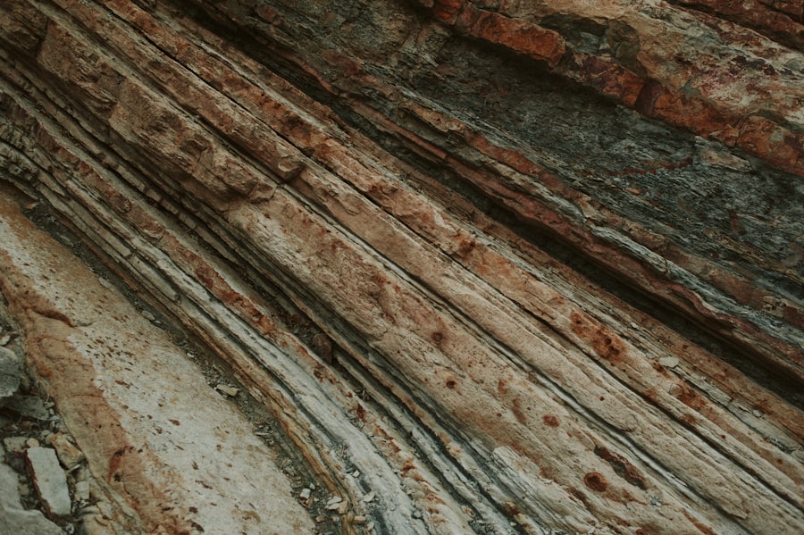
Perhaps one of the most powerful tools within stratigraphy is biostratigraphy, the study of fossils and their distribution in rock layers. Fossils are not merely ancient curiosities; they are biological markers, each species having existed for a specific period during Earth’s history. By identifying the types of fossils present in a rock layer, geologists can infer the relative age of that layer. This principle, known as the Principle of Faunal Succession, is a cornerstone of geological dating.
Index Fossils: The Geologist’s Stopwatch
Certain fossils are particularly valuable in biostratigraphy and are known as “index fossils.” These are organisms that possessed specific characteristics making them ideal for dating:
- Wide Geographic Distribution: They were found across extensive areas, allowing for correlation of rock layers in different regions.
- Short Stratigraphic Range: They existed for a relatively short geological time, meaning their presence in a layer pinpoints a specific period.
- Abundant and Easily Recognizable: They were common and possess distinctive features that make them easy to identify.
Examples of well-known index fossils include certain species of ammonites, trilobites, and foraminifera. The appearance and disappearance of these organisms in the fossil record allow geologists to bracket time intervals with remarkable precision. Imagine finding a specific, well-known celebrity’s photograph in a stack of family albums; you could infer that the album belongs to the period when that celebrity was most prominent. Index fossils function in a similar manner for geological time.
Reconstructing Ancient Ecosystems
Beyond dating, fossils provide invaluable insights into past life and ancient ecosystems. The types of flora and fauna preserved in a rock layer reveal the environmental conditions that prevailed at the time of deposition. For example, finding marine invertebrates suggests a watery environment, while plant fossils can indicate the climate and type of vegetation present. The study of fossil assemblages allows geologists to reconstruct food webs, understand predator-prey relationships, and piece together the evolutionary journey of life on Earth.
The Evolutionary Narrative in Stone
The progression of life forms observed in the fossil record, as documented through biostratigraphy, directly supports the theory of evolution. Simpler organisms tend to appear in older rocks, with increasingly complex and diverse forms emerging in younger strata. This gradual unfolding of life, etched in stone, is one of the most compelling lines of evidence for the evolutionary history of our planet.
Chronostratigraphy and Geochronology: Adding Dates to the Story
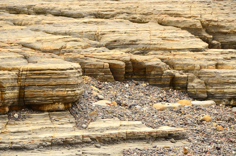
While stratigraphy excels at establishing relative ages (which layer is older or younger than another), geochronology and chronostratigraphy aim to assign absolute numerical ages to these rock layers. This is achieved through radiometric dating techniques, which analyze the decay of radioactive isotopes within rocks. This marriage of stratigraphy and radiometric dating provides a complete picture of Earth’s history, allowing us to place specific dates on the geological events and evolutionary milestones.
Radiometric Dating: The Clockwork of the Earth
Radiometric dating relies on the predictable decay of radioactive isotopes into stable daughter isotopes. By measuring the ratio of parent to daughter isotopes in a rock sample and knowing the half-life (the time it takes for half of the radioactive material to decay), scientists can calculate the time elapsed since the rock solidified.
- Uranium-Lead Dating: This technique is widely used for dating very old rocks, including some of the oldest minerals found on Earth.
- Potassium-Argon Dating: This method is useful for dating volcanic rocks and minerals with a lower potassium content.
- Carbon-14 Dating: This method is effective for dating organic materials up to about 75,000 years old and is crucial for understanding recent geological and archaeological history.
These radiometric clocks, embedded within the rocks themselves, allow us to quantify the vastness of geological time and assign absolute ages to the layers studied through stratigraphy.
Defining Geological Time Scales
The integration of stratigraphical and geochronological data has led to the development of the geological time scale, a standardized framework that divides Earth’s history into eons, eras, periods, and epochs. Each division is defined by significant events in Earth’s history, often marked by major changes in the fossil record or significant geological events. Stratigraphy provides the rock successions that define these boundaries, while geochronology provides the numerical ages that calibrate the scale. This systematic division allows scientists worldwide to communicate about specific time intervals with a common reference.
Limitations and Challenges
While powerful, radiometric dating is not without its challenges. The suitability of a particular dating method depends on the rock type and its geological history. Some rocks may have been altered by later geological processes, potentially resetting or disturbing the isotopic ratios. Furthermore, direct radiometric dating of sedimentary rocks is often impossible because they are formed from the accumulation of pre-existing material, whose original age may be obscured. In such cases, geologists rely on dating associated igneous layers or interbedded volcanic ash beds to constrain the ages of the sedimentary sequences.
Stratigraphy is a crucial field in geology that helps us understand the layers of sediment and rock that make up the Earth’s crust. For those interested in exploring this topic further, a related article can provide additional insights into the principles and applications of stratigraphy. You can read more about it in this informative piece on the subject, which discusses various stratigraphic techniques and their significance in geological studies. Check it out here for a deeper understanding of how stratigraphy shapes our knowledge of Earth’s history.
Sequence Stratigraphy and Basin Analysis: Understanding Earth’s Rhythms
| Metric | Description | Typical Units | Example Values |
|---|---|---|---|
| Stratum Thickness | Vertical thickness of a sedimentary layer | meters (m) | 0.5 – 50 m |
| Age of Stratum | Geological age of the layer | million years (Ma) | 0.01 – 2500 Ma |
| Fossil Content | Presence and type of fossils within the layer | qualitative | Trilobites, Ammonites, Foraminifera |
| Grain Size | Average size of sediment particles | millimeters (mm) | 0.002 – 2 mm |
| Lithology | Rock type composition of the stratum | qualitative | Sandstone, Shale, Limestone |
| Stratigraphic Range | Time interval during which a particular fossil or rock unit is found | million years (Ma) | 5 – 100 Ma |
| Depositional Environment | Environment in which sediment was deposited | qualitative | Marine, Fluvial, Aeolian |
Sequence stratigraphy is a more advanced branch of stratigraphy that focuses on understanding how sea levels and sediment supply interact to create cycles of deposition and erosion within sedimentary basins. By analyzing these sequences, geologists can interpret large-scale patterns of deposition and reconstruct the geological history of entire sedimentary basins.
Cycles of Rise and Fall: Sea Level Fluctuations
Sequence stratigraphy recognizes that sea level has not been constant throughout Earth’s history. Fluctuations in global sea level, driven by factors such as ice ages, tectonic uplift, and seafloor spreading, lead to characteristic patterns of coastal onlap and offlap. A period of rising sea level can inundate continental margins, leading to the deposition of marine sediments landward. Conversely, a falling sea level can expose these margins, leading to erosion and the deposition of sediments closer to shore.
Identifying Systems Tracts
Within these larger depositional sequences, geologists identify distinct “systems tracts,” each representing a specific environmental setting and depositional style related to sea-level changes. These include:
- Transgressive Systems Tract: Deposited during a period of rising sea level, characterized by shoreward migration of depositional environments and sediments.
- Highstand Systems Tract: Deposited during periods of high sea level, often characterized by progradation (seaward advancement) of depositional systems.
- Lowstand Systems Tract: Deposited during periods of low sea level, often found in the deeper parts of the basin.
- Regressive Systems Tract: Deposited during a period of falling sea level, characterized by seaward migration of depositional environments and sediments.
Understanding these systems tracts allows for a detailed reconstruction of paleogeography and the identification of potential hydrocarbon reservoirs, as certain depositional environments are more conducive to oil and gas formation.
Basin Analysis: The Big Picture
Sequence stratigraphy is a key component of basin analysis, a multidisciplinary approach to understanding the geological evolution of sedimentary basins. By combining sequence stratigraphy with seismic data, well logs, and other geological information, geologists can reconstruct the history of basin subsidence, sediment fill, and tectonic activity. This comprehensive understanding is crucial for exploration activities, such as identifying potential sources of oil and gas, and for assessing geological hazards like earthquakes and landslides. The sedimentary basin acts like a large, complex geological laboratory, and sequence stratigraphy provides the framework for understanding the experiments that have taken place within it.
The Applications of Stratigraphy: More Than Just Rocks
The principles of stratigraphy are not confined to academic curiosity; they have profound practical applications that impact our daily lives. From resource exploration to understanding environmental change, stratigraphy provides the foundational knowledge necessary for informed decision-making.
Resource Exploration: Unearthing Our Planet’s Wealth
Stratigraphy plays a critical role in the exploration for natural resources, particularly hydrocarbons (oil and natural gas) and mineral deposits. Understanding the depositional environments and geological structures of sedimentary basins, as elucidated by stratigraphy, is essential for identifying areas where these resources are likely to be found.
Hydrocarbon Exploration
The formation of oil and gas requires specific geological conditions: a source rock (rich in organic matter), a reservoir rock (porous and permeable to store hydrocarbons), a seal rock (impermeable to prevent hydrocarbon escape), and a trap (a geological structure that accumulates hydrocarbons). Stratigraphy helps geologists identify all these components. For instance, identifying ancient marine shales as source rocks, porous sandstones or limestones as reservoir rocks, and impermeable shales or evaporites as seal rocks relies heavily on stratigraphical analysis. Understanding the sequence of deposition and the formation of traps within these sequences is paramount for successful exploration.
Mineral Exploration
Certain mineral deposits are also intimately linked to specific geological settings and processes that are revealed through stratigraphy. For example, sedimentary iron formations, rich in iron ores, formed under specific geochemical conditions in ancient oceans. Evaporite deposits, formed from the evaporation of saline water, can contain valuable minerals like salt and potash. Stratigraphical studies help to delineate the extent and geological context of these mineral-rich layers.
Paleoclimate and Environmental Reconstruction
Stratigraphy provides an invaluable archive of past climates and environmental conditions. By studying the lithology of rock layers, the types of fossils present, and the chemical composition of the rocks, geologists can reconstruct past temperatures, atmospheric composition, sea levels, and the extent of glaciation. This historical environmental data is crucial for understanding the natural variability of Earth’s climate system and for putting current climate change into a long-term perspective. For example, studying ice cores, which are essentially stratigraphic sequences of ice, reveals past atmospheric composition and temperature fluctuations.
Understanding Geological Hazards
The study of stratigraphy is also vital for assessing and mitigating geological hazards. Understanding the history of faulting, volcanic activity, and sedimentation patterns associated with a region allows for better prediction of future events. For instance, identifying layers of ancient landslide debris or evidence of past seismic activity in the stratigraphic record of an area can help to assess its susceptibility to future landslides or earthquakes.
Archaeological and Anthropological Applications
While the primary focus of stratigraphy is geological time, its principles extend to shallower depths relevant to archaeology and anthropology. The study of soil layers (pedostratigraphy) and cultural layers (archaeostratigraphy) helps archaeologists to date artifacts and understand the sequence of human occupation at a site. The Law of Superposition is as applicable to a burial mound as it is to a mountain range, albeit on vastly different timescales.
In conclusion, stratigraphy is not merely an academic pursuit; it is a fundamental science that unlocks the secrets of Earth’s past. Its principles, from the simple elegance of superposition to the complex cycles of sequence stratigraphy, provide the framework for understanding our planet’s evolution and our place within it. The layers of rock are more than just geological formations; they are the pages of Earth’s story, waiting to be read by those who understand the power of stratigraphy.
FAQs
What is stratigraphy?
Stratigraphy is the branch of geology that studies rock layers (strata) and layering (stratification). It is primarily used to understand the chronological sequence of geological events and the history of the Earth.
How do geologists use stratigraphy?
Geologists use stratigraphy to analyze the order and relative position of rock layers to interpret the Earth’s history, date fossils, and correlate rock formations across different regions.
What are the main principles of stratigraphy?
The main principles include the Law of Superposition (younger layers are deposited on top of older ones), the Principle of Original Horizontality (layers are originally deposited horizontally), and the Principle of Cross-Cutting Relationships (features that cut through rocks are younger than the rocks they cut).
What is the difference between lithostratigraphy and biostratigraphy?
Lithostratigraphy focuses on the physical and mineralogical characteristics of rock layers, while biostratigraphy uses fossil content within the layers to establish relative ages and correlate strata.
Why is stratigraphy important in archaeology and paleontology?
Stratigraphy helps archaeologists and paleontologists determine the relative ages of artifacts and fossils by analyzing the layers in which they are found, providing context for understanding past environments and evolutionary history.