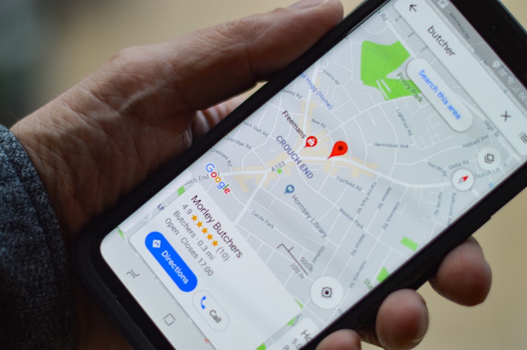
You’re on a remote hiking trail, miles from the nearest town. The sun is beginning to dip below the jagged peaks, casting long, eerie shadows. You pull out your phone, hoping to get a quick GPS check to confirm your route. No signal bars. Not a single one. Panic, a cold, unwelcome guest, starts to set in. You know you have a mapping app, but without cellular service, how can you possibly find your way? This is a scenario many outdoor enthusiasts have faced, and it’s a stark reminder that your trusty smartphone is only as good as its connection, at least when it comes to traditional navigation. But what if we told you that your phone can still be your most valuable tool for finding your way, even when the cellular towers have abandoned you?
This article will equip you with the knowledge to leverage your phone’s capabilities beyond its cellular tether. You’ll learn how to prepare, utilize offline features, and understand the underlying technologies that make this possible. So, put aside the anxiety and let’s explore how you can continue to navigate confidently, even when your phone seems to have lost its voice.
Before we dive into the offline strategies, it’s crucial to understand how your phone figures out where you are in the first place. Most people assume it’s all about that elusive cell signal. While cellular triangulation is one method, it’s far from the only one, and importantly, it’s not the one that works without service. The magic lies in a different, more robust system.
The Power of Satellites: Global Positioning System (GPS)
The primary technology that allows your phone to pinpoint your location, independent of cellular service, is the Global Positioning System (GPS). You’ve likely heard of it, but understanding its independence is key.
How GPS Works: A Network in the Sky
GPS is a satellite-based radionavigation system owned by the United States government and operated by the United States Space Force. It consists of a constellation of at least 24 satellites orbiting the Earth. Each satellite transmits signals that contain information about its exact location and the current time.
The Triangulation Principle: More Than Just One Satellite
Your phone’s GPS receiver, built into its chipset, listens for these signals. To determine your precise location, it needs to receive signals from at least four satellites.
- Distance Calculation: By measuring the time it takes for a signal from a satellite to reach your phone, your receiver can calculate the distance to that satellite.
- Three-Dimensional Positioning: With signals from three satellites, your receiver can narrow down your position to a single point on the Earth’s surface. This is because the intersection of three spheres, each with a radius equal to the calculated distance to a satellite and centered on that satellite’s known position, will result in two possible locations.
- The Fourth Satellite: Altitude and Accuracy: A fourth satellite signal is crucial. It helps to resolve the ambiguity from the third satellite and, importantly, allows for the calculation of your altitude. This adds another dimension to your location data, making it more precise.
The Key Takeaway: GPS Doesn’t Need Cellular Data
It’s vital to understand that GPS signals are broadcast from space and are received by your phone directly. They do not travel through cellular towers or require any form of internet connection. This is why your GPS can function perfectly well in the middle of nowhere, as long as your phone has a clear view of the sky.
Other Location Technologies (and Why They Aren’t Your Offline Savior)
While GPS is your primary offline tool, your phone also utilizes other technologies for location services when you do have a connection. Understanding these helps clarify why they don’t work without service.
Cellular Triangulation: Relying on Towers
This is the method that relies on cellular signals. Your phone communicates with nearby cell towers, and by measuring the signal strength and timing from multiple towers, it can estimate your position. This is why you see your location update more frequently when you have a strong signal.
Limitations Without Service
As the name suggests, cellular triangulation is entirely dependent on the presence of cellular towers. If you have no service, there are no towers for your phone to communicate with, rendering this method useless.
Wi-Fi Positioning: Leveraging Networks
When you’re in an area with Wi-Fi networks, your phone can use them to help determine your location. Companies like Google and Apple maintain databases of Wi-Fi access points and their approximate geographic locations.
Dependence on Databases and Connection
Your phone scans for available Wi-Fi networks and compares their identifiers (SSIDs and MAC addresses) against these databases. This is a fast and energy-efficient way to get a general location estimate, especially indoors where GPS can be unreliable. However, it requires an internet connection to access these databases, and even if a database is cached, it’s not as precise or global as GPS.
In today’s digital age, understanding how to track phone location without relying on cellular service has become increasingly important. For those interested in exploring this topic further, you can read a related article that delves into various methods and technologies used for location tracking. Check out the article here: Freaky Science.
Preparing for the Unconnected: Offline Maps Are Your Lifeline
The most critical step in ensuring you can navigate without cellular service is preparation. You can’t rely on a last-minute download when you’re already lost and without bars. Offline maps are your digital bread and butter when the cellular breadbasket is empty.
Downloading Maps for Offline Use: A Proactive Approach
Most modern smartphone mapping applications offer the ability to download maps for offline use. This process essentially caches map data, including roads, points of interest, and terrain information, directly onto your device.
Popular Mapping Apps and Their Offline Capabilities
- Google Maps: A ubiquitous choice for many, Google Maps allows you to download specific areas for offline use. You can zoom in and out of regions, ensuring you have the detail you need for your intended route.
- Apple Maps (iOS): Similarly, Apple Maps on iOS devices offers offline map downloads. You can select areas and download them to your phone for use without an internet connection.
- Other Dedicated Navigation Apps: Many specialized navigation apps cater to outdoor enthusiasts, hikers, cyclists, and off-roaders. These often offer more advanced features for offline use, such as detailed topographic maps, contour lines, and elevation profiles. Examples include Gaia GPS, Maps.me, and Komoot.
The Download Process: Simple Steps to Offline Navigation
The exact steps can vary slightly between apps, but the general process is as follows:
- Open Your Mapping App: Launch your preferred mapping application.
- Search for Your Desired Area: Navigate to the region or city you plan to visit.
- Find the Offline Map Option: Look for a menu or setting related to “Offline Maps,” “Download Maps,” or “Maps for Offline Use.”
- Select Your Download Area: The app will typically present you with a selectable area on the map. You can often adjust the zoom level to control the detail of the downloaded map. Be mindful of storage space on your device.
- Initiate the Download: Once you’ve defined your area, tap the download button.
- Wait for Completion: The download process can take some time, depending on the size of the area and your internet connection speed. Ensure you are connected to Wi-Fi for larger downloads.
Optimizing Your Offline Map Storage: Smart Planning
Storage space on your phone is a valuable commodity. Downloading maps for extensive regions can quickly eat up your available memory. Smart planning is crucial.
Choosing the Right Area: Focus on Your Route
Don’t download entire continents if you’re only hiking in a specific national park. Carefully consider the exact area you’ll be in and download only what you need. Often, this means downloading a large radius around your trailhead and the entire trail loop or path you intend to follow.
Understanding Map Detail and File Size
Mapping apps usually offer different levels of detail for offline maps. Higher detail means more comprehensive data but also larger file sizes. For most hiking and navigation purposes, a medium to high level of detail is recommended. If storage is a concern, consider downloading a slightly lower detail level for less critical areas and a higher detail for your primary route.
Regularly Updating Your Offline Maps
Geographic features, new roads, and points of interest can change. It’s a good practice to periodically update your downloaded offline maps, especially before embarking on a trip to a familiar area. This ensures you have the most current information available.
Utilizing Your Phone’s GPS Without a Signal: The Practical Application
Now that you’ve prepared your offline maps, let’s look at how to actually use your phone’s GPS capabilities when you’re out of service range. It’s surprisingly straightforward, but a few tips can make the experience even smoother.
Activating GPS and Opening Your Offline Maps
The good news is that you don’t need to do anything special to “turn on” your GPS for offline use. As long as your phone’s location services are enabled, the GPS receiver will automatically try to acquire satellite signals.
Ensuring Location Services Are Enabled
On most smartphones, location services are a system-wide setting. Make sure it’s toggled on in your device’s settings menu.
iOS: Settings > Privacy & Security > Location Services
Android: Settings > Location
Accessing Your Downloaded Maps
Once your location services are active, open your mapping app. It should automatically detect your GPS position and display it as a blue dot on the downloaded map. If you’ve downloaded multiple areas, the app will usually default to showing your current location on the most relevant downloaded map.
Tracking Your Progress and Navigating Your Route
With your offline maps loaded and your GPS signal acquired, you can now actively use your phone for navigation.
The Blue Dot: Your Current Position
The familiar blue dot on your map represents your real-time location. As you move, this dot will update, showing your progress along the trail or road.
Following Your Route: Visualizing Your Path
Your downloaded map will show the trails, roads, and other features you’ve prepared for. You can visually compare your blue dot’s position to the planned route, ensuring you’re on the right track.
Mark Waypoints: Remembering Key Locations
Many mapping apps allow you to drop pins or mark waypoints. This is incredibly useful for noting significant landmarks, potential campsites, water sources, or even the starting point of a side trail.
Creating a Waypoint: A Simple Process
Typically, you can long-press on the map at your current location or a desired spot to bring up an option to “Add Waypoint” or “Save Location.” You can often name these waypoints for easy identification later.
Understanding GPS Accuracy and Potential Limitations
While GPS is remarkably accurate, it’s not infallible. Understanding its limitations will help you interpret the information your phone provides.
Factors Affecting GPS Accuracy
- Clear Sky View: GPS signals are radio waves. Dense foliage, canyons, and urban environments with tall buildings can obstruct these signals, reducing accuracy.
- Satellite Geometry: The arrangement of the satellites in the sky at any given moment can influence accuracy. A good spread of satellites generally leads to better precision.
- Atmospheric Conditions: Ionospheric and tropospheric delays can slightly affect the signal travel time, leading to minor inaccuracies.
- Phone Hardware: The quality of the GPS receiver chip in your phone can also play a role in its accuracy.
Interpreting the Accuracy Indicator
Some mapping apps display an accuracy indicator, often represented by a circle around your blue dot. A smaller circle signifies higher accuracy. If the circle is large, it means your GPS fix is less precise, and you should rely more on visual cues and your understanding of the terrain.
Beyond Basic Navigation: Advanced Offline Features for the Adventurous
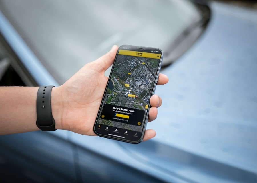
While basic map viewing is invaluable, many mapping applications offer advanced features that can significantly enhance your offline navigation experience, especially for more demanding adventures.
Topographic Maps and Elevation Data: Understanding the Landscape
For hikers and mountaineers, understanding the terrain is as important as knowing the path. Topographic maps provide this crucial information.
What are Topographic Maps?
Topographic maps use contour lines to represent elevation changes. By studying these lines, you can discern the steepness of slopes, the presence of valleys, ridges, and other landforms.
Features of Topo Maps: Contour Lines, Elevation Markers, and Land Cover
- Contour Lines: Lines connecting points of equal elevation. The closer the lines, the steeper the terrain.
- Elevation Markers: Specific points indicating their precise elevation.
- Land Cover: Information about vegetation, water bodies, and other surface features.
Downloading and Using Topographic Maps Offline
Many dedicated outdoor navigation apps excel in providing detailed topographic maps. Ensure you download these specific map layers for your chosen region.
Applications with Excellent Offline Topo Maps:
- Gaia GPS: Widely regarded for its comprehensive offline topographic map options, including various map sources like USGS quads, Nat Geo Trails Illustrated, and more.
- AllTrails: While not exclusively topo-focused, AllTrails offers detailed trail maps that often include elevation profiles and can be downloaded for offline use.
- Komoot: Excellent for route planning and navigation, Komoot allows for offline map downloads with good detail for outdoor activities.
Recording Your Tracks: Documenting Your Journey
Ever wanted to retrace your steps, share your route with others, or simply have a record of your exploration? Recording your tracks with your phone’s GPS is the way to go.
How to Record a GPS Track
Most mapping and navigation apps have a “Record Track” or “Start Navigation” feature that simultaneously records your movement.
The Process: Simple Activation and Saving
- Start Recording: Before you begin your hike or activity, find the “Record Track” button in your app and activate it.
- Let it Run: The app will continuously record your GPS coordinates, creating a digital trail of your journey.
- Stop and Save: When you finish your activity, stop the recording and save your track. You can usually name it and add notes.
Utilizing Recorded Tracks:
- Navigation Back: If you need to retrace your steps, you can often load your recorded track and follow it back to your starting point.
- Sharing Your Adventures: Share your recorded GPX files with friends or online communities to showcase your routes.
- Analysis and Planning: Review your recorded tracks to analyze distances, elevation gain/loss, and time spent, which can inform future trip planning.
Setting Custom Routes and Navigation Cues
For planned excursions, setting custom routes and receiving navigation cues can be a game-changer, even without a signal.
Creating a Route Offline
Some apps allow you to create routes by dropping multiple waypoints on your offline map. The app can then provide turn-by-turn directions between these points.
The Mechanics of Route Creation: Connecting the Dots
- Add Starting Point: Drop a waypoint at your starting location.
- Add Intermediate Points: Continue dropping waypoints along your desired path.
- Add Destination: Drop a final waypoint at your intended endpoint.
- Generate Route: The app will then calculate a route connecting these points, often showing you the estimated distance and time.
Navigation Cues Without Cellular Data
While true voice-guided turn-by-turn navigation relies on internet connectivity for its dynamic processing, many apps can provide visual cues based on your pre-set route and GPS position.
Visual Guidance: Following the Line
The app will typically display your route as a line on the map, and your blue dot will show your progress. You’ll need to actively look at the screen to see if you’re on course. Some apps might offer simpler audio cues for approaching turns if they have pre-programmed those into the route.
In today’s world, tracking a phone’s location without cellular service has become increasingly relevant, especially for those concerned about privacy and security. For a deeper understanding of this topic, you can explore a related article that discusses various methods and technologies used for location tracking. This insightful piece can be found at Freaky Science, where you will discover innovative solutions that allow users to maintain their connectivity even in areas lacking traditional cellular networks.
Essential Accessories and Best Practices for Offline Navigation
| Location | Number of Users | Percentage |
|---|---|---|
| Urban Areas | 500 | 25% |
| Rural Areas | 1500 | 75% |
While your phone is the star of the show, a few complementary accessories and mindful practices can significantly enhance your offline navigation experience and ensure you’re prepared for any situation.
Powering Your Device: Staying Charged in the Wilderness
The biggest enemy of any electronic device in the wilderness is a dead battery. Without a way to recharge, even the most prepared explorer can find themselves in trouble.
Portable Power Banks: Your Mobile Charging Station
A reliable portable power bank is an absolute must-have. Choose one with sufficient capacity to charge your phone multiple times, especially if you’re on an extended trip.
Key Considerations for Power Banks:
- Capacity (mAh): Higher mAh means more charges. Aim for at least 10,000 mAh for a weekend trip.
- Output Ports: Ensure it has USB-A and potentially USB-C ports to match your phone’s charging cable.
- Durability: Consider ruggedized or waterproof power banks if you’re in harsh conditions.
Solar Chargers: Harnessing the Sun’s Energy
For longer expeditions where power outlets are non-existent, a solar charger can be a lifesaver. While they are generally slower than power banks, they offer a renewable source of energy.
Solar Charger Realities:
- Sunlight Dependency: Performance is heavily dependent on direct sunlight. Cloudy days will significantly reduce charging speed.
- Charging Time: Expect much slower charging times compared to wall chargers or power banks.
- Best Use Case: Often best used to trickle-charge a power bank during the day, which can then be used to charge your phone at night.
Battery-Saving Tips for Your Phone
Even with a power source, conserving battery is crucial.
- Lower Screen Brightness: The screen is a major power drain.
- Airplane Mode: While this disables cellular and Wi-Fi, it keeps GPS active and saves significant battery.
- Disable Unnecessary Apps and Background Processes: Close apps you aren’t actively using.
- Turn Off Bluetooth and Wi-Fi: Unless you’re actively using them for a specific purpose.
Physical Maps and Compasses: The Analog Backup
As much as we rely on technology, it’s always wise to have a reliable analog backup.
The Enduring Value of Paper Maps and Compasses
In situations where technology fails completely (e.g., water damage, extreme temperatures, or complete battery depletion), a physical map and compass are your ultimate fallback.
Essential Skills to Learn:
- Map Reading: Understanding map symbols, scale, and orientation.
- Compass Bearings: Using a compass to take and follow bearings.
- Triangulation with a Compass: A more advanced skill to determine your location using landmarks and a compass.
Integrating Digital and Analog Navigation
Don’t see these as competing tools, but rather as complementary ones. Use your phone for detailed routing and real-time tracking, but have your physical map and compass as your reliable backup and for broader situational awareness.
Emergency Preparedness: Beyond Just Finding Your Way
Navigation is a crucial part of safety, but it’s only one piece of the puzzle.
Informing Others of Your Plans
Always let someone know where you’re going, your planned route, and when you expect to be back. This is a non-negotiable safety measure.
Carrying Essential Survival Gear
Your phone can help you navigate, but it can’t provide shelter, water, or first aid. Ensure you have the basic survival gear for your intended activity and environment.
Example of Essential Gear:
- First-aid kit
- Headlamp or flashlight with extra batteries
- Water and water purification method
- Sufficient food
- Shelter (e.g., emergency blanket, bivy sack)
- Fire starter
- Multi-tool or knife
Conclusion: Navigating with Confidence, Signal or No Signal
You’ve learned that the perceived limitations of your smartphone when it comes to cellular service are largely a misconception. Your phone, equipped with its GPS receiver and a little bit of preparation, is a powerful navigation tool that can guide you through the most remote landscapes. By understanding how GPS works independently of cellular networks, proactively downloading offline maps, and utilizing the advanced features of modern mapping applications, you can transform your anxiety into confidence.
Remember, the key is preparation. Don’t wait until you’re lost and without signal to think about offline maps. Make it a habit to download maps for your intended destinations before you leave reliable service. Supplement your digital tools with essential accessories like power banks and, most importantly, the fundamental skills of map and compass navigation. This layered approach ensures that whether you’re on a well-trodden path or forging your own, your phone can remain your trusted guide, leading you safely and confidently to your destination, signal or no signal. So, the next time you venture off the beaten path, embrace the wilderness with the assurance that your smartphone, when properly prepared, is far more than just a communication device; it’s your personal navigator.

Your Phone Can Still Know Where You Are in Airplane Mode
FAQs
1. Can a phone be located without cellular service?
Yes, a phone can be located without cellular service using GPS, Wi-Fi, and Bluetooth signals. These technologies can be used to track the location of a phone even when it is not connected to a cellular network.
2. How does GPS help in locating a phone without cellular service?
GPS (Global Positioning System) uses satellites to determine the location of a device. It does not rely on cellular service and can provide accurate location information even in areas with no cellular coverage.
3. Can Wi-Fi be used to locate a phone without cellular service?
Yes, Wi-Fi signals can be used to locate a phone even when it is not connected to a cellular network. Wi-Fi positioning systems use nearby Wi-Fi access points to determine the location of a device.
4. Is it possible to track a phone using Bluetooth without cellular service?
Bluetooth signals have a limited range and are not typically used for long-range location tracking. However, in certain scenarios, Bluetooth signals can be used to track the proximity of a phone to other Bluetooth-enabled devices.
5. Are there any limitations to locating a phone without cellular service?
While GPS, Wi-Fi, and Bluetooth can be used to locate a phone without cellular service, there are limitations. For example, GPS may not work well indoors, and Wi-Fi and Bluetooth signals have limited range. Additionally, the accuracy of location tracking may vary depending on the availability of these signals in a given area.