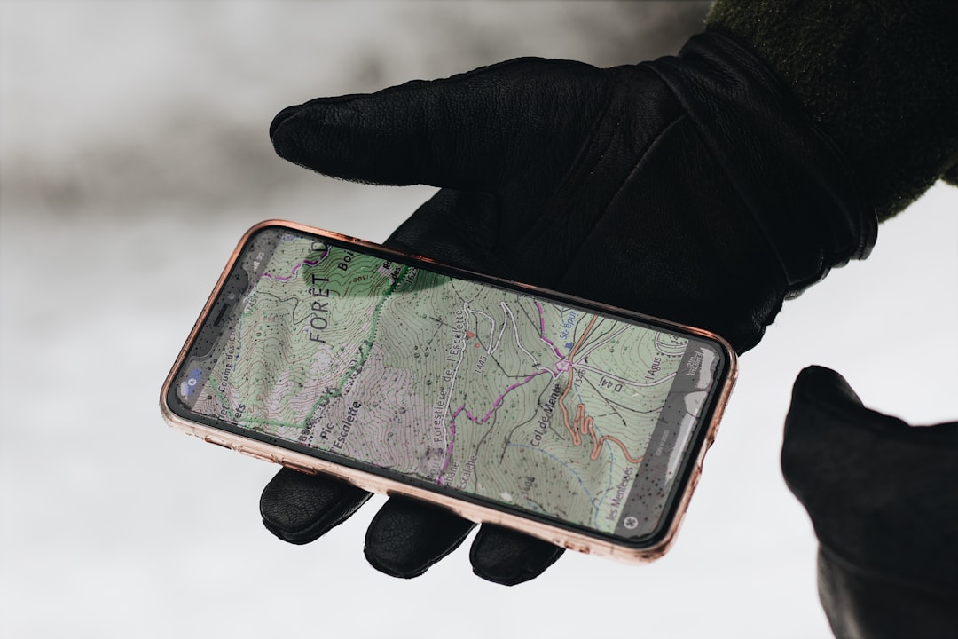
You’re standing at the trailhead, the scent of pine needles sharp in the air. The trail map is tucked away, a relic from a time when adventures often involved getting a little lost. Now, your smartphone, usually a beacon of connectivity, displays that dreaded “No Service” icon. But this isn’t a cause for panic; it’s an invitation. An invitation to explore the wild places, the places where the digital world fades and the real world truly comes alive. You’re ready for an off-grid adventure, and you’re armed with the knowledge of how to navigate it, even without a whisper of cellular service.
The Illusion of Dependence: Why You Don’t Need Data for Discovery
It’s easy to fall into the trap of believing that a smartphone is useless without a signal. You’ve become accustomed to the instant gratification of a quick Google search, the live traffic updates, the ability to call for help at a moment’s notice. But this reliance on cellular data for navigation is a modern crutch that can limit your exploration. True off-grid adventures demand a different approach, one that embraces independence and empowers you to forge your own path.
Reclaiming Your Autonomy: The Freedom of Self-Reliance
The thrill of navigating without a digital lifeline lies in reclaiming your autonomy. You are the captain of your own journey, not a passive recipient of directions dictated by a distant server. This independence fosters a deeper connection with your surroundings. You start paying attention to the subtle cues of the landscape, the direction of the sun, the flow of water, the patterns of the trees. These are the ancient navigation tools that have guided humans for millennia, and you’re about to tap into them.
Beyond the Beaten Path: Unlocking Hidden Gems
Cellular service tends to be strongest in populated areas, meaning the places where you’re most likely to lose signal are often the most pristine and least explored. This is where the magic of off-grid navigation truly shines. You can venture into remote canyons, traverse forgotten mountain passes, and discover secluded lakes that remain untouched by the masses. Your GPS, unburdened by the need for a signal, becomes your key to unlocking these hidden gems.
For those interested in exploring navigation options without relying on cellular service, a related article can be found at Freaky Science. This resource delves into various technologies and methods that enable users to effectively utilize GPS capabilities in remote areas, ensuring that adventurers and outdoor enthusiasts can stay on track even when traditional connectivity is unavailable.
The Satellite Savvy: How Your GPS Works Without a Cell Tower
Your smartphone’s GPS receiver is a marvel of modern engineering, and its fundamental function doesn’t rely on cellular networks at all. Understanding this core principle is the first step in shedding your dependence.
The Global Positioning System: A Symphony of Satellites
At its heart, GPS is a satellite-based radionavigation system. A constellation of over 30 satellites orbits the Earth, broadcasting precise timing signals. Your GPS receiver, whether it’s a dedicated handheld device or the chip within your smartphone, listens for these signals. By triangulating its position based on the signals received from at least four satellites, your device can determine your exact location on Earth with remarkable accuracy, often within meters.
The Triangulation Tango: A Precise Mathematical Ballet
Imagine the satellites as knowing their exact position in space and broadcasting that information along with the time the signal was sent. Your receiver picks up these signals. The time it takes for the signal to arrive tells your receiver how far away each satellite is. By knowing the distances to multiple satellites, your device can pinpoint your location. The more satellites it can “see,” the more accurate your position becomes. This intricate mathematical ballet happens silently and instantaneously, entirely independent of any ground-based cellular infrastructure.
Time is of the Essence: The Atomic Clocks in Orbit
The accuracy of GPS hinges on incredibly precise timing. The satellites are equipped with atomic clocks, the most accurate timekeeping devices known to humankind. Even tiny discrepancies in timing can lead to significant errors in position. This constant, precise ticking from space is what allows your GPS to provide reliable location data.
The Role of Assisted GPS (A-GPS): Enhancing, Not Essential
You might notice that your phone sometimes acquires a GPS lock faster when you have cellular service. This is due to Assisted GPS (A-GPS). A-GPS uses cellular data or Wi-Fi to download almanac and ephemeris data from a server. This data provides your GPS receiver with a rough idea of where the satellites should be in the sky, allowing it to find and lock onto them more quickly. However, once your receiver has acquired sufficient satellite signals, it can operate independently of A-GPS and the cellular network. The core GPS functionality remains intact, even without the “assistance.”
Downloading the Sky Map: A-GPS’s Efficiency Boost
Think of A-GPS as giving your GPS receiver a pre-downloaded map of the sky. Instead of having to search for satellites from scratch, it knows which ones to look for and in which general direction. This significantly reduces the time it takes to get an initial position fix, especially in challenging environments.
The True Navigator: When Satellites Take Over
Once your GPS receiver has acquired a strong signal from enough satellites, the A-GPS data becomes less critical. The device is now directly communicating with the satellites to calculate its position. This is the point where you can truly go off-grid, relying solely on the satellite network.
Preparing for the Unconnected Trail: Tools and Techniques
Embracing off-grid navigation requires a bit of foresight and preparation. You can’t just assume your existing setup will suffice. A few strategic choices can transform your smartphone into a robust navigation tool for the wild.
Offline Maps: Your Digital Compass for the Uncharted
The most crucial element of off-grid GPS navigation is having access to offline maps. These are detailed maps that are downloaded and stored directly on your device, so they can be accessed without an internet connection.
Choosing Your Mapping App: A World of Options
Numerous mapping applications offer robust offline capabilities. Consider apps like:
- Gaia GPS: Renowned for its extensive topographic and backcountry map layers, Gaia GPS is a favorite among hikers, backpackers, and off-roaders. You can download maps for specific regions, zoom in on intricate details, and even overlay different map types.
- OsmAnd+: This open-source app utilizes OpenStreetMap data, providing highly detailed maps with extensive points of interest. It offers a wealth of customization options and excellent offline routing capabilities.
- AllTrails (Pro version): While the free version relies on a signal, the Pro version of AllTrails allows you to download maps for offline use, making it a valuable tool for trail enthusiasts.
- Google Maps (Offline Areas): While not as specialized as some other options, Google Maps allows you to download large areas for offline use, which can be sufficient for general navigation in less remote locations.
Downloading Strategically: Maximizing Storage and Detail
The key to effective offline mapping is strategic downloading. Don’t try to download the entire world. Instead, focus on the specific areas you plan to explore. Consider:
- Resolution: Most apps allow you to choose the level of detail for your downloaded maps. For detailed backcountry navigation, opt for higher resolutions, but be mindful of storage space.
- Overlapping Regions: If your adventure spans multiple areas, ensure your downloaded maps overlap sufficiently to avoid gaps in coverage.
- Regular Updates: Periodically update your downloaded maps, especially if you’re returning to a previously visited area. Trail conditions can change, and map data is also updated.
Power Management: Keeping Your Navigator Alive
Your smartphone’s battery is your lifeline when you’re off the grid, especially for navigation. Conserving power is paramount.
Battery-Saving Habits: Small Changes, Big Impact
- Lower Screen Brightness: Your screen is a major power drain. Keep it at the lowest comfortable setting.
- Disable Unnecessary Features: Turn off Bluetooth, Wi-Fi, and cellular data when you don’t need them.
- Airplane Mode: This is your best friend. Engaging airplane mode will disable all wireless radios, dramatically extending battery life while still allowing GPS to function.
- Background App Refresh: Limit or disable background app refresh for non-essential applications.
- Close Unused Apps: Don’t let apps run idly in the background.
Portable Power Solutions: Your Backup Energy Source
- Power Banks: Invest in a high-capacity power bank. A 10,000mAh or 20,000mAh bank can provide multiple charges for your smartphone.
- Solar Chargers: For longer expeditions, a portable solar charger can be invaluable for topping up your power bank or directly charging your devices. Be realistic about their charging speed; they are best for supplementary power.
- Spare Batteries: If your device has a removable battery, carrying a spare fully charged battery is a simple yet effective backup.
Dedicated GPS Devices: The Rugged Navigator
While smartphones are incredibly versatile, dedicated GPS units offer enhanced durability, longer battery life, and often more advanced navigation features specifically designed for outdoor use.
Why Consider a Dedicated GPS?: Built for the Elements
- Durability: Many dedicated GPS devices are waterproof, shockproof, and built to withstand extreme temperatures, making them ideal for harsh environments.
- Battery Life: They typically boast significantly longer battery life than smartphones, often lasting for days or even weeks on a single charge.
- User Interface: Their buttons and screens are often designed for use with gloves or in bright sunlight, offering a more intuitive experience in challenging conditions.
- Specialized Features: Features like barometric altimeters for precise elevation tracking, compass calibration, and advanced waypoint management are common.
Popular Choices for the Trail: Garmin, Suunto, and More
- Garmin: A leader in GPS technology, Garmin offers a wide range of handheld GPS devices, from the rugged inReach series with satellite communication capabilities to more basic but reliable units.
- Suunto: Known for its durable and feature-rich outdoor watches, Suunto also offers GPS-enabled devices that are great for tracking routes and providing navigation.
- Magellan: Another reputable brand in the GPS market, Magellan provides a variety of devices suitable for hiking, geocaching, and other outdoor activities.
Navigating with Confidence: Essential Skills and Best Practices
Having the right tools is only half the battle. Mastering a few key navigation skills will ensure you can confidently find your way, even when your digital guide is your only companion.
Waypointing and Tracking: Marking Your Journey
Waypointing and tracking are fundamental to off-grid navigation. They allow you to mark important locations and record your path.
Setting Waypoints: Leaving Digital Breadcrumbs
- Trailheads and Campsites: Mark your starting point and planned camping locations.
- Water Sources: Identify reliable water sources, especially in dry climates.
- Points of Interest: Mark unique landmarks, scenic overlooks, or potential hazards.
- Descent/Ascent Points: Note key points on challenging climbs or descents.
Recording Tracks: Recreating Your Steps
- Backtracking: If you need to return the way you came, a recorded track is invaluable.
- Exploration: Record your routes when exploring off-trail to easily retrace your steps or share your discoveries.
- Documentation: For longer trips, a track log provides a detailed record of your journey.
Understanding Your Bearing: The Role of the Digital Compass
Your smartphone’s compass, while sometimes affected by magnetic interference, can be a vital tool when paired with your GPS data.
Calibrating Your Compass: Ensuring Accuracy
Most smartphone compass apps will prompt you to calibrate them. This usually involves a figure-eight motion to help the device understand the Earth’s magnetic field. Regular recalibration might be necessary, especially if you notice erratic readings.
Magnetic North vs. True North: A Crucial Distinction
It’s important to understand the difference between magnetic north (where your compass points) and true north (the geographic North Pole). Most mapping apps will allow you to toggle between these views. For precise navigation, especially over long distances, you may need to account for magnetic declination, which is the angle between magnetic north and true north at your specific location. Many offline mapping apps will automatically apply declination settings.
Reading the Terrain: Supplementing Your Digital Guide
While GPS is incredibly powerful, it’s not infallible. Developing an understanding of natural navigation cues can provide a vital backup and enhance your situational awareness.
Using Topographic Maps: The Unsung Hero
Even if you’re relying on your GPS, having a physical topographic map is a wise precaution. These maps are incredibly detailed and can help you orient yourself by identifying contour lines, elevation changes, and natural features like rivers and ridges.
Observing the Sun: A Universal Clock
The sun rises in the east and sets in the west, providing a constant directional reference. By understanding the time of day, you can make educated guesses about direction.
Following Water: A Natural Pathway
Rivers, streams, and creeks often flow downhill and can lead you towards civilization or larger bodies of water.
Vegetation and Wildlife: Subtle Clues
In some environments, prevailing winds can influence the growth of vegetation. Animal trails can also indicate paths of least resistance.
In today’s world, the reliance on GPS technology has become increasingly significant, especially for outdoor enthusiasts and travelers. However, many may not realize that GPS can function effectively without cellular service, making it a vital tool in remote areas. For those interested in exploring this topic further, you can read a related article that discusses the intricacies of GPS technology and its capabilities in the absence of cellular networks. Understanding these features can enhance your navigation skills and ensure you stay on track during your adventures. To learn more, check out this informative piece here.
Safety First: Staying Connected When You’re Disconnected
While you’re embracing the freedom of off-grid adventures, safety should always be your top priority. Being prepared for emergencies is crucial, even when you don’t have cell service.
Communication Beyond Cellular: Preparedness for the Unexpected
When you’re out of cellular range, traditional communication methods are unavailable. This is where specialized devices come into play.
Satellite Messengers: Your Lifeline to the Outside World
Devices like the Garmin inReach series or SPOT devices utilize satellite networks to send and receive messages, track your location, and, most importantly, send an SOS signal in case of an emergency. These are invaluable for solo adventurers or those venturing into particularly remote areas.
The SOS Function: A Last Resort, But Essential
The SOS button on these devices is a direct line to emergency response services. It should be reserved for life-threatening situations, but knowing it’s there provides immense peace of mind.
Two-Way Communication: More Than Just an Emergency Button
Many modern satellite messengers offer two-way texting capabilities, allowing you to communicate with loved ones or emergency contacts even when you have no other means of contact. This can be used for check-ins or to provide vital information to rescuers.
Informing Others: The Buddy System, Even When Solo
Even if you’re embarking on a solo adventure, the principle of the buddy system remains critical.
Detailed Itinerary: Sharing Your Plans
Before you leave, provide a trusted friend or family member with a detailed itinerary:
- Your planned route and expected duration.
- Your starting and ending points.
- Your expected check-in times.
- Information about your gear and any emergency contacts.
Establishing Check-in Procedures: Reliable Communication Channels
Agree on a system for checking in. This might involve sending a pre-arranged text message via your satellite messenger at specific times or leaving updates with a contact person. If you miss a check-in, your contact will know to initiate a search.
Emergency Preparedness Kit: Beyond the Digital
Your digital navigation tools are powerful, but they are just one part of your overall preparedness.
Essential First-Aid: Addressing Injuries
A well-stocked first-aid kit is non-negotiable. Know how to use its contents and be prepared to treat common injuries like cuts, sprains, and blisters.
Shelter and Survival: Weathering the Unexpected
Carry essential survival gear, including a lightweight tarp or bivy sack for emergency shelter, fire-starting materials (waterproof matches, lighter, tinder), and extra layers of clothing.
Water Purification: Ensuring Hydration
A water filter or purification tablets are crucial for ensuring you have safe drinking water, even from seemingly pristine sources.
Embracing the Unplugged Experience: The True Rewards of Off-Grid Adventure
The challenges of navigating without cellular service are precisely what make the experience so rewarding. You’re not just traveling from point A to point B; you’re engaging with the world in a profound and authentic way.
Rediscovering Your Senses: A Deeper Connection
Without the constant distractions of notifications and digital updates, your senses come alive. You notice the subtle rustling of leaves, the chirping of birds, the warmth of the sun on your skin, the intricate patterns of bark on a tree. This heightened awareness fosters a deeper connection with the natural world.
Problem-Solving and Resilience: Building Inner Strength
When you encounter an unexpected obstacle or a navigational challenge, you are forced to think critically and problem-solve. This process builds resilience, confidence, and a sense of self-reliance that extends far beyond your outdoor adventures. You learn that you are capable of more than you might have imagined.
The Joy of Discovery: Unplanned Encounters
Without the constraints of pre-defined routes dictated by algorithms, you are free to explore. You might stumble upon a hidden waterfall, a breathtaking vista, or an interesting piece of wildlife. These unplanned encounters are often the most memorable and enriching parts of an adventure.
A Digital Detox: Recharging Your Mind
In our hyper-connected world, a break from technology can be incredibly beneficial. Off-grid adventures offer a true digital detox, allowing your mind to rest, de-stress, and recharge. You return feeling refreshed, renewed, and with a greater appreciation for the present moment.
So, the next time you see that “No Service” icon, don’t despair. See it as an invitation, a gateway to a richer, more authentic adventure. With a little preparation and the right mindset, your GPS device can be your trusted companion, guiding you through the wild, untamed spaces where true discovery awaits. You are ready to explore. You are ready to go off-grid.

Your Phone Can Still Know Where You Are in Airplane Mode
FAQs
What is GPS without cellular service?
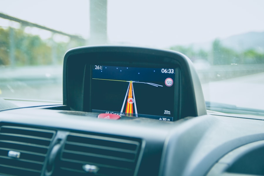
GPS without cellular service refers to the ability of a GPS device to function and provide location information without the need for a cellular network connection. This means that the device can still track and provide location data even in remote areas where there is no cellular coverage.
How does GPS without cellular service work?
GPS without cellular service relies on signals from satellites to determine the device’s location. The GPS receiver in the device calculates its position by measuring the time it takes for signals from multiple satellites to reach the device. This information is then used to determine the device’s precise location.
What are the benefits of GPS without cellular service?
The main benefit of GPS without cellular service is the ability to navigate and track locations in areas where there is no cellular coverage. This can be particularly useful for outdoor activities such as hiking, camping, and boating, as well as for remote work in areas with limited connectivity.
What are some examples of GPS devices that work without cellular service?
Examples of GPS devices that work without cellular service include handheld GPS units designed for outdoor activities, GPS watches for fitness and outdoor sports, and specialized GPS trackers for vehicles and assets. These devices are designed to rely solely on satellite signals for location tracking.
Are there any limitations to GPS without cellular service?
While GPS without cellular service can provide accurate location information in remote areas, it may have limitations in urban environments with tall buildings or dense foliage that can obstruct satellite signals. Additionally, without cellular connectivity, these devices may not be able to provide additional features such as real-time traffic updates or location sharing.