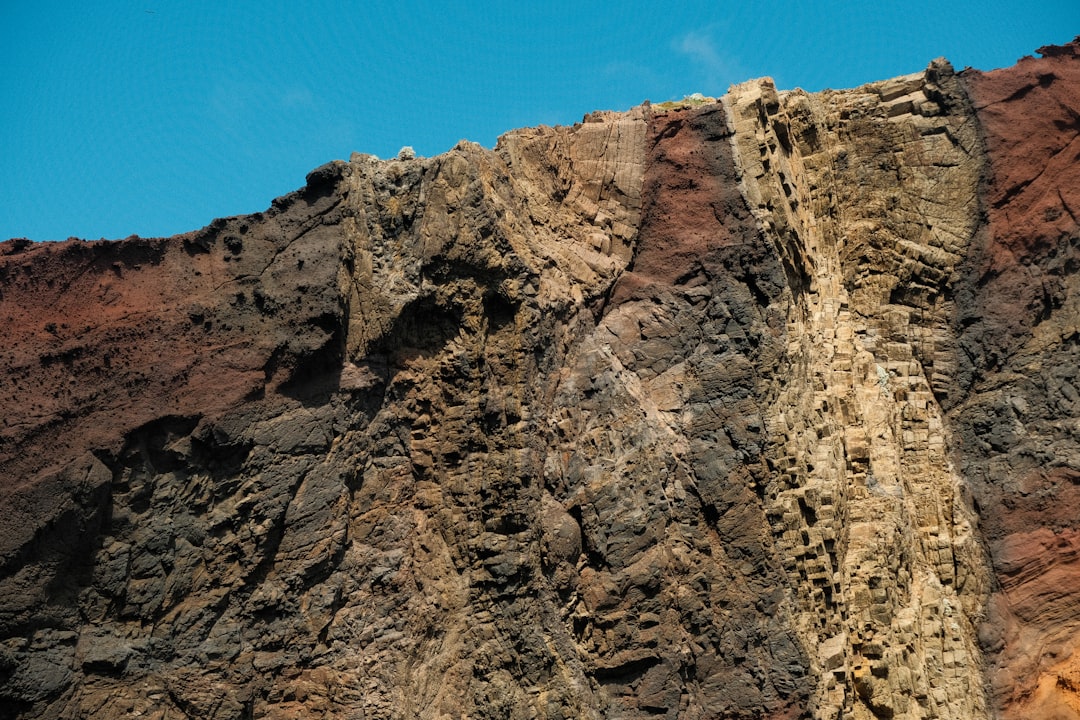
Stratigraphy, a fundamental branch of geology, offers a unique lens through which one can read the Earth’s biography. It is the study of rock layers, or strata, and their sequence, composition, and relationships. By meticulously examining these layered records, geologists unlock the secrets of past environments, climatic conditions, and the evolution of life. This article delves into the core principles and applications of stratigraphy, illuminating its significance in understanding our planet’s deep history.
Stratigraphy is built upon a set of bedrock principles that have been refined over centuries of observation and scientific inquiry. These principles act as the Rosetta Stone for deciphering the narrative written in the rocks, providing a framework for interpreting the order and relationships of geological formations.
The Principle of Superposition
Perhaps the most intuitive principle, the Law of Superposition, states that in any undisturbed sequence of sedimentary rocks, the oldest layers will be at the bottom, and the youngest layers will be at the top. Imagine a stack of books; the ones placed down first are at the bottom, while those added last rest on top. Similarly, geological strata accumulate over time, with newer deposits accumulating on top of older ones. This principle is paramount, establishing the temporal order of rock units, allowing us to build a chronological sequence of events etched in stone. Deviations from this principle, such as overturned sequences due to tectonic forces, are also recognized and studied within this framework, offering further insights into Earth’s dynamic history.
The Principle of Original Horizontality
Sedimentary rocks, when initially deposited by wind or water, are generally laid down in horizontal layers. The Principle of Original Horizontality posits that if these layers are found tilted, folded, or even vertical, it indicates that they have been subjected to subsequent deformational forces after their deposition. This principle is crucial for distinguishing between pre-deformation and post-deformation events. When geologists encounter tilted strata, they understand that the Earth’s crust has undergone significant movements, such as mountain building or faulting, after the sediments were originally laid down. The angle of tilt and the patterns of folding can further reveal the direction and magnitude of these tectonic pressures.
The Principle of Lateral Continuity
This principle asserts that sedimentary layers extend laterally in all directions until they thin out, encounter a depositional edge, or change facies. This means that a layer of rock found in one location is likely to be the same layer found in another location, provided it hasn’t been eroded or displaced. Consider spreading a layer of paint across a wide surface; it will continue to spread until it runs out or reaches an edge. Similarly, sedimentary layers are continuous sheets, and their presence across a widespread area allows for correlation between different rock exposures. This principle is vital for understanding the extent of ancient environments and for connecting rock formations across vast distances, enabling the reconstruction of larger geological structures and past landscapes.
The Principle of Cross-Cutting Relationships
The Principle of Cross-Cutting Relationships dictates that any geological feature that cuts across another feature must be younger than the feature it cuts. This applies to faults, igneous intrusions, and unconformities. Think of a knife slicing through a cake; the knife is younger than the cake it cuts. If a fault displaces a layer of rock, the fault must have formed after the rock layer was in place. Similarly, an igneous dike that intrudes through existing sedimentary layers is younger than those sedimentary layers. This principle is indispensable for establishing the relative ages of various geological events and structures, providing a critical tool for unraveling complex geological histories.
The Principle of Faunal Succession
The Principle of Faunal Succession, a cornerstone of biostratigraphy, states that fossil organisms succeed one another in a definite and recognizable order, and at any given period of time, life forms were unique. Therefore, any rock layer containing a specific assemblage of fossils can be identified and correlated with other rock layers containing the same fossil assemblage, regardless of their geographic location. This principle revolutionized our understanding of geological time and is the backbone of the geological timescale. Imagine collecting unique stamps from different historical periods; each collection marks a distinct era. Similarly, the fossil assemblages found in rock layers are like unique fingerprints of past life, allowing geologists to date and correlate rocks. This principle is a powerful tool for dating sedimentary rocks and for understanding the evolutionary history of life on Earth.
Stratigraphy, the branch of geology concerned with the study of rock layers and layering, plays a crucial role in understanding Earth’s history and the processes that have shaped it over time. For those interested in exploring more about the fascinating aspects of stratigraphy and its applications in various fields, you can check out this related article on Freaky Science, which delves into the significance of sedimentary layers and their implications for paleontology and archaeology.
Types of Stratigraphy: A Multifaceted Approach
Stratigraphy is not a monolithic field; it encompasses various sub-disciplines, each focusing on different aspects of rock layers and their interpretation. These diverse approaches allow for a comprehensive understanding of geological history.
Lithostratigraphy: The Language of Rock Types
Lithostratigraphy focuses on the physical characteristics of rock layers, such as their composition, texture, color, and grain size. It involves defining and correlating rock units based on these observable properties. Geologists meticulously map and describe these rock units, creating stratigraphic columns that represent the vertical succession of rock types in a given area. Imagine building with different types of bricks; each type has a unique appearance and feel. Lithostratigraphy categorizes and orders these “bricks” of the Earth’s crust. Lithostratigraphic units, such as formations and groups, serve as the fundamental building blocks for regional geological maps and are essential for understanding the depositional environments and tectonic settings under which these rocks formed.
Formations: The Basic Building Blocks
Formations are mappable bodies of rock characterized by distinctive lithologic features and are the fundamental units of lithostratigraphy. A formation is generally thick enough to be shown on geological maps and is given a formal name, typically derived from a geographic location where it is well-exposed. Formations represent a period of relatively uniform depositional conditions. Understanding the boundaries of formations helps geologists to identify cycles of deposition and to delineate significant changes in geological processes.
Groups and Supergroups: Broader Correlations
Groups are formed by combining two or more related formations that share common lithologic or depositional characteristics. Supergroups represent even larger lithostratigraphic units, comprising several groups or formations that are considered to be related in terms of their depositional history. These larger-scale units facilitate regional correlations and provide a broader context for understanding geological provinces and their development over geological time.
Biostratigraphy: The Fossil Record as a Chronometer
Biostratigraphy utilizes the study of fossil organisms preserved within rock layers to determine their relative ages and to correlate rock units across different locations. As previously mentioned, the Principle of Faunal Succession is central to this approach. By identifying specific fossil species or assemblages, geologists can establish the age of a rock layer with remarkable precision. This is akin to using an ancient calendar where each extinct species represents a specific date or era. Biostratigraphy is indispensable for constructing the geological timescale and for dating sedimentary rocks where other radiometric dating methods are not feasible.
Index Fossils: Precision Dating Tools
Index fossils, also known as guide fossils, are particularly important in biostratigraphy. These are fossils that are easily identifiable, widespread geographically, and existed for a relatively short period of geological time. Their presence in a rock layer provides a strong indication of its age. Famous examples include ammonites, trilobites, and certain species of planktonic foraminifera, each having a distinct stratigraphic range.
Fossil Assemblages: Broader Chronological Context
While index fossils offer precise dating, fossil assemblages provide a broader chronological context. The collection of various fossil species found within a rock layer can indicate the general age and environmental conditions. For instance, the presence of warm-water marine fossils suggests a different past climate than that indicated by cold-water or terrestrial fossils.
Chronostratigraphy: Absolute Time in Rock Layers
Chronostratigraphy aims to divide geological time into units and to relate these units to specific rock sequences. It provides an absolute age framework for the rock record. While biostratigraphy and lithostratigraphy establish relative ages, chronostratigraphy seeks to assign numerical ages to these rock layers using radiometric dating. This is like assigning precise calendar dates to the pages in Earth’s biography.
Radiometric Dating: The Clockwork of the Earth
Radiometric dating techniques, such as uranium-lead dating or carbon-14 dating, are crucial for chronostratigraphy. These methods rely on the predictable decay rates of radioactive isotopes within minerals to determine the absolute age of rocks. This allows geologists to place numerical ages on different periods of Earth’s history, providing a concrete timeline for geological events and evolutionary developments.
Geochronologic Units: Defining Time Intervals
Chronostratigraphic units, like eons, eras, periods, epochs, and ages, represent intervals of geological time. The rock units that correspond to these time intervals are called geochronologic units. For example, the Jurassic Period is a geochronologic unit, and the rocks deposited during that time are referred to as the Jurassic System.
Chemostratigraphy: The Chemical Fingerprints of the Past
Chemostratigraphy analyzes the chemical composition of sedimentary rocks and pore fluids to interpret past environmental conditions and to correlate rock layers. Variations in the abundance of certain elements, isotopes, or organic compounds can reflect changes in climate, sea level, ocean chemistry, or the composition of the biosphere. Imagine analyzing the chemical signature of different ink used to write a historical document; subtle differences can reveal the origin or age of the writing.
Isotope Geochemistry: Tracing Past Processes
Stable isotopes, such as oxygen and carbon isotopes, are particularly valuable in chemostratigraphy. The ratio of different isotopes of an element can provide information about past temperatures, the source of water, and the carbon cycle. For instance, changes in the ratio of oxygen isotopes in marine fossils can indicate fluctuations in global temperatures or the volume of ice sheets.
Trace Elements: Environmental Clues
The concentration of trace elements in rocks can also serve as environmental proxies. For example, the presence of certain elements might indicate periods of volcanic activity, anoxia in ancient oceans, or changes in weathering processes. These chemical signatures act as subtle but informative clues about the conditions under which the rocks were formed.
Applications of Stratigraphy: Unlocking Earth’s Secrets
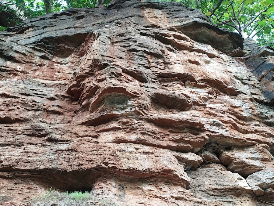
The principles and techniques of stratigraphy have far-reaching applications, extending beyond academic curiosity to practical endeavors that impact our daily lives.
Petroleum Exploration and Production: Finding the Black Gold
Stratigraphy plays an indispensable role in the exploration and production of hydrocarbons, such as oil and natural gas. Understanding the depositional environments of ancient sedimentary basins, the types of source rocks, reservoir rocks, and seals, and the structural traps all rely heavily on stratigraphic principles. Geologists use stratigraphic models to predict where valuable hydrocarbon deposits might be found. The layered nature of the Earth is a natural archive of where organic matter accumulated, transformed, and became trapped.
Reservoir Characterization: Understanding the Underground Landscape
Lithostratigraphy and chemostratigraphy are crucial for characterizing reservoir rocks. By understanding the porosity and permeability of different rock layers, geologists can estimate the volume of hydrocarbons present and optimize extraction strategies. The finer details of rock composition and texture, revealed through detailed stratigraphic analysis, are paramount in this endeavor.
Source Rock Identification: Tracing the Origin of Oil and Gas
Biostratigraphy and chemostratigraphy are employed to identify and date source rocks, the sedimentary layers from which oil and gas originated. The presence of specific organic matter and hydrocarbon biomarkers within these rocks, in relation to their stratigraphic position, provides evidence of their generative potential.
Paleoclimate Reconstruction: Reading the Earth’s Thermometer
Stratigraphy is a vital tool for reconstructing past climates. By examining fossil evidence, sediment types (such as ice-rafted debris or coal deposits), and geochemical signals (like stable isotope ratios), scientists can infer past temperature, precipitation patterns, and atmospheric composition. This historical perspective on climate change is essential for understanding current climate trends and for making informed predictions about future climate scenarios. The rock layers are like pages in a diary, each detailing a specific season or year in Earth’s climatic history.
Ice Core Records: Frozen Archives of Climate
While not strictly sedimentary strata, ice cores extracted from polar regions are essentially layered archives of past climate, containing trapped air bubbles, dust, and isotopic variations that provide invaluable paleoclimate data. Stratigraphic principles are applied to the interpretation of these layered ice sequences.
Ocean Sediment Cores: Marine Climate Archives
Sediments accumulating on the ocean floor offer a continuous record of past climate. Analyzing the composition of these layered sediments, including fossil plankton and the isotopic signatures of the seafloor, allows scientists to reconstruct oceanographic conditions and global climate changes over millions of years.
Hazard Assessment and Mitigation: Predicting and Preventing Disasters
Stratigraphy provides critical information for assessing and mitigating geological hazards such as landslides, earthquakes, and volcanic eruptions. Understanding the layering of geological materials, the presence of weak layers, and the history of seismic activity within a region are all informed by stratigraphic studies.
Landslide Analysis: Understanding Slope Instability
The identification of specific weak or impermeable rock layers within a slope, as revealed by lithostratigraphy, can help predict areas prone to landslides. The history of past landslides, also often recorded in the stratigraphy of an area, provides valuable data for risk assessment.
Earthquake History: Unraveling Seismic Activity
Stratigraphic evidence, such as offset layers along faults or the deposition of seismically induced sediment layers (turbidites), can reveal the frequency and magnitude of past earthquakes. This historical seismic record is crucial for understanding the seismic hazard of a region and for designing earthquake-resistant infrastructure.
Paleontological Research and Evolutionary Biology: The Story of Life
Biostratigraphy is intimately linked with paleontology and evolutionary biology. The ordered succession of fossils within rock layers provides tangible evidence for the theory of evolution by natural selection. By studying the fossil record chronologically, scientists can trace the evolutionary lineages of organisms, understand patterns of extinction and diversification, and reconstruct past ecosystems.
Tracing Evolutionary Pathways: From Simple to Complex
The discovery of transitional fossils, embedded within specific stratigraphic positions, has provided compelling evidence for the gradual evolution of life from simpler to more complex forms. Each fossil, placed within its stratigraphic context, is a snapshot of life at a particular moment in Earth’s history, allowing us to reconstruct the grand narrative of life’s unfolding.
Reconstructing Ancient Ecosystems: A Glimpse into the Past
By studying the fossil assemblages and the lithological context of rock layers, paleontologists can reconstruct ancient ecosystems, understanding the interactions between different organisms and their environment. This allows for a deeper appreciation of the biodiversity that has existed on Earth throughout its history.
Techniques and Tools in Stratigraphic Study
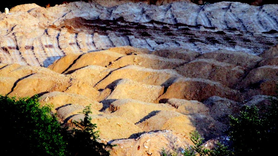
Modern stratigraphy employs a sophisticated array of techniques and tools to meticulously study rock layers, providing ever-increasing detail and accuracy in our understanding of Earth’s past.
Fieldwork: The Art of Direct Observation
The bedrock of stratigraphic study remains firsthand observation in the field. Geologists meticulously describe and measure rock outcrops, noting lithologies, sedimentary structures, fossil content, and the relationships between different layers. This direct engagement with the rock record is where the fundamental data is gathered.
Stratigraphic Columns: Visualizing the Layers
Detailed stratigraphic columns are constructed in the field, representing the vertical sequence of rock units. These columns serve as the primary graphical representation of the stratigraphy of an area, documenting the lithologies, thicknesses, and significant geological features of each layer.
Measured Sections: Precise Quantitative Data
Measured sections involve the precise measurement of the thickness of individual rock units and their constituent layers. This quantitative data is crucial for lithostratigraphic correlations and for understanding the scale and duration of depositional events.
Core Analysis: Peering Beneath the Surface
Drilling operations provide access to rock samples from below the surface, allowing geologists to study rock sections that are not exposed in outcrops. These rock cores are invaluable for detailed stratigraphic analysis, especially in areas where surface exposures are limited, such as offshore or in densely vegetated regions.
Well Logging: Inferring Stratigraphy from Boreholes
Well logging involves lowering various geophysical instruments into boreholes to measure the physical properties of the surrounding rock layers. These logs, which can include measurements of resistivity, radioactivity, and acoustic velocity, provide a continuous record of the stratigraphy and lithology of the subsurface, allowing for correlation with surface exposures and other boreholes.
Core Logging and Sampling: Detailed Examination
Rock cores are meticulously logged, describing their lithology, sedimentary structures, and fossil content. Samples are then taken from the cores for further laboratory analysis, including thin-section petrography, geochemical analysis, and radiometric dating, providing a high level of detail about the rock layers.
Remote Sensing and Geophysical Methods: Expanding the View
Modern technologies have revolutionized stratigraphic studies, allowing for the examination of rock layers over vast areas and beneath the surface without direct drilling.
Seismic Reflection and Refraction: Imaging Underground Structures
Seismic surveys, used extensively in hydrocarbon exploration, generate acoustic waves that penetrate the Earth’s crust. The reflections and refractions of these waves from different rock layers provide detailed images of subsurface structures, allowing geologists to map the stratigraphy of large regions and to identify seismic horizons that can be correlated across vast distances.
Ground Penetrating Radar (GPR): Shallow Subsurface Exploration
GPR uses radar pulses to image shallow subsurface structures. It is particularly useful for studying near-surface stratigraphy, such as in archaeological investigations, engineering studies, and for mapping shallow water tables and geological anomalies.
Satellite and Aerial Imagery: Regional Scale Observations
Satellite and aerial imagery provide broad-scale views of geological formations and surface features. Changes in vegetation, soil color, and landforms can all be indicative of underlying stratigraphic variations and can aid in regional stratigraphic mapping and correlation.
Stratigraphy is a crucial field in geology that helps us understand the layers of sedimentary rocks and their historical significance. For those interested in exploring this topic further, an insightful article can be found at Freaky Science, which delves into various aspects of geological formations and their implications for understanding Earth’s history. This resource provides a comprehensive overview that complements the study of stratigraphy and its applications in various scientific disciplines.
The Future of Stratigraphy: Evolving with Technology
| Metric | Description | Typical Units | Example Values |
|---|---|---|---|
| Stratum Thickness | Vertical thickness of a sedimentary layer | meters (m) | 0.5 – 50 m |
| Age of Stratum | Geological age of the layer | Million years ago (Ma) | 0.01 – 2500 Ma |
| Fossil Content | Presence and type of fossils within the layer | Qualitative | Marine fossils, plant remains, microfossils |
| Grain Size | Average size of sediment particles | Millimeters (mm) | 0.002 – 2 mm (clay to sand) |
| Lithology | Rock type and composition | Qualitative | Sandstone, shale, limestone |
| Stratigraphic Range | Vertical extent of a fossil or rock unit in the stratigraphic column | meters (m) | 1 – 100 m |
| Depositional Environment | Environment where sediment was deposited | Qualitative | Fluvial, marine, deltaic, lacustrine |
Stratigraphy is a dynamic field, continuously evolving with advancements in technology and analytical techniques. The quest to understand Earth’s history is an ongoing endeavor, and stratigraphy will undoubtedly play a central role in future discoveries.
Computational Stratigraphy and Big Data
The increasing volume of geological data, collected through advanced exploration techniques and digital mapping, necessitates the use of computational methods and big data analytics. Stratigraphers are developing sophisticated algorithms and software to process, analyze, and interpret these massive datasets, leading to more accurate correlations and a deeper understanding of complex stratigraphic relationships.
Integration of Multiple Stratigraphic Disciplines
The future of stratigraphy lies in the increasingly integrated application of its various sub-disciplines. Combining lithostratigraphic, biostratigraphic, chronostratigraphic, and chemostratigraphic data allows for a more robust and comprehensive understanding of geological history. This multi-proxy approach offers a more complete picture by cross-referencing information from different sources.
Advanced Analytical Techniques: Unlocking Finer Details
New and more sensitive analytical techniques continue to emerge, enabling stratigraphers to extract even finer details from rock layers. Advances in mass spectrometry, microscopy, and computational geochemistry will undoubtedly lead to new insights into past environments, evolutionary processes, and the timing of geological events.
Climate Change and Stratigraphic Research
As the Earth’s climate continues to change, stratigraphic research will become even more critical. Studying past climate shifts recorded in the rock layers provides invaluable context for understanding present-day climate change and for developing effective mitigation strategies. The Earth’s layered record is arguably one of our most important teachers in navigating the complexities of our changing planet.
FAQs
What is stratigraphy?
Stratigraphy is the branch of geology that studies rock layers (strata) and layering (stratification). It is primarily used to understand the chronological sequence of geological events and the history of the Earth.
How do geologists use stratigraphy?
Geologists use stratigraphy to analyze the order and relative position of rock layers to interpret the Earth’s history, date fossils, and correlate rock formations across different regions.
What are the main principles of stratigraphy?
The main principles include the Law of Superposition (younger layers are deposited on top of older ones), the Principle of Original Horizontality (layers are originally deposited horizontally), and the Principle of Cross-Cutting Relationships (features that cut through rocks are younger than the rocks they cut).
What types of stratigraphy exist?
There are several types, including lithostratigraphy (based on rock type), biostratigraphy (based on fossil content), chronostratigraphy (based on age), and sequence stratigraphy (based on depositional sequences).
Why is stratigraphy important in fields like archaeology and oil exploration?
In archaeology, stratigraphy helps date artifacts and understand human activity over time. In oil exploration, it assists in identifying rock formations that may contain hydrocarbons, guiding drilling and extraction efforts.