
The Earth’s magnetic field is a dynamic and complex phenomenon, vital for protecting the planet from solar radiation and guiding navigational systems. One aspect of this field, magnetic declination, refers to the angle on the horizontal plane between magnetic north (the direction the needle of a compass points) and true north (the direction along a meridian towards the geographic North Pole). This declination is not static; it undergoes continuous change, a process known as magnetic declination drift. Understanding and tracking this drift is crucial for numerous applications, from aviation and marine navigation to geophysical research and directional drilling. This article delves into the latest updates regarding the tracking of magnetic declination drift, exploring the methodologies, global observatories, computational models, and the implications of these changes.
The Earth’s magnetic field originates primarily from the geodynamo, the convective motion of molten iron and nickel in the planet’s outer core. Variations in these complex fluid dynamics drive the changes observed at the Earth’s surface. Magnetic declination drift is a manifestation of these core processes. You can learn more about the earth’s magnetic field and its effects on our planet.
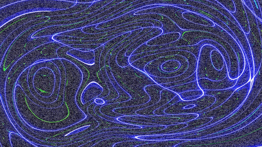
Geomagnetic Secular Variation
The term “secular variation” describes the slow, long-term changes in the Earth’s magnetic field. These variations occur on timescales of years to millennia and are directly attributable to changes in the geodynamo. At any given location, magnetic declination does not simply maintain a fixed offset from true north; it slowly shifts eastward or westward over time. This continuous reorientation requires regular updates to navigational charts and systems. For instance, a mariner using an outdated chart without accounting for secular variation could find their compass pointing several degrees away from the intended direction, potentially leading to navigational errors.
Geomagnetic Jerks
Superimposed on the gradual secular variation are more abrupt, short-term changes called “geomagnetic jerks.” These events represent sudden shifts in the rate of change of the geomagnetic field components, including declination. Jerks typically manifest over periods of a few years and are thought to originate from sudden accelerations or decelerations of fluid flow within the outer core. While less predictable than secular variation, their occurrence highlights the turbulent nature of the geodynamo. Scientists closely monitor these jerks as they offer valuable insights into the dynamics of the Earth’s interior. The ability to detect and characterize these jerks impacts the accuracy of magnetic models, as they can suddenly alter the expected drift rate.
Recent updates on magnetic declination drift have highlighted the importance of staying informed about changes in Earth’s magnetic field, which can significantly impact navigation and various technologies. For a deeper understanding of this phenomenon and its implications, you can read a related article that explores the latest findings and research in the field. Check it out here: Magnetic Declination Drift Updates.
Observational Networks and Data Acquisition
Accurate tracking of magnetic declination drift relies heavily on a robust global network of geomagnetic observatories and specialized survey campaigns. These facilities continuously monitor the Earth’s magnetic field components, providing the raw data essential for understanding its temporal evolution.
Global Geomagnetic Observatory Network (GGON)
The GGON comprises over 150 permanent observatories strategically distributed across the globe. These observatories, often operated by national geological surveys or academic institutions, employ highly sensitive magnetometers to record continuous series of magnetic field measurements. These measurements include the magnetic declination, inclination (the angle the magnetic field lines make with the horizontal), and total intensity. Data collected from these observatories are crucial for:
- Establishing baseline values: Providing reference points for magnetic field characteristics at various locations.
- Monitoring secular variation: Tracking the gradual changes in the field over decades.
- Detecting geomagnetic jerks: Identifying abrupt shifts in the field’s rate of change.
The data acquired by the GGON is often processed and disseminated by international bodies such as the International Association of Geomagnetism and Aeronomy (IAGA), making it accessible to the scientific community and relevant industries.
Satellite Missions for Geomagnetic Field Mapping
In addition to ground-based observatories, satellite missions play a critical role in providing comprehensive, global coverage of the Earth’s magnetic field. Satellites orbiting the Earth can measure the magnetic field from hundreds of kilometers above the surface, offering unparalleled spatial resolution and global coverage that ground observatories cannot achieve.
- Swarm Mission (ESA): Launched in 2013, the European Space Agency’s Swarm mission consists of three identical satellites flying in formation. Swarm provides highly accurate and high-resolution measurements of the Earth’s magnetic field, allowing scientists to pinpoint the sources of magnetic field variations from the core, mantle, crust, oceans, ionosphere, and magnetosphere. Its data is instrumental in refining models of magnetic declination drift.
- CHAMP and Ørsted Missions: Preceding Swarm, missions like CHAMP (CHAllenging Minisatellite Payload) and Ørsted provided foundational data that revolutionized geomagnetic field modeling. These missions demonstrated the immense value of satellite data in understanding the Earth’s magnetic field and its evolution. The legacy of these missions continues to inform and validate current satellite observations and models.
Marine and Aerial Magnetic Surveys
For more localized and high-resolution mapping, especially in areas with complex crustal magnetic anomalies, marine and aerial magnetic surveys are conducted. Aircraft and ships equipped with magnetometers can collect dense datasets over specific regions. While these surveys are not primarily designed for tracking long-term declination drift, they provide crucial ground truth and high-resolution spatial information that can complement global models, particularly in coastal areas or regions with significant geological features that influence local magnetic declination.
Computational Models for Predicting Drift
Observational data, whether from ground-based observatories or satellites, forms the backbone for developing and refining sophisticated computational models. These models are essential for predicting future magnetic declination and understanding its past behavior.
International Geomagnetic Reference Field (IGRF)
The IGRF is a standard mathematical model of the Earth’s main magnetic field and its secular variation. It is produced by IAGA and updated every five years, with the latest iteration being the IGRF-13, updated in 2020. The IGRF provides a set of spherical harmonic coefficients that describe the magnetic field at the Earth’s surface and in near-Earth space. Users can input a location and date into the IGRF model to obtain the magnetic declination, inclination, and total field intensity for that specific point in time. The IGRF is widely used in:
- Navigation: Air traffic control, marine navigation, and GPS systems often incorporate IGRF data for accurate compass corrections.
- Geophysical research: Providing a reference field for anomalies.
- Directional drilling: Guiding drills in the oil and gas industry.
The IGRF is a predictive model, meaning it extends its forecast for the magnetic field five years into the future. However, inherent uncertainties mean that the accuracy of the prediction degrades over time, underscoring the need for quinquennial updates.
World Magnetic Model (WMM)
The WMM is another widely used geomagnetic field model, developed jointly by the U.S. National Oceanic and Atmospheric Administration (NOAA) and the British Geological Survey (BGS). Like the IGRF, the WMM is updated every five years, with the current version being WMM2020. Its primary purpose is to serve as the standard model for navigation, especially for military applications and commercial aviation worldwide. It covers a broader scope, providing not just declination but all components of the magnetic field. A key difference from the IGRF is its emphasis on operational accuracy for navigation. The WMM is embedded in countless navigation systems and devices globally, making its regular updates critical for safety and efficiency.
- Predictive Horizon: The WMM also offers a 5-year prediction. However, the rapid changes in the Earth’s magnetic field, particularly the accelerated westward drift of the North Magnetic Pole, have sometimes challenged the accuracy of these predictions, occasionally necessitating out-of-cycle updates. This highlights the dynamic nature of the field and the limitations of even the most sophisticated models.
Advanced Geodynamo Simulations
Beyond empirical models like IGRF and WMM, scientists are increasingly using advanced numerical simulations of the geodynamo. These simulations attempt to model the physical processes within the Earth’s outer core responsible for generating the magnetic field. While computationally intensive, these models offer the potential for a deeper, mechanistic understanding of magnetic field variations, including declination drift and geomagnetic jerks. They aim to:
- Explain observed phenomena: Provide physical explanations for the patterns seen in geomagnetic data.
- Improve long-term predictions: By understanding the underlying physics, potentially enable more accurate long-term forecasts of magnetic field behavior.
- Test hypotheses: Evaluate theories about the Earth’s core and its dynamics.
While still in the research phase for operational applications, these simulations represent the forefront of geomagnetic modeling and hold promise for significantly enhancing our predictive capabilities in the future.
Implications of Magnetic Declination Updates
The ceaseless drift of magnetic declination necessitates continuous monitoring and regular updates to navigational systems. Failure to incorporate these changes can have significant practical consequences across various sectors.
Aviation and Marine Navigation
For pilots and mariners, magnetic declination is a critical parameter for accurate compass readings. Compasses point to magnetic north, and to navigate relative to true north, the declination must be precisely known and applied as a correction.
- Safety Critical Systems: In aviation, particularly for instruments like the horizontal situation indicator (HSI), incorporating the correct declination is essential. Outdated declination values can lead to small but cumulative navigational errors, which, over long distances or in poor visibility, could lead to off-course trajectories, increased fuel consumption, or even safety incidents.
- Marine Charts: Nautical charts typically include declination information for the year of their publication and an annual rate of change. Mariners must manually adjust these values or rely on electronic chart systems (ECDIS) that automatically apply the corrections using updated magnetic models. The rapid shift of the North Magnetic Pole, for example, has necessitated more frequent updates to charts in polar regions.
Geophysical Surveying and Directional Drilling
Industries that rely on precise directional information for subsurface operations also depend heavily on accurate magnetic declination data.
- Oil and Gas Exploration: Directional drilling, paramount in the oil and gas industry, involves guiding drilling tools along a predetermined path beneath the Earth’s surface. Magnetometers within the drilling assembly help determine the wellbore’s azimuth. An incorrect magnetic declination input can lead to significant deviations from the intended target, potentially resulting in drilling into unintended zones, missing a reservoir, or even colliding with existing wellbores. The costs associated with such errors can be substantial.
- Mineral Exploration: Similarly, geophysical surveys for mineral exploration often use magnetometers to detect buried ore bodies. Accurate declination data ensures that the collected magnetic anomaly maps are correctly oriented and interpreted, facilitating more efficient exploration efforts.
Space Weather Prediction and Research
While declination drift primarily relates to the core field, the modeling improvements driven by declination tracking also benefit space weather prediction. The main field acts as a shield against solar storms. Understanding its current state and evolution helps in:
- Predicting Geomagnetic Storms: Enhancing the accuracy of models that predict how geomagnetic storms interact with the Earth’s magnetic field, which is vital for protecting power grids, satellites, and communication systems.
- Understanding Ionospheric Currents: The core field influences the dynamics of the ionosphere, where dynamic electrical currents are generated. Accurate core field models aid in distinguishing these internal changes from external magnetic variations caused by space weather.
Recent updates on magnetic declination drift have highlighted the importance of understanding how Earth’s magnetic field is constantly changing. For those interested in exploring this topic further, a related article provides in-depth insights into the factors influencing these shifts and their implications for navigation and technology. You can read more about it in this informative piece on Freaky Science, which delves into the science behind magnetic declination and its real-world applications.
Future Outlook and Challenges in Tracking Declination Drift
| Year | Location | Magnetic Declination (°) | Annual Drift (°/year) | Update Source |
|---|---|---|---|---|
| 2020 | New York, USA | -13.2 | 0.1 | NOAA Geomagnetic Model |
| 2020 | London, UK | -0.5 | 0.06 | British Geological Survey |
| 2020 | Sydney, Australia | 12.3 | -0.08 | Geoscience Australia |
| 2023 | New York, USA | -12.9 | 0.1 | NOAA Geomagnetic Model Update |
| 2023 | London, UK | -0.32 | 0.06 | British Geological Survey Update |
| 2023 | Sydney, Australia | 12.06 | -0.08 | Geoscience Australia Update |
The endeavor to track magnetic declination drift is continuously evolving, driven by technological advancements and the inherent complexity of the Earth’s magnetic field.
Enhanced Resolution and Real-time Monitoring
Future advancements are likely to focus on increasing the spatial and temporal resolution of magnetic field measurements.
- Next-Generation Satellite Missions: Future satellite missions may employ more sophisticated magnetometers, constellation designs with more satellites, or even lower orbital altitudes to provide even higher resolution data. The concept of “swarms of swarms” (multiple small satellite constellations) could offer unprecedented data density.
- Ground-based Sensor Networks: The expansion of ground-based sensor networks, potentially incorporating low-cost magnetometers in remote regions, could fill observational gaps and provide more localized data inputs for regional models. The integration of IoT-enabled sensors for more real-time data streaming is also a developing area.
Improved Predictive Capabilities of Models
A significant challenge remains in improving the predictive accuracy of geomagnetic models, especially over longer time periods.
- Assimilative Models: Efforts are underway to develop “assimilative models” that continuously integrate new observational data into the geodynamo simulations. Similar to weather forecasting, this approach allows models to self-correct and improve their short-term and medium-term predictions. The challenge lies in efficiently integrating diverse data types and managing the computational overheads.
- Understanding Core-Mantle Interaction: A more profound understanding of the coupling between the Earth’s liquid outer core and the solid mantle is crucial. The mantle’s thermal and electrical conductivity can influence the core’s dynamics, potentially affecting secular variation and jerks. Research into these interactions promises to refine predictive models.
Addressing the Westward Drift and Polar Wander
The rapid and somewhat erratic westward drift of the North Magnetic Pole, and specifically its acceleration towards Siberia, presents a particular challenge. This unexpected speed often means operational models like the WMM need more frequent updates than their quinquennial schedule.
- Dynamic Updating Mechanisms: The development of mechanisms for more flexible or ‘on-demand’ updates to operational models becomes imperative. This might involve an adaptive update cycle based on real-time monitoring of pole movement and secular variation rates, rather than a fixed 5-year interval.
- Regional Models for High-Variability Zones: In regions experiencing particularly rapid declination changes, such as the Arctic, the development of specialized high-resolution regional models might be necessary to supplement global models, providing more accurate local corrections.
In conclusion, tracking magnetic declination drift is a continuous and complex scientific endeavor. From the intricate workings of the Earth’s core, through the vigilant eyes of global observatories and satellites, to the sophisticated algorithms of computational models, every piece of the puzzle contributes to ensuring the accuracy of countless navigational and industrial applications. The ongoing pursuit of higher resolution data, more robust predictive models, and a deeper understanding of geomagnetism remains crucial as the Earth’s magnetic field continues its relentless, dynamic dance.
WATCH THIS! 🌍 EARTH’S MAGNETIC FIELD IS WEAKENING
FAQs
What is magnetic declination?
Magnetic declination is the angle between magnetic north (the direction a compass needle points) and true north (geographic north). It varies depending on your location on Earth.
Why does magnetic declination change over time?
Magnetic declination changes due to the movement of the Earth’s molten iron core, which affects the planet’s magnetic field. This gradual shift causes the magnetic poles to drift, altering declination values.
How often are magnetic declination updates released?
Magnetic declination updates are typically released every five years by organizations such as the National Oceanic and Atmospheric Administration (NOAA) and the World Magnetic Model (WMM) team to reflect changes in the Earth’s magnetic field.
How can I find the current magnetic declination for my location?
You can find the current magnetic declination by using online calculators provided by agencies like NOAA, or by consulting updated magnetic declination maps and models.
Why is it important to have updated magnetic declination information?
Accurate magnetic declination information is crucial for navigation, surveying, aviation, and military operations to ensure compass readings are correctly aligned with true north.
What is magnetic declination drift?
Magnetic declination drift refers to the gradual change in magnetic declination values over time due to the shifting position of the Earth’s magnetic poles.
Can magnetic declination drift affect GPS devices?
GPS devices primarily use satellite signals for positioning and are not directly affected by magnetic declination. However, compass functions within GPS units rely on magnetic declination data, so updates are necessary for accurate compass readings.
How do magnetic declination updates impact navigation?
Updated magnetic declination values ensure that compass bearings are accurate, which is essential for safe and precise navigation, especially in wilderness, maritime, and aviation contexts.
What tools or models are used to calculate magnetic declination?
Magnetic declination is calculated using geomagnetic models such as the World Magnetic Model (WMM) and the International Geomagnetic Reference Field (IGRF), which incorporate satellite and ground-based magnetic data.
Is magnetic declination the same worldwide?
No, magnetic declination varies globally and can be east or west of true north depending on geographic location. It can range from 0° to over 30° in some regions.