North America, a vast and diverse landmass, is often referred to as a “cracking continent” due to its dynamic geological processes. This term encapsulates the ongoing changes that shape the continent’s landscape, driven by the movement of tectonic plates and the forces of nature. From the majestic Rocky Mountains to the expansive Great Plains, North America’s geological features tell a story of transformation and evolution.
The continent’s history is marked by significant events, including volcanic eruptions, earthquakes, and the gradual shifting of landmasses, all of which contribute to its current state. The concept of a “cracking continent” highlights the intricate relationship between geological forces and the environment. As tectonic plates shift and collide, they create a variety of geological phenomena that not only define the physical landscape but also influence ecosystems and human activities.
Understanding these processes is essential for comprehending the continent’s past and predicting its future. The following sections will delve into the formation of North America, the movement of tectonic plates, and the evidence of continental drift that has shaped this remarkable land.
Key Takeaways
- North America’s continent is constantly changing due to geological processes such as continental drift, tectonic plate movement, and volcanic activity.
- Tectonic plates beneath North America are constantly shifting, leading to the formation of new geological features and the potential for earthquakes.
- Evidence of continental drift in North America can be seen in the alignment of geological formations and the distribution of fossils and rock types.
- Geological features resulting from continental drift in North America include mountain ranges, rift valleys, and coastal plains.
- Human interaction and adaptation to North America’s cracking continent require an understanding of geological processes and the potential for natural disasters such as earthquakes and volcanic activity.
The Formation of the North American Continent
The formation of North America is a tale that spans billions of years, beginning with the primordial Earth. Initially, the continent was part of a supercontinent known as Pangaea, which existed around 335 million years ago. Over time, geological forces caused Pangaea to break apart, leading to the gradual emergence of North America as a distinct landmass.
This process involved complex interactions between tectonic plates, volcanic activity, and sedimentation, all contributing to the continent’s unique geological identity. As North America separated from other landmasses, it underwent significant transformations. The collision of tectonic plates led to the uplift of mountain ranges, such as the Appalachians and Rockies, while erosion shaped valleys and plains.
The interplay between these forces created a diverse array of landscapes, from rugged mountains to flat prairies. The geological history of North America is not merely a record of its physical formation; it also reflects the environmental conditions that have influenced the development of ecosystems and human civilizations throughout history.
Tectonic Plates and Their Movement
Tectonic plates are massive slabs of Earth’s lithosphere that float on the semi-fluid asthenosphere beneath them. North America is situated on the North American Plate, which interacts with several neighboring plates, including the Pacific Plate to the west and the Caribbean Plate to the south. The movement of these plates is driven by convection currents in the Earth’s mantle, resulting in various geological phenomena such as earthquakes, volcanic eruptions, and mountain building.
The boundaries between tectonic plates can be classified into three main types: divergent, convergent, and transform. Divergent boundaries occur when plates move apart, allowing magma to rise and create new crust. Convergent boundaries form when plates collide, leading to subduction or mountain formation.
Transform boundaries involve lateral sliding between plates, often resulting in seismic activity. In North America, these interactions are particularly evident along the West Coast, where the Pacific Plate meets the North American Plate, creating a region prone to earthquakes and volcanic activity.
Evidence of Continental Drift in North America
| Location | Evidence of Continental Drift |
|---|---|
| Appalachian Mountains | Fossil evidence of similar species found on both sides of the Atlantic Ocean |
| Mid-Atlantic Ridge | Seafloor spreading and magnetic striping |
| Great Lakes | Glacial striations and deposits indicating movement of glaciers |
| Mississippi River Delta | Matching rock formations and geological structures with those in Africa |
The theory of continental drift, first proposed by Alfred Wegener in the early 20th century, posits that continents were once joined together and have since drifted apart. Evidence supporting this theory can be found throughout North America in various forms. One significant piece of evidence is the similarity of rock formations and fossil records across different regions.
For instance, similar types of rocks can be found in both eastern Canada and western Europe, suggesting that these areas were once part of a larger landmass. Additionally, paleoclimatic data provides insight into past environmental conditions that further supports continental drift. Fossils of tropical plants have been discovered in present-day Arctic regions, indicating that these areas were once located closer to the equator.
Such findings highlight how the movement of tectonic plates has not only altered geographical boundaries but has also influenced climate patterns over millions of years. The cumulative evidence reinforces the notion that North America has undergone significant changes since its formation.
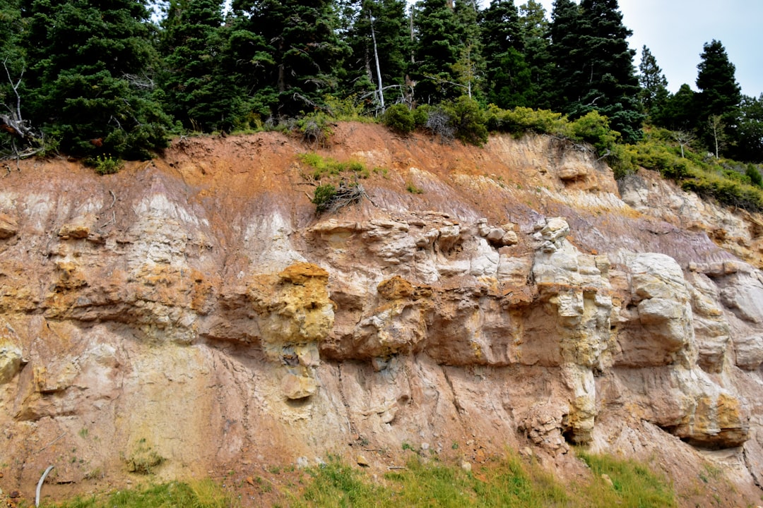
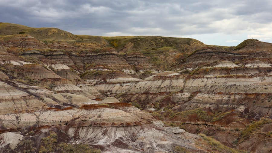
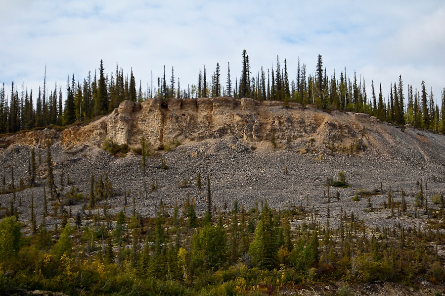
Geological Features Resulting from Continental Drift
The geological features resulting from continental drift are diverse and strikingly beautiful. Mountain ranges such as the Rockies and Appalachians were formed through tectonic activity associated with plate collisions. These mountains are not only significant for their height but also for their ecological diversity, providing habitats for countless species.
Valleys and basins formed by erosion and sedimentation further illustrate how continental drift has sculpted North America’s landscape. In addition to mountains and valleys, other geological features such as rift valleys and fault lines are direct results of tectonic movements. The Basin and Range Province in the western United States showcases a series of parallel mountain ranges separated by desert valleys, a clear indication of extensional forces at work.
Similarly, the San Andreas Fault exemplifies a transform boundary where two tectonic plates slide past each other, leading to frequent seismic activity. These features serve as reminders of the dynamic processes that continue to shape North America’s geological identity.
Impact of Continental Drift on North America’s Landscape
The impact of continental drift on North America’s landscape is profound and multifaceted. As tectonic plates shift over millions of years, they have not only altered physical geography but have also influenced climate patterns and biodiversity across the continent. For example, the uplift of mountain ranges has created rain shadows that affect precipitation distribution, leading to diverse ecosystems ranging from lush forests to arid deserts.
Moreover, continental drift has played a crucial role in shaping river systems and drainage patterns. The Mississippi River, one of North America’s most significant waterways, has been influenced by geological processes that have altered its course over time. As mountains rise and erode, rivers carve their paths through landscapes, creating fertile valleys that support agriculture and human settlement.
The interplay between geological forces and hydrology underscores how continental drift has shaped not only the physical landscape but also human civilization’s development.
Geological Processes Contributing to North America’s Cracking Continent
Several geological processes contribute to North America’s characterization as a “cracking continent.” Among these processes are erosion, sedimentation, volcanic activity, and seismic events. Erosion shapes landscapes by wearing down mountains and redistributing sediments across plains and valleys. This continuous cycle contributes to the dynamic nature of North America’s surface.
Volcanic activity is another critical factor in shaping the continent’s geology. The Pacific Northwest is home to several active volcanoes that have formed as a result of subduction along convergent plate boundaries. These volcanoes not only create new landforms but also influence local ecosystems through ash deposition and thermal activity.
Additionally, seismic events resulting from tectonic movements can lead to significant changes in landscapes over short periods, further emphasizing the continent’s dynamic nature.
The Role of Earthquakes in North America’s Geological Evolution
Earthquakes play a pivotal role in North America’s geological evolution by reshaping landscapes and influencing ecosystems. The region is particularly susceptible to seismic activity due to its position along several tectonic plate boundaries. The San Andreas Fault in California is one of the most well-known examples of this phenomenon; it has experienced numerous significant earthquakes that have altered both natural landscapes and human infrastructure.
The impact of earthquakes extends beyond immediate destruction; they can also lead to long-term changes in landforms. For instance, ground shaking can cause landslides or liquefaction in saturated soils, resulting in shifts in topography. Additionally, earthquakes can create new fault lines or alter existing ones, contributing to ongoing geological evolution.
Understanding these processes is essential for assessing risks and preparing for future seismic events in this geologically active region.
Volcanic Activity and its Influence on North America’s Crust
Volcanic activity significantly influences North America’s crust through both explosive eruptions and effusive lava flows. The Cascade Range in the Pacific Northwest is home to several active volcanoes that have shaped the landscape over millennia. These volcanoes are primarily associated with subduction zones where oceanic plates dive beneath continental plates, leading to magma formation.
This process fosters biodiversity by creating unique habitats for various plant and animal species. Furthermore, volcanic activity contributes to geothermal energy resources that are increasingly being harnessed for sustainable energy production across North America.
Human Interaction and Adaptation to North America’s Cracking Continent
Human interaction with North America’s cracking continent has evolved alongside its geological changes. As civilizations developed over thousands of years, they adapted to the diverse landscapes shaped by tectonic activity. Indigenous peoples learned to navigate mountainous terrains and fertile river valleys while utilizing natural resources for sustenance.
In modern times, urban development has often occurred in geologically active regions despite inherent risks such as earthquakes or volcanic eruptions. Cities like San Francisco and Los Angeles exemplify this phenomenon; they thrive economically yet remain vulnerable to seismic hazards due to their proximity to fault lines. As awareness grows regarding these risks, efforts are being made to implement better building codes and disaster preparedness plans aimed at mitigating potential impacts on human populations.
The Future of North America’s Geological Evolution
The future of North America’s geological evolution remains uncertain yet fascinating as tectonic processes continue to shape its landscape. Scientists predict that ongoing plate movements will lead to further changes in topography over millions of years—mountains may rise while others erode away; new rift valleys could form while existing ones deepen. Additionally, climate change poses new challenges for understanding how geological processes interact with environmental factors such as rising sea levels or increased weathering rates due to extreme weather events.
As researchers continue studying these complex interactions between geology and climate systems, they will gain valuable insights into predicting future changes across this dynamic continent. In conclusion, North America’s status as a “cracking continent” reflects its rich geological history shaped by tectonic movements over billions of years. From its formation as part of Pangaea to its current state marked by diverse landscapes influenced by earthquakes and volcanic activity—each aspect contributes uniquely to understanding this remarkable landmass’s evolution over time.
Recent studies have brought to light fascinating geological evidence suggesting that North America is undergoing a significant transformation, with signs indicating that the continent is gradually cracking. This phenomenon has sparked interest among geologists and researchers who are keen to understand the underlying causes and potential implications of such a shift. For those interested in delving deeper into this topic, a related article on Freaky Science provides further insights into the geological processes at play. You can read more about it by visiting