
Zealandia, the mostly submerged continent east of Australia, presents a complex and significant challenge regarding tsunami risk. Its unique geological setting, characterized by active subduction zones, positions it as a region of particular concern for both local populations and the wider Pacific. Understanding the mechanisms driving these subduction zones and the potential consequences of their seismic activity is paramount for disaster preparedness and mitigation strategies. This article explores the geological context of Zealandia’s subduction zones, discusses the specific risks they pose, and outlines the current state of research and monitoring efforts.
Zealandia, approximately two-thirds the size of Australia, is predominantly submerged beneath the southwest Pacific Ocean, with New Zealand forming its largest emergent landmass. This continental fragment is bounded by a series of plate boundaries, most notably the Hikurangi Subduction Zone to the east of New Zealand and the Puysegur Subduction Zone to the southwest. The interaction of these tectonic plates is the primary driver of seismic and volcanic activity across the continent, directly influencing its tsunami potential.
Plate Tectonics and Subduction
At the heart of Zealandia’s geological activity lies the process of subduction. This occurs when one tectonic plate slides beneath another, descending into the Earth’s mantle. The immense stresses generated by this process can accumulate over long periods, eventually releasing sudden bursts of energy in the form of earthquakes.
Pacific Plate Subducting Beneath Australian Plate
Along Zealandia’s eastern margin, the mighty Pacific Plate is being overridden by the Australian Plate. This convergence forms the Hikurangi Subduction Zone, a critical area of study. The angle at which the Pacific Plate dives beneath the Australian Plate varies along its length, influencing the style and magnitude of potential earthquakes. In the northern sections, particularly east of the North Island, the subduction angle is relatively shallow, leading to a greater potential for “slow slip events” – aseismic slips that release stress gradually over weeks or months, but also accumulate strain that can eventually lead to large quakes. Further south, the subduction becomes steeper, implying different seismic characteristics.
Australian Plate Subducting Beneath Pacific Plate
Conversely, to the southwest of Zealandia, the Australian Plate is subducting beneath the Pacific Plate, forming the Puysegur Subduction Zone. While less commonly discussed than the Hikurangi, this zone is nonetheless active and capable of generating significant earthquakes. The dynamics here are distinct, with the Australian Plate being relatively older and denser in this region. This difference in plate characteristics contributes to variations in seismic behavior and the potential for rupture.
Continental Fragments and Crustal Deformation
Zealandia itself is not a monolithic block but a collection of continental fragments that have undergone significant deformation due to the ongoing tectonic activity. This internal fragmentation means that the stress from the subducting plates is not uniformly distributed.
Distributed Deformation within Zealandia
Rather than a single, clean subduction interface, the subduction zones around Zealandia interact with a highly fractured continental crust. This “distributed deformation” means that earthquakes can occur not only directly on the plate boundary but also within the overriding plate, in zones of weakness or pre-existing faults. These intraplate earthquakes can also contribute to tsunami generation, albeit often with different characteristics than megathrust events. The complex interplay of stresses can be likened to a crumpled sheet of paper, where the folds and tears represent faults that can rupture.
Recent studies have highlighted the significant tsunami risk associated with the Zealandia subduction zones, emphasizing the need for increased awareness and preparedness in coastal regions. For a deeper understanding of the geological factors contributing to this risk, you can read a related article that explores the dynamics of subduction zones and their potential impact on tsunami generation. For more information, visit this article.
Tsunami Generation Mechanisms
The potential for tsunami generation around Zealandia is intrinsically linked to the subduction zone earthquakes. Tsunamis are primarily generated by the sudden displacement of a large volume of water, and seismic events provide the most potent mechanism for this.
Megathrust Earthquakes
The most destructive tsunamis are typically generated by megathrust earthquakes, which occur at the interface between the subducting and overriding plates. When such an earthquake ruptures, the seafloor is rapidly uplifted or subsided over a broad area, pushing or pulling the overlying water column.
Characteristics of Megathrust Ruptures
Megathrust ruptures can be enormous, extending for hundreds of kilometers along the plate interface and lasting for several minutes. The amount of vertical displacement of the seafloor directly correlates with the initial size of the tsunami wave. The largest megathrust earthquakes, often exceeding magnitude 8.0, are the primary concern for regional and trans-oceanic tsunamis. The rupture process is like a colossal hand suddenly lifting or dropping a large section of the ocean floor, sending ripples outward.
Submarine Landslides Triggered by Earthquakes
Beyond the direct seafloor displacement, megathrust earthquakes can also trigger massive submarine landslides. These landslides, often occurring on steep continental slopes or within submarine canyons, can independently generate tsunamis. The sudden movement of substantial volumes of sediment down the slope can displace a significant amount of water, creating what are known as “tsunami-genic” landslides. These can generate localized but highly destructive tsunamis, sometimes even larger than those directly from the seismic event, particularly in near-field locations.
Intraslab Earthquakes
While megathrust events are the primary focus, earthquakes occurring within the subducting plate (intraslab earthquakes) can also pose a tsunami risk. These events occur as the descending plate continues to fracture and deform deep within the Earth’s mantle.
Deeper Earthquakes and Limited Seafloor Deformation
Intraslab earthquakes are generally deeper than megathrust events. While they can still be large in magnitude, their depth means that the seafloor deformation they cause tends to be less extensive and more localized. Consequently, intraslab earthquakes typically generate smaller tsunamis compared to megathrust events. However, the exact location and focal mechanism of an intraslab earthquake can still lead to localized water displacement, particularly if the rupture propagates to shallower depths or occurs directly beneath a steep bathymetric feature.
Historic and Paleotsunami Evidence
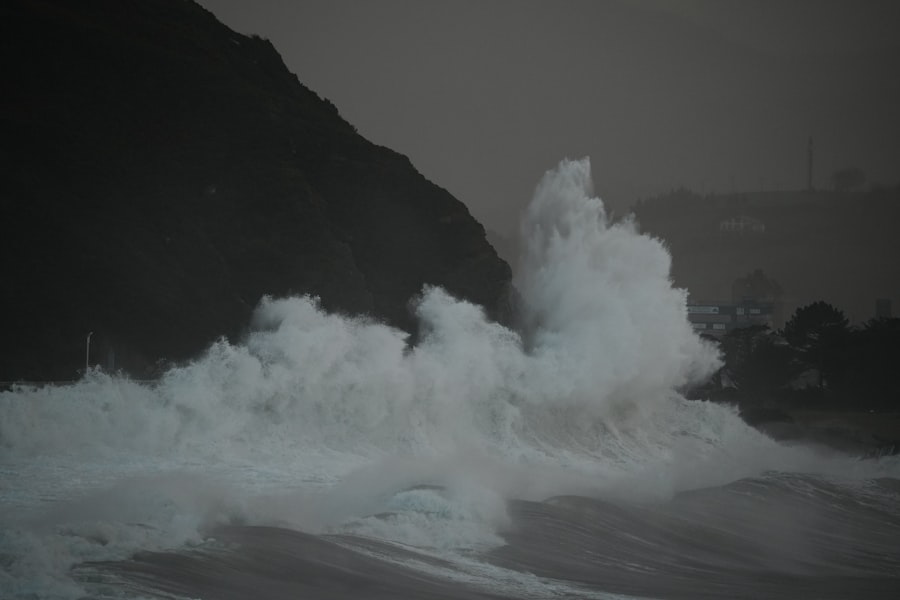
The geological record and historical accounts offer crucial insights into past tsunami events around Zealandia, helping scientists to understand the frequency and magnitude of these hazards.
Records from the Hikurangi Subduction Zone
The Hikurangi Subduction Zone has a long history of seismic activity, with evidence of multiple past tsunami events. Paleotsunami research, which involves studying geological deposits like sand sheets and peats, has revealed traces of large tsunamis impacting the eastern coast of New Zealand.
Sediment Layers and Microfossils
Scientists analyze sediment cores and coastal outcrops for evidence of tsunami inundation. Distinctive layers of sand, sometimes containing marine microfossils in freshwater environments, are tell-tale signs of past tsunami surges. Radiocarbon dating of organic material within these layers allows researchers to establish a timeline of past events. These layers are like nature’s indelible timestamp, recording the destructive reach of ancient waves.
Indigenous Oral Traditions
Māori oral traditions, passed down through generations, also contain narratives that describe large waves and coastal inundation events, some of which are consistent with the geological evidence of past tsunamis. Integrating these traditional knowledge systems with scientific data provides a richer and more localized understanding of long-term tsunami hazards.
Puysegur Subduction Zone History
While less extensively studied for paleotsunami evidence compared to the Hikurangi, the Puysegur Subduction Zone has also demonstrated its tsunami-generating potential.
2004 Macquarie Island Earthquake and Tsunami
A significant event occurred in December 2004, when a magnitude 8.1 earthquake struck near Macquarie Island, within the broader Puysegur region. This earthquake generated a widespread tsunami that was recorded across the Pacific, including gauges around New Zealand and Australia. Although the tsunami was relatively small in New Zealand, it served as a stark reminder of the potential for such events from this southwestern margin of Zealandia.
Tsunami Hazard and Risk Assessment
Assessing the tsunami hazard for Zealandia requires a multi-faceted approach, integrating geological understanding, seismic monitoring, and numerical modeling.
Hazard to New Zealand Coasts
New Zealand, as the largest emergent part of Zealandia, is particularly vulnerable to tsunamis from both Hikurangi and Puysegur subduction zones, as well as distant sources.
Near-Field Tsunami Risk
The most immediate and severe risk comes from near-field tsunamis generated by ruptures on the Hikurangi Subduction Zone. These tsunamis would reach the eastern coast of the North Island within minutes to tens of minutes, allowing very little time for official warnings. The destructive power of these local tsunamis, characterized by their rapid arrival and potential for high run-up, poses a significant threat to coastal communities. Imagine a sudden, giant wave arriving almost without warning, leaving little time to escape.
Distant Tsunami Risk
New Zealand is also susceptible to distant tsunamis generated in other parts of the Pacific Ocean, such as those from the South American subduction zones or the Tonga-Kermadec Trench. While these tsunamis allow for longer warning times (hours), their significant energy can still cause widespread coastal inundation. The sheer scale of the Pacific Ocean means that a powerful earthquake thousands of kilometers away can still send a destructive wave towards New Zealand’s shores.
Hazard to Other Pacific Nations
While New Zealand is at the forefront of Zealandia’s tsunami risk, significant megathrust events on either the Hikurangi or Puysegur subduction zones could generate trans-oceanic tsunamis capable of impacting other Pacific Island nations and even distant coastlines.
Potential Impact on Pacific Island States
The relatively shallow waters surrounding many Pacific Island states make them particularly vulnerable to incoming tsunami waves, which tend to amplify as they approach shorelines. A large rupture on the Hikurangi Subduction Zone, for instance, could send destructive waves towards island nations like Fiji, Tonga, and Samoa. The vulnerability of these low-lying islands, often with limited infrastructure, amplifies the humanitarian dimension of this risk.
Recent studies have highlighted the significant tsunami risk associated with the Zealandia subduction zones, emphasizing the need for increased awareness and preparedness in coastal communities. For a deeper understanding of the geological factors contributing to this risk, you can explore a related article that discusses the dynamics of subduction zones and their potential impact on tsunami generation. This insightful piece can be found here, providing valuable information for those interested in the science behind these natural phenomena.
Mitigation and Preparedness
| Subduction Zone | Location | Maximum Estimated Tsunami Height (m) | Recurrence Interval (years) | Historical Tsunami Events | Risk Level |
|---|---|---|---|---|---|
| Kermadec Trench | North of New Zealand | 10-15 | 200-500 | Several large events recorded, including 1947 tsunami | High |
| Hikurangi Subduction Zone | East Coast of North Island, New Zealand | 5-10 | 100-300 | 1863 and 1947 tsunamis documented | High |
| Puysegur Trench | Southwest of South Island, New Zealand | 3-7 | 300-600 | Limited historical tsunami data | Moderate |
| Chatham Rise | East of South Island, New Zealand | 1-3 | Variable | No significant tsunami events recorded | Low |
Effective tsunami risk management revolves around a combination of scientific understanding, robust monitoring systems, and well-exercised emergency response plans.
Tsunami Warning Systems
Modern tsunami warning systems are critical tools in mitigating the impact of these destructive waves. Their effectiveness relies on rapid detection and dissemination of information.
Seismic Networks
An extensive network of seismographs across New Zealand and surrounding regions continuously monitors ground motion. When a significant earthquake occurs, particularly offshore, seismic data is rapidly analyzed to determine its location, magnitude, and potential to generate a tsunami. This initial assessment forms the basis for issuing preliminary warnings.
Deep-Ocean Tsunami Detection Buoys (DART buoys)
DART buoys are paramount for accurately confirming the presence and characteristics of a tsunami wave in the open ocean. These buoys measure changes in water pressure on the seafloor, providing real-time data on the passage of tsunami waves. This information is crucial for refining warning messages and providing more accurate arrival times and expected wave heights. These buoys act as sentinels, silently waiting to detect the subtle, yet powerful, pressure changes that herald a tsunami’s arrival.
Public Education and Evacuation Planning
Even with sophisticated warning systems, public awareness and preparedness are indispensable for saving lives.
“Long or Strong, Get Gone” Message
For near-field tsunamis, where the warning time is minimal, public education messages become even more vital. The “Long or Strong, Get Gone” message, widely promoted in New Zealand, encourages people on the coast to immediately evacuate to higher ground if they experience a prolonged earthquake (long) or a very strong earthquake (strong) that makes it difficult to stand. This simple yet powerful directive empowers individuals to take immediate action without waiting for an official warning.
Community Evacuation Routes and Drills
Local authorities across vulnerable coastal areas develop and publicize tsunami evacuation maps, identifying safe zones and optimal routes. Regular community drills and exercises help to familiarize residents with these plans, ensuring a swift and orderly evacuation when a real threat emerges. This collective practice is like rehearsing a play, ensuring everyone knows their part when the curtain rises.
Research and Future Directions
Ongoing scientific research is fundamental to improving our understanding of Zealandia’s subduction zones and refining tsunami hazard assessments.
Subduction Zone Imaging and Modeling
Advanced geophysical techniques, such as seismic reflection and refraction surveys, are used to “image” the subsurface structure of the subduction zones. This provides detailed information on the geometry of the plate interface, the presence of asperities (locked patches that accumulate stress), and the characteristics of the overlying crust. This sub-surface data then feeds into sophisticated numerical models that simulate potential earthquake ruptures and the resulting tsunami generation and propagation.
Geodetic Monitoring
GPS and other geodetic techniques continuously measure ground deformation across Zealandia. These measurements can detect subtle movements of the Earth’s crust, revealing where strain is accumulating along the subduction interface. Identifying areas of high strain accumulation helps pinpoint regions where future large earthquakes are more likely to occur, offering valuable insights for long-term hazard forecasting. These instruments act as diligent watchmen, meticulously recording the slow, imperceptible movements of the Earth’s surface that precede powerful events.
In conclusion, Zealandia’s subduction zones represent a dynamic and potent source of tsunami risk for New Zealand and the wider Pacific. The interplay of tectonic plates, the potential for powerful megathrust earthquakes, and the dual threat of near-field and distant tsunamis necessitate a comprehensive and continually evolving approach to hazard assessment, warning, and preparedness. Through continued scientific investigation, robust monitoring infrastructure, and proactive community engagement, the region can strive to mitigate the potential impact of these formidable natural phenomena.

WARNING: The 8th Continent Is Moving
FAQs
What is Zealandia and why is it significant in studying tsunamis?
Zealandia is a nearly submerged continental fragment in the southwest Pacific Ocean, largely comprising New Zealand and New Caledonia. It is significant in studying tsunamis because it sits above several active subduction zones, where one tectonic plate is sliding beneath another, creating potential for large earthquakes and subsequent tsunamis.
What are subduction zones and how do they relate to tsunami risk in Zealandia?
Subduction zones are regions where one tectonic plate is forced under another, often causing intense seismic activity. In Zealandia, these zones are responsible for generating earthquakes that can displace large volumes of water, leading to tsunamis that pose risks to coastal communities.
Which subduction zones around Zealandia are considered most hazardous for tsunamis?
The Hikurangi subduction zone off the east coast of New Zealand is considered one of the most hazardous. It has a history of producing large earthquakes and tsunamis. Other areas around Zealandia with subduction activity also contribute to the overall tsunami risk in the region.
How are scientists monitoring tsunami risks in Zealandia’s subduction zones?
Scientists use a combination of seismic monitoring, GPS measurements, ocean buoys, and underwater sensors to track tectonic activity and sea level changes. These tools help detect earthquakes and potential tsunami generation, allowing for early warning systems to be activated.
What measures are in place to protect communities in Zealandia from tsunami hazards?
Communities in Zealandia, particularly in New Zealand, have established tsunami warning systems, evacuation plans, and public education programs. Infrastructure is also designed to withstand seismic events, and ongoing research aims to improve risk assessment and emergency response strategies.