
The Crucial Role of Surface Ice Structure in Climate Modeling
Surface ice, encompassing glaciers, ice sheets, sea ice, and permafrost, plays a fundamental and multifaceted role in Earth’s climate system. Its highly reflective nature, known as albedo, significantly influences the amount of solar radiation absorbed by the planet, thereby regulating global temperatures. Changes in the extent, thickness, and structure of surface ice are direct indicators of climate change and possess the power to feedback into the climate system in complex ways. For instance, the melting of ice sheets contributes to sea-level rise, while the reduction of sea ice alters ocean circulation patterns and atmospheric heat transport. Permafrost thaw releases potent greenhouse gases like methane and carbon dioxide, creating a positive feedback loop that accelerates warming. Understanding the intricate structural details of these ice formations is therefore paramount for accurate climate research and reliable future projections.
The internal structure of ice, including its crystalline orientation, presence of air bubbles, grain size, and layering, dictates its physical properties. These properties, in turn, influence its mechanical behavior, thermal conductivity, and its interaction with the surrounding environment. For example, the presence and distribution of air bubbles in glacial ice provide invaluable archives of past atmospheric composition, offering insights into historical CO2 levels and climate variability. The crystalline fabric of ice can reveal the stress history and flow dynamics of glaciers and ice sheets. Similarly, the complex structure of sea ice, with its brine channels, inclusions, and fracturing patterns, significantly impacts its thermodynamic properties and its role in polar ecosystems. Consequently, the development and refinement of techniques that can precisely detect and characterize these surface ice structures are critical for advancing our comprehension of past, present, and future climate scenarios.
Recent advancements in surface ice structure detection have been highlighted in a related article that explores innovative techniques and technologies used in this field. For more in-depth insights and findings, you can read the article here: Freaky Science. This resource provides valuable information on the methodologies employed in detecting and analyzing ice structures, which is crucial for understanding climate change and its impacts on polar regions.
Emerging Technologies for Unveiling Ice Subsurface Geometries
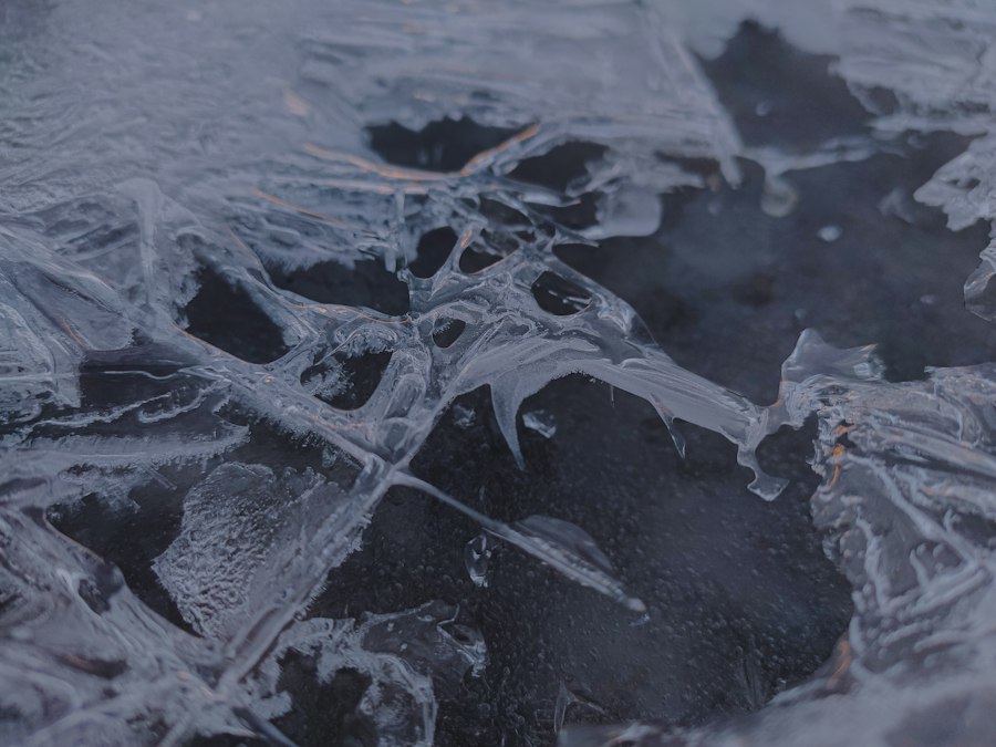
The quest to understand the subsurface structure of ice has been a driving force behind innovation in geophysical sensing. Historically, direct observation and rudimentary drilling provided limited insights. However, modern advancements have opened up unprecedented avenues for non-invasive and detailed investigation. These technologies leverage various physical principles to penetrate ice and reveal its internal architecture and underlying topography.
Advanced Radar and Seismic Imaging Techniques
Ground-penetrating radar (GPR) has long been a staple in ice research, but recent innovations have significantly enhanced its capabilities. Modern GPR systems employ multi-frequency antennas and sophisticated signal processing algorithms to achieve higher resolutions and deeper penetration depths. This allows for the detailed mapping of internal ice layers, firnification processes, and the detection of buried ice features. The ability to distinguish between different ice types and their structural variations is crucial for understanding ice deformation and melt rates. Furthermore, the development of interferometric GPR (InSAR) techniques applied to ice surfaces is enabling the precise measurement of surface deformation, which can be directly linked to internal ice flow and stress.
Seismic methods, traditionally used in glaciology for studying ice sheet dynamics and bedrock topography, have also seen significant advancements. New seismic sources and highly sensitive receivers, coupled with advanced data inversion techniques, allow for the creation of high-resolution 3D seismic models of ice interiors. These models can reveal complex englacial structures, such as shear zones, debris inclusions, and subglacial hydrology networks, all of which are critical for understanding ice sheet stability and meltwater routing. The application of passive seismic monitoring, which utilizes ambient seismic noise, is also gaining traction for continuously tracking changes in ice structure and rheology over time.
Sonar and Acoustic Profiling for Sub-Ice Environments
While much focus is placed on the ice itself, the environment beneath ice, particularly in the case of ice shelves and subglacial lakes, is equally vital. Advanced sonar systems, including multibeam echo sounders and side-scan sonar, are indispensable for mapping the bathymetry and morphology of the seafloor beneath ice shelves and in the Arctic Ocean. These technologies provide crucial data on the grounding line positions of ice shelves, the presence of seamounts that can influence ice flow, and the depositional environments that can record past ice sheet behavior.
Acoustic profiling techniques are also being employed to study the properties of the ice-water interface and the ice itself from below. Autonomous underwater vehicles (AUVs) equipped with specialized acoustic sensors can navigate complex sub-ice environments, gathering data on ice thickness, roughness, and the presence of brine or meltwater channels within the ice. These acoustic signatures can provide valuable information about the thermodynamic processes occurring at the ice-ocean interface, which are key drivers of ice shelf melt and stability. The development of novel acoustic transducers and signal processing methods is continuously improving the resolution and accuracy of these underwater ice characterization techniques.
Harnessing Remote Sensing for Global Ice Structure Monitoring
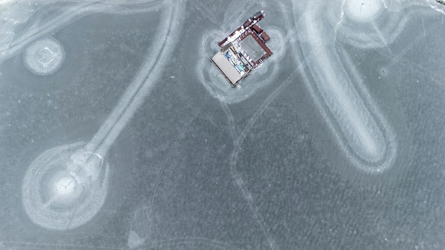
The vastness and inaccessibility of many ice-covered regions necessitate the use of remote sensing technologies for comprehensive monitoring. Satellites and aerial platforms equipped with sophisticated sensors provide a bird’s-eye view, enabling the detection and characterization of surface ice structures over large spatial and temporal scales.
Satellite-Based Radar and Optical Imaging Innovations
Satellite-borne radar, particularly Synthetic Aperture Radar (SAR), has revolutionized the study of ice. SAR’s ability to penetrate clouds and operate day or night makes it ideal for continuous monitoring of polar regions. Recent advancements in SAR interferometry (InSAR) allow for the precise measurement of ice sheet and glacier flow velocities, providing critical data on ice dynamics and potential destabilization. Furthermore, polarimetric SAR (PolSAR) techniques can distinguish between different ice types (e.g., first-year ice, multi-year ice) and their structural characteristics by analyzing the polarization of backscattered radar waves. This is invaluable for understanding sea ice drift, melt, and the formation of refrozen leads.
Optical imaging from satellites, while affected by cloud cover, offers complementary information. High-resolution optical sensors are used to map the extent of surface melt, identify crevasses and moulins on ice sheets, and monitor changes in snow cover and albedo. The development of multispectral and hyperspectral imagers is enabling more detailed discrimination of surface features, such as distinguishing between different snow grain sizes or identifying the presence of dust and soot deposited on ice, which can significantly impact melt rates. Time-series analysis of optical imagery provides a powerful tool for tracking seasonal changes and long-term trends in ice surface features.
LiDAR and Laser Altimetry for Surface Topography and Change Detection
Light Detection and Ranging (LiDAR) technology, whether deployed from aircraft or increasingly from satellites, provides highly accurate measurements of surface topography. This is crucial for mapping glacier and ice sheet surface elevation, detecting changes in ice volume over time, and identifying features like crevasses and ice cliffs with remarkable detail. Airborne LiDAR surveys have been instrumental in providing detailed Digital Elevation Models (DEMs) of ice-covered areas, which are essential for glaciological modeling and understanding ice flow.
Satellite-based laser altimeters, such as those used on the ICESat missions, directly measure the elevation of the ice surface. By comparing altimetry data acquired at different times, scientists can accurately quantify ice loss or gain in vast regions. The precision of these instruments allows for the detection of subtle changes in ice sheet elevation that are indicative of melting or accumulation. Advanced processing techniques are also enabling the derivation of information about surface roughness from altimetry data, offering further insights into the physical state of the ice surface.
Advanced Spectroscopic and Thermal Techniques for Ice Composition
Beyond surface geometry, the chemical and thermal properties of ice are critical indicators of its history and its interaction with the climate system. Spectroscopic and thermal sensing techniques are providing new ways to probe these aspects.
Infrared and Microwave Radiometry for Thermal Properties and Snow Characteristics
Infrared (IR) radiometry measures the thermal radiation emitted by a surface, providing information about its temperature. For ice, this means understanding surface melt, snowpack temperature, and the presence of temperature anomalies that might indicate subsurface features. Satellite-borne IR radiometers are used to map sea surface temperatures and ice surface temperatures, helping to identify melt zones and track the progression of seasonal ice melt.
Microwave radiometry, operating at longer wavelengths, is particularly useful for observing snow and ice characteristics through cloud cover. It is sensitive to the dielectric properties of snow, which are influenced by factors like snow grain size, density, and water content. This allows for the estimation of snow depth, snow water equivalent, and the detection of wet snow conditions, all of which are important for understanding snowpack evolution and its impact on the underlying ice. Advanced microwave instruments are also capable of detecting the presence of brine within sea ice, offering insights into its salinity and permeability.
Raman Spectroscopy and Hyperspectral Imaging for Impurity Detection
Raman spectroscopy is a powerful analytical technique that can identify the chemical composition of materials by analyzing the inelastic scattering of light. When applied to ice, Raman spectroscopy can detect the presence of impurities such as dust, volcanic ash, or biological material within the ice matrix. These impurities can significantly influence the optical properties of ice, reducing its albedo and accelerating melt.
Hyperspectral imaging, which captures spectral information across many narrow wavelength bands, can be used to map the distribution of these impurities on the ice surface and in shallow subsurface layers. By analyzing the unique spectral signatures of different materials, hyperspectral sensors can identify and quantify the presence of light-absorbing impurities, providing valuable data for improving albedo models and understanding the drivers of ice melt. This technique is particularly useful for mapping areas affected by wildfire smoke, dust storms, or Saharan dust deposition on glaciers and ice sheets.
Recent advancements in surface ice structure detection have opened new avenues for understanding climate change and its effects on polar regions. A related article discusses innovative techniques that enhance the accuracy of ice thickness measurements, which are crucial for predicting sea level rise. For more insights on this topic, you can explore the findings in this detailed article that delves into the methodologies used in ice structure analysis.
Data Integration and Machine Learning for Enhanced Ice Analysis
| Metric | Description | Typical Values | Measurement Techniques | Applications |
|---|---|---|---|---|
| Ice Thickness | Measurement of the depth of ice layers on surfaces | 0.1 mm to several meters | Ground Penetrating Radar (GPR), Ultrasonic Sensors | Structural safety, climate studies |
| Surface Roughness | Quantifies the texture and irregularities of ice surfaces | Micrometer to millimeter scale variations | LIDAR, Photogrammetry, Laser Scanning | Slip hazard assessment, vehicle traction analysis |
| Ice Type Classification | Identification of ice types such as frost, glaze, rime | N/A (categorical) | Hyperspectral Imaging, Visual Inspection, Machine Learning | Weather forecasting, aviation safety |
| Surface Temperature | Temperature of the ice surface influencing formation and melting | -50°C to 0°C (typical natural range) | Infrared Thermography, Contact Thermometers | Ice growth prediction, de-icing strategies |
| Reflectance/Albedo | Measure of ice surface reflectivity to solar radiation | 0.3 to 0.9 (dimensionless) | Spectroradiometers, Satellite Remote Sensing | Climate modeling, energy balance studies |
| Crack and Defect Detection | Identification of fractures or weaknesses in ice layers | Crack widths from micrometers to centimeters | Ultrasound, Acoustic Emission Sensors, Visual Imaging | Structural integrity monitoring, safety assessments |
The sheer volume and complexity of data generated by these advanced detection techniques necessitate sophisticated methods for analysis and interpretation. The integration of diverse datasets and the application of machine learning algorithms are proving to be transformative in unlocking deeper insights into surface ice structures.
Fusion of Multi-Sensor Data for Comprehensive Ice Characterization
The most powerful approach often involves fusing data from multiple sensors. For example, combining SAR data, which provides information on ice motion and structure, with optical imagery, which reveals surface features and melt extent, can create a more complete picture of ice sheet dynamics. Similarly, integrating satellite-derived data with ground-based measurements from GPS, weather stations, and in-situ ice core analysis provides essential ground-truthing and calibration for remote sensing products.
Data fusion techniques aim to combine the strengths of different datasets, overcoming limitations of individual sensors. This can involve co-registration of data from different sources, statistical methods for combining information, and the development of integrated modeling frameworks that can assimilate diverse observational inputs. The goal is to achieve a holistic understanding of ice behavior that is beyond the reach of any single data stream.
Machine Learning and Artificial Intelligence for Pattern Recognition and Prediction
Machine learning (ML) and artificial intelligence (AI) are rapidly becoming indispensable tools in climate research, particularly for analyzing complex ice-related datasets. ML algorithms can be trained to identify subtle patterns and anomalies in radar, optical, and thermal imagery that might be missed by human observers. This can include the automated detection of new crevasses, the mapping of complex brine channel networks in sea ice, or the identification of specific ice deformation patterns.
Furthermore, ML models are being developed for the prediction of ice-related hazards, such as the likelihood of ice shelf calving or glacier surge events, by learning from historical data and physical models. Predictive models can also forecast the future evolution of ice structures and their impact on sea level rise and ocean circulation. The ability of AI to process and learn from massive datasets is accelerating the pace of discovery and improving the accuracy of climate projections related to ice. The ongoing development of novel ML architectures and training methodologies promises even greater capabilities in the future.

Water Boiled While Ice Formed. Could a Lander Sink Into It?
FAQs
What is surface ice structure detection?
Surface ice structure detection is the process of identifying and analyzing the physical characteristics and properties of ice formations on surfaces, such as roads, runways, or bodies of water.
How is surface ice structure detection performed?
Surface ice structure detection can be performed using various techniques, including remote sensing technologies like radar or LiDAR, as well as on-site inspections using specialized equipment to measure ice thickness, density, and other parameters.
Why is surface ice structure detection important?
Surface ice structure detection is important for assessing the safety and stability of surfaces affected by ice formations, as well as for monitoring environmental changes related to ice accumulation and melting.
What are some applications of surface ice structure detection?
Surface ice structure detection is used in various fields, including transportation (for assessing road and runway conditions), climate research (for studying ice formation and melting patterns), and emergency response (for predicting and managing ice-related hazards).
What are the challenges associated with surface ice structure detection?
Challenges related to surface ice structure detection include the variability of ice formations, the need for accurate and timely data collection, and the development of reliable detection methods that can operate in different environmental conditions.