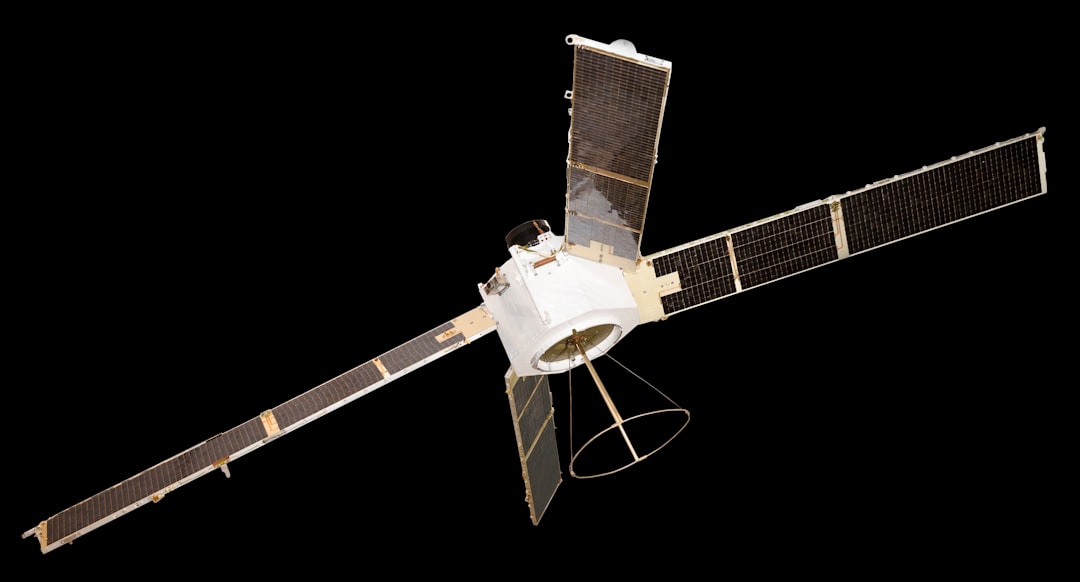
You’ve probably used it today, perhaps without even thinking about it. That little blue dot on your phone’s map, guiding you to your destination. But have you ever wondered how your phone, seemingly adrift in the vastness of space, actually knows where it is? It all comes down to an intricate dance of signals between your device and a constellation of satellites orbiting high above. This isn’t magic; it’s a testament to remarkable engineering. Let’s delve into the technical heart of how GPS satellites communicate with your phone.
Before we dissect the communication process, it’s crucial to grasp the fundamental architecture of the Global Positioning System. You likely know it as GPS, but its official name is the NAVSTAR GPS (Navigation Signal Timing and Ranging Global Positioning System). It’s a U.S. government-owned satellite-based radio navigation system. The system is comprised of three main segments: the space segment, the control segment, and the user segment. Your phone belongs to the latter, but its functionality is entirely dependent on the other two.
The Space Segment: A Constellation in Orbit
The space segment is the most visible component of GPS. It’s a network of satellites, officially around 31 active satellites, though this number can fluctuate slightly. These satellites aren’t just floating aimlessly; they are meticulously placed in what’s known as medium Earth orbit (MEO).
Orbit Details and Satellite Numbers
Each GPS satellite orbits the Earth approximately twice a day, completing a full revolution in about 12 hours. They are positioned in six different orbital planes, ensuring that at any given time, at least four satellites are visible from anywhere on the Earth’s surface. This redundancy is critical for accurate positioning. The number of active satellites can vary, but the operational constellation is maintained to provide continuous global coverage.
Altitude and Speed
These satellites orbit at an altitude of approximately 20,200 kilometers (12,550 miles) above the Earth. At this altitude, they travel at speeds of roughly 14,000 kilometers per hour (8,700 miles per hour). This high speed, combined with their orbital path, is essential for the system’s timing calculations.
The Control Segment: The Watchful Eyes
While the satellites do the broadcasting, they aren’t entirely autonomous. The control segment is responsible for maintaining and operating the GPS satellites. This segment consists of a master control station, monitor stations scattered across the globe, and ground antenna stations.
Master Control Station Functions
The master control station, located at Schriever Space Force Base in Colorado, is the brain of the operation. It continuously monitors the health and performance of all the satellites in the constellation. This includes tracking their orbits, checking their atomic clocks, and ensuring their payloads are functioning correctly.
Monitor Stations and Data Collection
The network of monitor stations acts as the eyes and ears of the control segment. These stations passively receive signals from the satellites. They collect data on the satellites’ precise orbital paths and the timing of their signals. This information is then transmitted to the master control station.
Ground Antennas and Signal Uploads
Ground antenna stations are used to communicate with the satellites. They upload corrected orbital data and clock synchronization information to the satellites. This constant recalibration is vital for maintaining the accuracy of the navigation signals. Without this continuous oversight, the satellites’ timing would drift, rendering them useless for precise positioning.
The User Segment: Your Pocket-Sized Navigator
This is where you come in. The user segment comprises all the GPS receivers in the world – from your smartphone to dedicated navigation devices in cars and aircraft. These receivers are designed to pick up signals from the satellites and process them to determine your location.
Types of GPS Receivers
While your phone is a common example, the world is filled with various GPS receivers. Military applications often use specialized, more robust receivers. Surveying equipment utilizes highly precise receivers for mapping and land measurement. Consumer devices, like the ones in your car or on your wrist, prioritize a balance of accuracy, power consumption, and cost.
Importance of Signal Acquisition
The primary role of your phone’s GPS receiver is to acquire signals from as many satellites as possible. The more satellites your receiver can “see,” the more accurate your position will be. This is why having a clear view of the sky is crucial for good GPS performance. Obstructions like tall buildings or dense foliage can block or weaken these signals.
GPS satellites communicate with phones through a complex system of signals that allow for precise location tracking. These satellites transmit radio signals that are received by GPS-enabled devices, which then calculate their position based on the time it takes for the signals to arrive. For a deeper understanding of this technology and its implications, you can read more in the article available at Freaky Science.
The Science of Location: How Satellites Determine Your Position
At its core, GPS relies on a simple yet ingenious principle: trilateration. It’s a method of determining your position based on distances to known points. In the case of GPS, these known points are the satellites, and the distances are calculated by measuring the time it takes for their signals to reach your receiver.
Time is of the Essence: The Role of Atomic Clocks
Each GPS satellite is equipped with incredibly precise atomic clocks. These clocks are the backbone of the entire system. They are synchronized with ground-based atomic clocks in the control segment and are accurate to within nanoseconds. This incredible precision is absolutely essential because the speed of light is constant, and even minuscule errors in timing can translate into significant errors in distance calculations.
Synchronization and Drift Correction
The control segment constantly monitors and corrects any drift in the atomic clocks on board the satellites. This synchronization process ensures that the timing information broadcast by each satellite is as accurate as possible. Imagine trying to measure a kilometer with a ruler that’s slightly off – the results would be inaccurate. The same applies to GPS.
Signal Propagation Speed
The GPS signals travel from the satellites to your receiver at the speed of light. This speed is a known constant, approximately 299,792,458 meters per second. By knowing this speed and measuring the travel time of a signal, your receiver can calculate the distance to the satellite.
Distance Calculation: The Time-of-Flight Method
Your GPS receiver measures the precise time a signal is transmitted by a satellite and the exact time it’s received. The difference between these two times is the signal’s travel time. Multiplying this travel time by the speed of light gives you the pseudorange, which is essentially the distance between your receiver and that specific satellite.
Pseudorange vs. True Range
It’s important to note that the calculated distance is called a “pseudorange” rather than a “true range.” This is because there are inherent errors in the receiver’s clock compared to the highly precise atomic clocks on the satellites. However, these errors are factored into the calculations.
Measuring Distance to Multiple Satellites
Your receiver needs to calculate its distance to at least four satellites to pinpoint its location accurately in three dimensions (latitude, longitude, and altitude) and correct for receiver clock errors.
Trilateration in Action: Triangulating Your Position
With the distances to multiple satellites calculated, your receiver can perform trilateration. Imagine drawing circles on a map. If you know you are exactly 100 miles from point A and 50 miles from point B, there are only two possible locations where those circles intersect. Adding a third point narrows down the possibilities further.
The Power of Three Satellites
With signals from three satellites, your receiver can determine a 2D position (latitude and longitude). The intersection of three spheres, each representing the distance to a satellite, would define a circle on the Earth’s surface.
The Necessity of a Fourth Satellite
However, to get an accurate 3D position (latitude, longitude, and altitude) and to account for the inaccuracies in your receiver’s internal clock, a fourth satellite is required. The fourth satellite’s signal helps to resolve the ambiguity and provide a precise three-dimensional fix. If your receiver’s clock were perfectly synchronized with the satellite clocks, three satellites would be enough for a 3D fix.
The Signals: What Your Phone Actually Receives

GPS satellites don’t just send out a single, simple signal. They broadcast a complex set of data that includes crucial information for positioning. This information is modulated onto radio waves and transmitted in specific frequency bands.
Radio Frequencies: The Carrier Waves
GPS signals are transmitted on specific radio frequencies. The primary frequencies used are L-band frequencies, specifically L1 (1575.42 MHz), L2 (1227.60 MHz), and L5 (1176.45 MHz). Different frequencies are used for different purposes, and newer generations of satellites and receivers utilize multiple frequencies for improved accuracy and robustness.
L1 Frequency: The Standard
The L1 frequency is the most commonly used and is broadcast by all GPS satellites. It carries two main types of signals: the Coarse/Acquisition (C/A) code and the Precision (P) code. For civilian use, the C/A code is predominantly used.
L2 and L5 Frequencies: Enhancing Accuracy
L2 and L5 frequencies are primarily used for military applications or by advanced civilian receivers. They help to mitigate errors caused by the ionosphere, a layer of charged particles in Earth’s atmosphere that can refract GPS signals. By receiving signals on multiple frequencies, receivers can better correct for these atmospheric distortions.
The Data Packets: Navigation Messages
Embedded within these radio waves are navigation messages. These messages are essentially data packets containing vital information that your GPS receiver needs. They are broadcast at a relatively slow rate (typically 50 bits per second), but they contain all the necessary intelligence.
Ephemeris Data: Satellite’s Precise Orbit
A crucial part of the navigation message is the ephemeris data. This data provides the precise orbital path (trajectory) of each individual satellite for a specific period. It tells your receiver exactly where each satellite is located in space at any given time. This is like having a detailed timetable and map for each satellite.
Almanac Data: The Big Picture
The almanac data is a more general overview of the entire GPS constellation. It provides less precise orbital information for all the satellites, along with their health status and clock corrections. This helps your receiver quickly acquire signals from multiple satellites, even if they are not currently overhead, by giving it an idea of where to “look” for them.
Time Information: Synchronization is Key
The navigation message also includes precise time information. This allows your receiver to synchronize its internal clock with the satellite’s atomic clock, which is essential for accurate time-of-flight calculations.
Codes: Differentiating Signals and Authenticating Data
GPS signals use specific codes to distinguish them from other radio signals and to carry different types of information.
Coarse/Acquisition (C/A) Code: Civilian Access
The C/A code is a pseudorandom noise (PRN) code that is freely accessible to civilian users. It’s like a unique fingerprint for each satellite, allowing your receiver to identify which satellite is transmitting a particular signal.
Precision (P) Code: Military Security
The P code is a more complex and encrypted code intended for military use. It offers higher accuracy and security. When the P code is encrypted, it becomes the Y code.
The Receiver’s Role: Processing the Signals
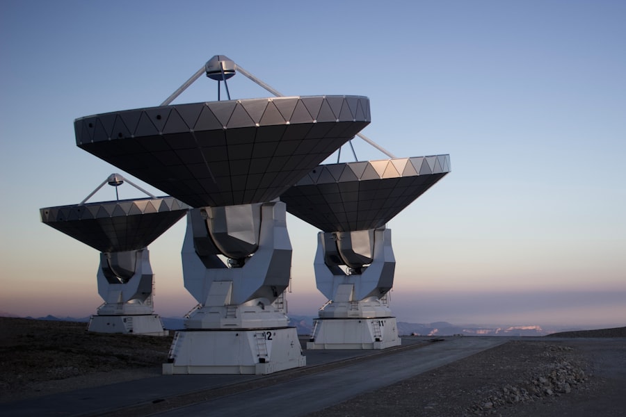
Once your phone’s GPS receiver has acquired the signals from multiple satellites, it embarks on a complex process of decoding and calculation to determine your location. This is where the raw data becomes actionable information.
Signal Acquisition and Tracking
The first step is acquiring the signals. Your receiver’s antenna “listens” for the radio waves broadcast by the satellites. It then uses the C/A codes to identify and lock onto the signals from individual satellites. Once a signal is acquired, the receiver continuously tracks it to maintain a stable connection.
Acquiring the C/A Code
The receiver’s circuitry is designed to recognize the specific patterns of the C/A codes. This process can take a few seconds to a couple of minutes, especially when you first turn on your device or if you’ve moved a significant distance.
Doppler Shift Compensation
As satellites move relative to your receiver, their signals experience a Doppler shift – a change in frequency. Your receiver must compensate for this Doppler shift to accurately measure the signal’s original frequency and thus its travel time.
Decoding the Navigation Message
After acquiring and tracking the signals, your receiver decodes the navigation message broadcast by each satellite. This involves extracting the ephemeris data, almanac data, and time information.
Extracting Ephemeris and Almanac
The receiver processes the bitstream of the navigation message to extract the precise orbital parameters for the satellites it’s tracking. It also receives the almanac for the entire constellation.
Time Synchronization
The time information from the satellites is used to synchronize your receiver’s internal clock. This is a critical step, as even a small clock error can lead to significant position errors.
Calculating Pseudoranges and Position
With all the necessary data, your receiver performs the core calculations. It uses the decoded ephemeris data and the synchronized time to calculate the pseudorange to each satellite.
Time-of-Flight Calculation Refinement
The receiver refines the time-of-flight calculation by accounting for atmospheric delays (ionospheric and tropospheric), though this correction is more accurate with multi-frequency receivers.
The Trilateration Algorithm
Finally, the receiver applies the trilateration algorithm. Using the calculated pseudoranges to at least four satellites, it solves a set of equations to determine your latitude, longitude, and altitude. The receiver’s internal clock error is also solved for in this process.
GPS satellites play a crucial role in how our smartphones determine their location, utilizing a complex system of signals and timing to provide accurate positioning. For a deeper understanding of this fascinating technology, you can explore an insightful article that explains the communication between GPS satellites and mobile devices. This article delves into the mechanisms behind the signals and how they are processed by your phone to deliver precise location data. To learn more about this topic, check out this related article.
Beyond Basic GPS: Assisted GPS (A-GPS) and Other Enhancements
| Aspect | Description |
|---|---|
| Number of Satellites | There are typically 24 operational GPS satellites in orbit. |
| Signal Frequency | GPS satellites transmit at two carrier frequencies: L1 (1575.42 MHz) and L2 (1227.60 MHz). |
| Signal Strength | The signal strength from GPS satellites is relatively weak, typically around -130 dBm to -160 dBm. |
| Line of Sight | GPS satellites communicate with phones through line of sight, meaning they need a clear view of the sky to establish a connection. |
| Data Transmission | GPS satellites transmit data such as ephemeris and almanac information to phones, which is used to calculate the phone’s position. |
While traditional GPS is powerful, your smartphone often utilizes additional technologies to enhance its location accuracy and speed, especially in challenging environments. The most common of these is Assisted GPS (A-GPS).
Assisted GPS (A-GPS): Speeding Up the Fix
A-GPS leverages cellular network infrastructure to accelerate the GPS acquisition process. Instead of relying solely on slow satellite downloads of almanac and ephemeris data, your phone can download this information much faster from nearby cellular towers.
How A-GPS Works
When you enable location services on your phone, it can connect to cellular towers. These towers can relay approximate satellite positions and timing information to your phone. This allows your phone’s GPS receiver to “know” where to look for the satellites and what signals to expect, significantly reducing the time it takes to get a “fix.”
Benefits of A-GPS
The primary benefit of A-GPS is faster time-to-first-fix (TTFF). This means your phone can start providing location data much quicker, especially when you first turn on your device or are in an area with weak satellite signals. It also helps in urban canyons or indoor environments where direct satellite visibility is limited.
Data Usage Considerations
It’s worth noting that A-GPS does use a small amount of cellular data. However, the amount is generally negligible.
Wi-Fi and Cellular Triangulation: Complementary Location Technologies
Your smartphone doesn’t only rely on GPS. It also uses other location sensing technologies to complement GPS and provide a more robust location experience.
Wi-Fi Positioning
Your phone can scan for nearby Wi-Fi networks. By comparing the unique identifiers (SSIDs) and signal strengths of these networks with a vast database of known Wi-Fi access points and their geographical locations, your phone can estimate its position. This is particularly useful indoors where GPS signals are weak.
Cellular Tower Triangulation
Similar to A-GPS, your phone can also use the signal strength and known locations of multiple cellular towers to triangulate its position. This method is generally less precise than GPS but can provide a location estimate when GPS is unavailable.
Sensor Fusion: The Synergy of Multiple Inputs
Modern smartphones are equipped with a variety of sensors, including accelerometers, gyroscopes, and magnetometers. These sensors work in conjunction with GPS, A-GPS, Wi-Fi, and cellular data to provide a more comprehensive and accurate understanding of your device’s movement and orientation. This process is known as sensor fusion.
Inertial Navigation and Dead Reckoning
Accelerometers and gyroscopes allow for “dead reckoning” – estimating your position based on your last known position and your movement over time. This is particularly useful for short periods when GPS signals might be temporarily lost, such as in tunnels.
Enhancing Accuracy and Responsiveness
By combining data from all these sources, your smartphone can achieve a more accurate, responsive, and reliable location service, even in environments where traditional GPS might struggle. It’s this intricate interplay of technologies that makes your phone’s navigation so seamless and seemingly magical.
In conclusion, the journey of a GPS signal from a satellite orbiting hundreds of miles above to your phone in your hand is a remarkable feat of engineering and physics. It involves precise timing, complex data transmission, and sophisticated signal processing. The next time you rely on your phone’s GPS, take a moment to appreciate the invisible network and the intricate communication that makes it all possible.

Your Phone Can Still Know Where You Are in Airplane Mode
FAQs
How do GPS satellites communicate with phones?
GPS satellites communicate with phones using radio signals. The satellites transmit signals that are picked up by GPS receivers in phones, which then calculate the phone’s location based on the signals received.
How many GPS satellites are in orbit?
There are currently 24 operational GPS satellites in orbit, with additional satellites serving as backups in case of any failures.
What frequency do GPS satellites use to communicate with phones?
GPS satellites transmit signals at two carrier frequencies: L1 (1575.42 MHz) and L2 (1227.60 MHz). These frequencies are used for communication with GPS receivers in phones.
How accurate is GPS communication with phones?
GPS communication with phones can provide location accuracy within a few meters under optimal conditions. However, factors such as signal blockage, atmospheric conditions, and receiver quality can affect the accuracy of GPS communication.
Can GPS communication with phones be affected by interference?
Yes, GPS communication with phones can be affected by interference from sources such as buildings, trees, and other electronic devices. This interference can degrade the quality of the GPS signal and impact the accuracy of location determination.