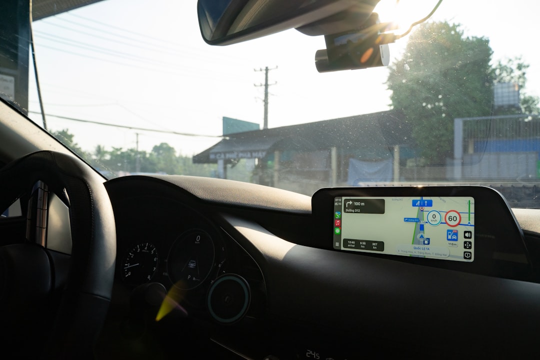
You’ve likely experienced it: that sinking feeling when your phone’s GPS signal wavers, displaying a blank screen or an infuriating “No Internet Connection” message just as you desperately need directions. Whether you’re deep in the wilderness, on a remote road trip, or simply in an area with spotty cell service, being without reliable navigation can be more than just inconvenient – it can be a genuine source of stress and even danger. But what if you could navigate anywhere, without needing an internet connection? That’s where the magic of offline GPS comes in.
Unlocking the Power of Offline Navigation
You’re probably thinking, “Isn’t GPS always online?” The answer is a resounding no, and understanding this distinction is key to truly navigating anywhere. The Global Positioning System (GPS) itself is a constellation of satellites orbiting the Earth, operated by the United States government. These satellites transmit signals that your GPS device – whether it’s a dedicated unit or your smartphone – receives to determine your location. This entire process is fundamentally independent of cellular or internet connectivity. What you do often need an internet connection for is downloading maps and real-time traffic data. But with the right tools and a bit of foresight, you can bypass this dependency entirely.
The Myth of Always-On GPS
You’ve probably clicked on a navigation app on your phone, seen a beautiful map, and assumed it was all happening in real-time. While the satellite signals are indeed always there, the detailed map imagery, road networks, points of interest, and routing algorithms are often downloaded dynamically from servers via the internet. This is why you can zoom in and out, search for specific addresses, and get live traffic updates. However, this convenience comes with a hidden vulnerability: if your internet connection drops, your mapping capabilities can become severely limited or completely disappear. You might see your blue dot on a blank screen, or worse, the app might simply freeze.
Your Digital Map Cache: The Foundation of Offline Success
The core principle of navigating anywhere without internet is leveraging the ability to download and store detailed map data on your device beforehand. Think of it as building your own personal digital map library. These downloaded maps contain all the information you need – roads, highways, streets, topographical features, and often even points of interest – allowing your GPS receiver to pinpoint your location and plot routes without needing to communicate with distant servers. This proactive approach is your first and most important step towards true location independence.
For those interested in exploring the capabilities of GPS technology without relying on an internet connection, a related article can be found at Freaky Science. This resource delves into various methods and tools that allow users to navigate effectively using GPS systems offline, highlighting the importance of pre-downloading maps and utilizing dedicated GPS devices. Whether you’re hiking in remote areas or traveling abroad, understanding how to leverage GPS without internet access can significantly enhance your navigation experience.
The Essential Hardware: Your Navigation Toolkit
While software plays a crucial role, the hardware you choose is the bedrock of your offline navigation strategy. Thankfully, you likely already possess some of the most powerful tools. The key is understanding how to harness their full offline potential.
Dedicated GPS Devices: The Purists’ Choice
For the serious adventurer, the long-haul trucker, or anyone who prioritizes reliability above all else, dedicated GPS units remain an excellent option. These devices are purpose-built for navigation. They typically boast robust construction, long battery life, and superior GPS reception, often performing better in challenging environments where smartphone signals might struggle.
Ruggedized and Adventure-Ready
Think of devices designed for hikers, off-road enthusiasts, or maritime use. These are often waterproof, shockproof, and built to withstand extreme temperatures. Their screens are usually designed for better visibility in bright sunlight, and they often have physical buttons that are easier to operate with gloves on. Many of these units come with the ability to load pre-downloaded maps for vast regions, ensuring you’re covered no matter how far off the beaten path you venture.
Long Battery Life for Extended Journeys
One of the biggest advantages of dedicated GPS devices is their longevity. Unlike smartphones, which are multi-purpose devices that drain power quickly with constant screen usage and background processes, dedicated GPS units are optimized for power efficiency. You can often expect days, if not weeks, of continuous use on a single charge, making them ideal for multi-day treks or expeditions where recharging opportunities are scarce.
Smartphones: The Versatile Navigator
Your smartphone, that ubiquitous device in your pocket, is a surprisingly capable offline GPS unit. With the right apps and preparation, it can rival dedicated devices for many everyday and even some adventurous scenarios. The key is to move beyond the default online mapping experience and embrace offline capabilities.
App Selection: The Cornerstone of Offline Functionality
This is where your strategic choices make the biggest difference. Many popular navigation apps offer offline map downloads. Some are exclusively designed for offline use, while others offer offline functionality as an add-on. You’ll want to research apps that allow you to download large geographical areas, offer detailed map data, and provide robust routing features for offline use. Consider apps that allow for customization of downloaded areas, enabling you to tailor your map coverage precisely to your needs.
Pre-Download: Your Digital Passport to Anywhere
The crucial step for smartphone-based offline navigation is pre-downloading your maps. Most apps will prompt you to download maps for specific regions. You can often select entire countries, states, or even custom-drawn areas. This download process requires an internet connection, so you’ll need to do it before you leave home or when you have reliable Wi-Fi. Don’t underestimate the size of these map files; for extensive travel, you might need to manage your storage space carefully.
Battery Management: A Crucial Consideration
As mentioned, smartphones are power-hungry. To maximize your offline navigation time, you’ll need to be mindful of battery usage. This means dimming your screen, disabling unnecessary background apps, and utilizing airplane mode when you don’t need cellular connectivity for calls or texts. Carrying a portable power bank is also an essential accessory for any extended offline journey.
Mastering Offline Mapping Software: Your Digital Compass
The apps you choose are your digital compass and your roadmap. They transform raw GPS data into actionable navigation. Understanding their offline capabilities is paramount.
Dedicated Offline Mapping Apps: Built for Independence
These applications are designed from the ground up to function without an internet connection. They often offer advanced features that are specifically geared towards offline use, such as detailed topographical data, offline search capabilities, and specialized routing for different types of travel (e.g., hiking, cycling, driving).
Feature-Rich and Powerful
You’ll find apps that offer downloadable maps in various formats, allowing for extensive customization. Some provide contour lines for elevation, 3D terrain views, and even the ability to overlay custom waypoints and tracks. The routing engines in these apps are often optimized for offline operation, meaning they can calculate complex routes efficiently without needing to access online servers. This is crucial for navigating in areas where you might need to re-route frequently due to unexpected obstacles.
Community-Driven Map Data and Updates
Many of these offline mapping apps benefit from community contributions. Users can report errors, add points of interest, and update map data, creating a constantly evolving and improving mapping resource. This collaborative approach ensures that the maps remain accurate and relevant, even in areas with limited official mapping updates.
Mainstream Navigation Apps with Offline Capabilities: The Hybrid Approach
Many of the navigation apps you’re already familiar with, like Google Maps and Maps.me, offer robust offline map downloads. While they might be known for their online features, their offline functionality is often overlooked but incredibly valuable.
Downloading Specific Regions
You can typically download maps for specific cities, states, or countries within these apps. This process is straightforward and usually involves selecting an area on the map and choosing the download option. It’s a good idea to download maps for your entire intended route, plus a buffer zone, to ensure seamless navigation.
Offline Routing and Search
Once maps are downloaded, these apps can often still provide turn-by-turn navigation and even perform offline searches for addresses and points of interest within the downloaded areas. While real-time traffic updates will be unavailable, the core routing functionality remains intact. This makes them excellent choices for everyday driving and for areas where you anticipate intermittent internet connectivity.
Keeping Maps Updated
It’s important to remember that downloaded maps can become outdated. Periodically connect to Wi-Fi and update your downloaded maps to ensure you have the latest road information and points of interest. This is a simple but vital step to maintaining accurate offline navigation.
Planning Your Offline Adventure: Preparation is Key
The success of your “navigate anywhere” mission hinges on thorough preparation. You can’t simply expect your device to magically know where to go without a plan.
Pre-Trip Reconnaissance: Know Before You Go
Before you even leave your home, take the time to research your destination and potential routes. Look at maps online, identify key landmarks, and anticipate any areas where internet connectivity might be particularly problematic. This early reconnaissance will inform your offline map download strategy.
Identifying Potential Connectivity Black Spots
Use online resources, forums, and even discussions with locals to identify areas known for poor cell service. This will help you prioritize which regions need the most comprehensive offline map coverage. If you’re planning a road trip through a national park or a remote rural area, assume that connectivity will be limited and plan accordingly.
Understanding Local Geography and Terrain
Familiarize yourself with the general geography of your destination. Are you expecting mountainous terrain, vast deserts, or dense forests? This knowledge can inform the level of detail you need in your downloaded maps, such as the importance of contour lines or the availability of detailed trails.
Downloading Maps Strategically: Don’t Overlook Anything
This is arguably the most critical step in ensuring you can navigate anywhere. Don’t wait until you’re on the road to download your maps.
Covering Your Entire Route and Beyond
Download maps for your entire intended route, but also extend this coverage to surrounding areas. You never know when a detour might be necessary, or if you might decide to explore an interesting side road. A little extra coverage can save you a lot of stress.
Optimizing Storage Space
Offline map files can be quite large, especially for detailed maps of extensive regions. If you’re using a smartphone with limited storage, you might need to be strategic. Consider downloading only the necessary areas or using apps that allow you to select different levels of detail for downloaded maps. You might also consider using a micro SD card if your device supports it.
The Importance of Wi-Fi Connectivity
Always ensure you have a stable Wi-Fi connection when downloading maps. These files can be substantial, and a dropped cellular connection mid-download could lead to corrupted files or incomplete maps, rendering them useless. Take advantage of free Wi-Fi at home, libraries, or cafes.
For those interested in navigating without relying on an internet connection, a fascinating article discusses various techniques and tools that enhance GPS functionality in offline scenarios. This resource highlights the importance of offline maps and GPS apps that can be invaluable for adventurers and travelers alike. To explore more about these innovative solutions, you can read the full article here: GPS without internet connection.
Beyond Basic Navigation: Enhancing Your Offline Experience
Offline GPS is more than just finding your way from point A to point B. It’s about empowering you to explore with confidence, knowing you have the tools to stay oriented, even when the digital world goes silent.
Waypoints and Track Logging: Leaving Your Own Trail
Most offline GPS applications allow you to create and save waypoints – specific locations you want to mark. This is invaluable for remembering points of interest, campsite locations, or the start of a scenic trail. Furthermore, track logging allows your device to record your movement, creating a breadcrumb trail that you can follow back to your starting point.
Marking Important Locations
Imagine reaching a breathtaking viewpoint or finding a hidden waterfall. With offline navigation, you can mark these spots as waypoints, ensuring you can easily find them again or share their coordinates with others. For hikers and campers, marking your campsite and water sources is a safety essential.
Navigating Back to Your Starting Point
Track logging is a literal lifesaver in wilderness situations. If you become disoriented, you can simply follow your recorded track back to where you began. This feature is also incredibly useful for exploring off-trail areas or for documenting your journey.
Offline Search and Points of Interest: Discovering Your Surroundings
While real-time search might be limited without internet, many offline mapping apps include comprehensive databases of points of interest (POIs). This can include campgrounds, restaurants, gas stations, attractions, and more.
Finding Essential Services
Even without an internet connection, you can often search for and navigate to essential services like gas stations or lodging within your downloaded map area. This can be a crucial resource when you’re traveling in remote regions where finding amenities can be challenging.
Discovering Local Gems
Offline POI databases can also help you discover local attractions, historical sites, or natural wonders that you might otherwise miss. This allows for a richer and more spontaneous exploration of your surroundings, even when you’re disconnected.
Emergency Preparedness: Your Lifeline in the Unknown
The ability to navigate offline is not just about convenience; it’s a vital aspect of emergency preparedness. In situations where communication lines are down, or you find yourself in an unexpected predicament, your offline GPS can be your most important tool.
Signaling for Help with Coordinates
If you need to contact emergency services and can’t get a signal for voice or text, being able to provide accurate GPS coordinates is critical. Your offline navigation device can pinpoint your exact location, allowing rescuers to find you more efficiently.
Finding Your Way to Safety
In the event of a natural disaster or any situation that forces you to evacuate, reliable offline navigation can help you find the safest and most direct routes to designated shelters or out of harm’s way, even if conventional communication is disrupted.
By embracing the power of offline GPS, you’re not just equipping yourself with a navigation tool; you’re unlocking a new level of freedom and security. You’re no longer tethered to the whim of cell towers or Wi-Fi signals. You are empowered to explore, to wander, and to discover, truly navigating anywhere your spirit desires.

Your Phone Can Still Know Where You Are in Airplane Mode
FAQs

What is GPS?
GPS stands for Global Positioning System, which is a network of satellites that orbit the Earth and provide location and time information to GPS receivers.
How does GPS work without an internet connection?
GPS works without an internet connection by using signals from at least four satellites to triangulate the receiver’s position on Earth. The GPS receiver calculates its position based on the time it takes for the signals to travel from the satellites to the receiver.
Can GPS work without a data plan or Wi-Fi connection?
Yes, GPS can work without a data plan or Wi-Fi connection. The GPS receiver only needs to be able to receive signals from the satellites, and does not require internet access to determine its position.
What are the limitations of using GPS without an internet connection?
While GPS can work without an internet connection, it may have limitations in areas with obstructed views of the sky, such as dense urban areas or deep valleys. Additionally, without internet access, the GPS receiver may not be able to download maps or real-time traffic information.
What are some examples of GPS devices that work without internet connection?
Examples of GPS devices that work without an internet connection include standalone GPS units, GPS-enabled smartwatches, and GPS navigation systems in vehicles. These devices rely solely on the signals from GPS satellites to determine location and provide navigation assistance.