The Mapimí Basin, located in the northeastern region of Durango, Mexico, is a significant geological feature that has intrigued scientists and researchers for decades. Its formation is attributed to a complex interplay of geological processes that have unfolded over millions of years. The basin is primarily a sedimentary structure, formed during the late Cretaceous to early Tertiary periods.
The geological history of the Mapimí Basin is marked by significant tectonic events, sediment deposition, and erosion, which have collectively shaped its current landscape. The basin’s formation can be traced back to the tectonic activities associated with the Laramide Orogeny, a mountain-building event that occurred approximately 70 to 40 million years ago. This orogeny resulted in the uplift of the Sierra Madre Occidental and the subsequent subsidence of surrounding areas, including the Mapimí Basin.
As tectonic forces continued to act upon the region, sedimentary layers began to accumulate, creating a rich geological tapestry that would later become a focal point for scientific inquiry.
Key Takeaways
- Mapimí Basin was formed through a complex geological process involving tectonic activity and erosion.
- Early geological studies in Mapimí Basin led to important discoveries in the fossil record and paleontological findings.
- Tectonic activity has had a significant impact on the formation of Mapimí Basin, shaping its geological features and landforms.
- Water and erosion have played a crucial role in shaping the landscape of Mapimí Basin over time.
- Mapimí Basin is important for understanding Earth’s geological history and continues to be a focus of modern geological research and exploration.
Early Geological Studies and Discoveries in Mapimí Basin
The early geological studies in the Mapimí Basin can be traced back to the late 19th and early 20th centuries when pioneering geologists began to explore the region’s unique geological features. These initial investigations laid the groundwork for understanding the basin’s complex geological history. Researchers such as José María de la Luz y Caballero and others conducted field studies that documented the stratigraphy and lithology of the area, providing valuable insights into its geological evolution.
As exploration continued, significant discoveries were made regarding the fossil record within the basin. The presence of marine fossils indicated that parts of the basin were once submerged under ancient seas. These findings not only contributed to the understanding of the region’s geological past but also sparked interest in paleontological research.
The early studies in Mapimí Basin set a precedent for future investigations, highlighting its importance as a site for geological and paleontological research.
The Impact of Tectonic Activity on the Formation of Mapimí Basin
Tectonic activity has played a pivotal role in shaping the Mapimí Basin’s geological landscape. The ongoing movements of tectonic plates have led to both uplift and subsidence in the region, creating a dynamic environment that continues to evolve. The basin’s formation is closely linked to the tectonic forces generated by the collision of the North American Plate with other surrounding plates.
This interaction has resulted in significant geological features, including fault lines and folds that characterize the basin’s structure. Moreover, tectonic activity has influenced sedimentation patterns within the basin. As landforms were uplifted or subsided, sedimentary deposits accumulated in response to changing environmental conditions.
The interplay between tectonic forces and sedimentation has resulted in a diverse array of rock formations, each telling a story of the basin’s geological history. Understanding these tectonic influences is crucial for comprehending the broader geological processes that have shaped not only the Mapimí Basin but also surrounding regions.
The Geological Features and Landforms of Mapimí Basin
| Geological Feature | Description |
|---|---|
| Mapimí Basin | A large, semiarid structural basin located in northern Mexico, known for its unique geological formations and landforms. |
| Faults and Folds | The basin is characterized by numerous faults and folds, resulting from tectonic activity and the movement of the Earth’s crust. |
| Volcanic Activity | Evidence of past volcanic activity can be seen in the form of volcanic rocks and landforms within the basin. |
| Erosional Features | The basin exhibits various erosional features such as canyons, mesas, and buttes, shaped by the forces of wind and water over time. |
| Salt Flats | The presence of salt flats in the basin is a result of the evaporation of ancient bodies of water, leaving behind deposits of salt and other minerals. |
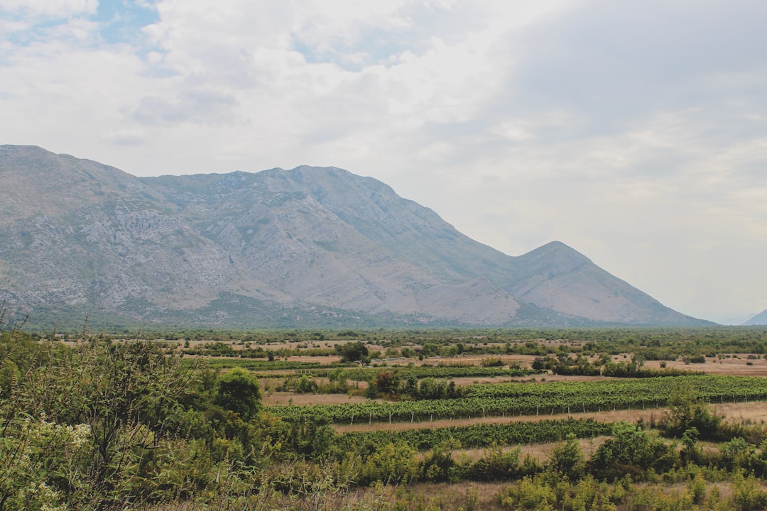
The Mapimí Basin is characterized by a diverse range of geological features and landforms that reflect its complex geological history. One of the most prominent features is its extensive sedimentary rock formations, which include limestone, sandstone, and shale. These rock types provide valuable information about the depositional environments that existed during different geological periods.
In addition to sedimentary rocks, the basin is home to various landforms shaped by erosion and weathering processes. The presence of mesas, buttes, and canyons adds to the visual appeal of the landscape while also serving as indicators of the region’s geological evolution.
These landforms are not only significant from a geological perspective but also contribute to the unique biodiversity found within the basin. The interplay between geology and ecology creates a rich tapestry of life that thrives in this distinctive environment.
The Role of Water and Erosion in Shaping the Mapimí Basin
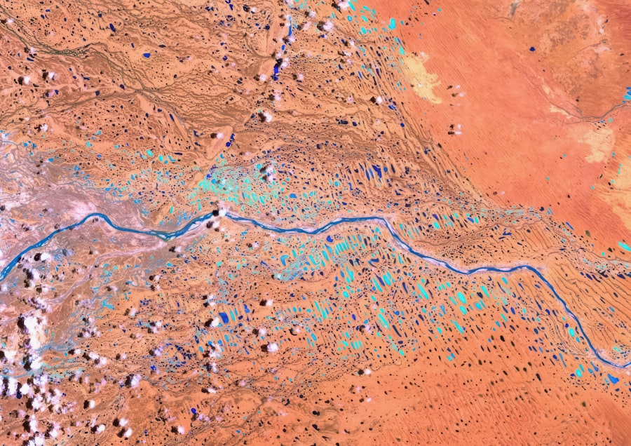
Water has been a fundamental agent in shaping the Mapimí Basin’s landscape over millennia. The processes of erosion and sediment transport have played a crucial role in sculpting its features. Rivers and streams that once flowed through the basin carved out valleys and canyons, while rainfall contributed to weathering processes that further altered rock formations.
The interaction between water and geology has created a dynamic environment where change is constant. Erosion has not only shaped physical features but has also influenced sediment deposition patterns within the basin. As water flows through various terrains, it carries sediments from higher elevations to lower areas, contributing to the accumulation of sedimentary layers.
This ongoing process highlights the importance of hydrological systems in understanding the geological evolution of Mapimí Basin. The relationship between water and geology underscores how interconnected these natural processes are in shaping landscapes.
The Fossil Record and Paleontological Discoveries in Mapimí Basin
The fossil record within the Mapimí Basin is a treasure trove for paleontologists seeking to understand ancient life forms and ecosystems. The sedimentary layers contain an array of fossils, including marine organisms such as ammonites and bivalves, which provide evidence of a time when this region was submerged under water. These fossils offer critical insights into past biodiversity and environmental conditions, allowing scientists to reconstruct ancient ecosystems.
In addition to marine fossils, terrestrial fossils have also been discovered within the basin, indicating a rich history of land-dwelling organisms. The presence of dinosaur remains has garnered significant attention from researchers and enthusiasts alike. These paleontological discoveries not only enhance our understanding of evolutionary processes but also highlight the importance of Mapimí Basin as a site for ongoing research in paleontology.
Human Interaction and Use of Mapimí Basin Throughout History
Human interaction with the Mapimí Basin dates back thousands of years, with indigenous populations utilizing its resources for sustenance and shelter. Archaeological evidence suggests that early inhabitants relied on the basin’s diverse ecosystems for hunting, gathering, and agriculture. The strategic location of the basin made it an attractive area for settlement, leading to a rich cultural history intertwined with its geological features.
As time progressed, European colonization brought new challenges and changes to the region. Mining activities emerged as a significant aspect of human interaction with the basin’s geology, particularly during periods of mineral exploration. The extraction of resources such as silver and lead transformed both the landscape and local economies.
This historical context underscores how human activities have shaped not only the physical environment but also cultural narratives associated with Mapimí Basin.
The Influence of Climate Change on the Geological Evolution of Mapimí Basin
Climate change has had profound effects on geological processes throughout Earth’s history, and the Mapimí Basin is no exception. Fluctuations in climate have influenced erosion rates, sedimentation patterns, and even tectonic activity over time. Changes in temperature and precipitation levels have altered hydrological systems within the basin, impacting both geological formations and ecosystems.
The ongoing effects of climate change continue to pose challenges for understanding the future evolution of Mapimí Basin’s geology. As temperatures rise and weather patterns shift, researchers are increasingly focused on how these changes will affect erosion rates and sediment transport dynamics. Understanding these relationships is crucial for predicting how landscapes will evolve in response to ongoing climatic shifts.
Modern Geological Research and Discoveries in Mapimí Basin
In recent years, modern geological research has brought new insights into the complexities of Mapimí Basin’s geology. Advances in technology have enabled scientists to conduct detailed analyses of rock formations, sediment samples, and fossil records with unprecedented precision. Techniques such as remote sensing and geophysical surveys have enhanced our understanding of subsurface structures and stratigraphy.
Recent discoveries have shed light on previously unknown aspects of the basin’s geological history. For instance, studies have revealed new fossil sites that provide additional context for understanding ancient ecosystems. Furthermore, interdisciplinary approaches combining geology with ecology have led to a more holistic understanding of how geological processes influence biodiversity within the basin.
The Importance of Mapimí Basin in Understanding Earth’s Geological History
The significance of Mapimí Basin extends beyond its local context; it serves as a vital reference point for understanding broader geological processes on Earth. Its unique stratigraphy provides insights into sedimentation patterns during different geological epochs, contributing to our knowledge of Earth’s evolutionary history. Researchers often use data from Mapimí Basin to draw parallels with other regions worldwide, enhancing our understanding of global geological phenomena.
By examining its geological features, researchers can gain insights into similar processes occurring elsewhere on Earth today. This connection underscores the importance of preserving such sites for future generations as they hold invaluable information about our planet’s past.
The Future of Geological Exploration in Mapimí Basin
Looking ahead, the future of geological exploration in Mapimí Basin appears promising as researchers continue to uncover new findings that deepen our understanding of this unique region. Ongoing studies aim to address unanswered questions regarding its geological history while also exploring potential applications for resource management and conservation efforts. As technology advances further, opportunities for collaboration between geologists, paleontologists, ecologists, and other disciplines will likely increase.
Such interdisciplinary approaches will enhance our ability to address complex challenges related to climate change impacts on geology and biodiversity within Mapimí Basin. Ultimately, continued exploration will not only enrich scientific knowledge but also foster greater appreciation for this remarkable geological landscape.
The Mapimí Basin, located in the central part of northern Mexico, is a region rich in history and ecological significance. Known for its unique desert landscapes and diverse wildlife, the basin has been a subject of interest for historians and scientists alike. For those interested in exploring more about the historical and scientific aspects of the Mapimí Basin, a related article can be found on Freaky Science. This article delves into the fascinating details of the region’s past and its current ecological importance. To read more, visit the article on Freaky Science.
WATCH THIS! They Crashed a US Missile Into the Zone of Silence
FAQs
What is the Mapimí Basin?
The Mapimí Basin is a geological depression located in the northern part of Mexico, primarily in the states of Durango and Coahuila. It is known for its unique landscape and geological features.
What is the history of the Mapimí Basin?
The history of the Mapimí Basin dates back millions of years, with its formation attributed to tectonic activity and the shifting of the Earth’s crust. It has been shaped by various geological processes, including the deposition of sediments and the erosion caused by ancient rivers.
What are some notable features of the Mapimí Basin?
The Mapimí Basin is characterized by its flat, desert-like terrain, as well as the presence of salt flats, sand dunes, and volcanic formations. It is also home to unique flora and fauna adapted to its arid environment.
What role has the Mapimí Basin played in history?
The Mapimí Basin has been an important area for human activity throughout history, with evidence of ancient settlements and rock art dating back thousands of years. It has also been a significant region for mining and agriculture, contributing to the local economy.
How has the Mapimí Basin been studied and explored?
The Mapimí Basin has been the subject of geological and archaeological research, with scientists and scholars studying its unique features and the history of human occupation in the area. Exploration of the basin has also been conducted by adventurers and outdoor enthusiasts.