Exploring Hydrology: The Study of Water Systems
Hydrology, at its essence, is the scientific discipline dedicated to the study of Earth’s water. It delves into the origin, distribution, and movement of water on, above, and below the surface of the planet, as well as its subsequent interaction with living organisms and the environment. Think of Earth as a giant, intricate plumbing system; hydrology is the blueprint and the maintenance manual for that system. Without understanding how water flows, replenishes, and is utilized, managing this precious resource becomes a gamble, akin to navigating a ship without a compass. This field encompasses a vast spectrum, from the microscopic journey of a water molecule to the colossal forces shaping rivers and oceans, and its insights are fundamental to addressing many of humanity’s most pressing challenges.
The hydrologic cycle, often referred to as the water cycle, is the continuous process by which water circulates from the Earth’s surface to the atmosphere and back again. It is the planet’s primary mechanism for distributing and renewing its water resources, a tireless, ceaseless motion that sustains life as we know it. This cycle is not a linear path but rather a complex network of interconnected processes, each playing a vital role in the grand circulation. The energy that powers this immense engine is primarily solar radiation, driving evaporation and transpiration, and gravity, which dictates the flow of water downhill.
Evaporation: The Ascent of Vapor
Evaporation is the process by which liquid water is converted into water vapor, a gaseous state, and rises into the atmosphere. This transformation occurs from various sources: the vast surfaces of oceans, lakes, and rivers; moist soil; and even the surface of snow and ice (sublimation). The rate of evaporation is influenced by several factors, including temperature, humidity, wind speed, and the availability of water. A hot, dry, and windy day will witness a far greater amount of evaporation than a cool, humid, and still one. Imagine water molecules on the surface of a pond, agitated by heat and energy, eventually gaining enough momentum to break free from their liquid bonds and ascend into the sky.
Transpiration: The Plant’s Breath
Transpiration is the process where water is carried through plants from roots to small pores on the underside of leaves, called stomata, where it changes to vapor and is released to the atmosphere. This biological act is a crucial component of the water cycle, accounting for a significant portion of water vapor entering the atmosphere, particularly in vegetated areas. Plants effectively act as living pumps, drawing water from the soil and exhaling it as vapor, a silent contribution to cloud formation and precipitation. This process is intricately linked to photosynthesis, as the stomata open to take in carbon dioxide, which facilitates the release of water vapor.
Condensation: The Formation of Clouds
As water vapor rises into the atmosphere, it encounters cooler temperatures. This cooling causes the water vapor to transition back into liquid water droplets or ice crystals, a process known as condensation. These microscopic droplets and crystals cluster together, forming clouds. The type of cloud that forms depends on the altitude and temperature at which condensation occurs, ranging from wispy cirrus clouds to towering cumulonimbus storm clouds. Condensation is the atmospheric precursor to precipitation, the visible manifestation of water returning from its gaseous state.
Precipitation: The Return of Water
Precipitation is any product of the condensation of atmospheric water vapor that falls under gravity. This can take various forms, including rain, snow, sleet, and hail. The type of precipitation is determined by atmospheric temperature profiles. When these water droplets or ice crystals in clouds coalesce and grow heavy enough, gravity pulls them down to the Earth’s surface. Precipitation is the primary mechanism by which fresh water is replenished on land, feeding rivers, lakes, and groundwater reserves.
Surface Runoff: The Overland Flow
Surface runoff occurs when the amount of precipitation exceeding the infiltration capacity of the soil flows over the land surface. This water then collects in streams, rivers, and eventually empties into lakes or oceans. The rate of surface runoff is influenced by the intensity of rainfall, the slope of the land, the type of soil, and the presence of vegetation. Heavy rainfall on impermeable surfaces, like highly compacted soil or paved areas, will lead to rapid and extensive runoff, potentially causing flash floods.
Infiltration and Percolation: The Underground Journey
Infiltration is the process by which water on the ground surface enters the soil. Once in the soil, water can move deeper through a process called percolation. This underground journey is crucial for replenishing groundwater aquifers, which are significant reservoirs of fresh water. The rate of infiltration is affected by soil type, soil moisture content, and pore space. Sandy soils, with their larger pores, allow for faster infiltration than clay soils, which have smaller pore spaces.
Hydrology, the study of water in the environment, encompasses various aspects such as the water cycle, water quality, and the impact of human activities on water resources. For those interested in exploring this topic further, a related article can be found at Freaky Science, which delves into innovative research and findings in the field of hydrology. This resource provides valuable insights into current trends and challenges faced in water management and conservation efforts.
Surface Water Hydrology: The Dynamics of Rivers and Lakes
Surface water hydrology focuses on the study of water bodies that exist on the Earth’s surface, primarily rivers, lakes, and wetlands. These systems are the most visible components of the hydrologic cycle and are critical for human consumption, agriculture, and ecosystems. Understanding the flow dynamics, water quality, and sediment transport within these systems is paramount for effective water management. These surface water bodies are the arteries and veins of the landscape, carrying vital sustenance and shaping the terrain.
Rivers and Streams: The Arteries of the Land
Rivers and streams are natural flowing watercourses, usually freshwater, flowing towards an ocean, sea, lake or another river. Their study involves understanding streamflow, which is the discharge of water passing through a given point in a river or stream, measured in cubic meters per second or cubic feet per second. Factors influencing streamflow include the amount of precipitation, snowmelt, groundwater inflow, and human interventions like dams and diversions. Rivers are dynamic entities, constantly altering their courses, eroding banks, and depositing sediment, a testament to the relentless power of flowing water.
Streamflow Measurement and Analysis
Streamflow is measured using various techniques, including stream gauges that record water levels, which are then converted into discharge values using established rating curves. Hydrographs, graphical representations of streamflow over time, provide valuable insights into the timing and magnitude of floods and droughts, as well as the overall behavior of a river system. Analyzing these patterns allows hydrologists to predict future flows, design flood control measures, and assess water availability.
River Geomorphology and Sediment Transport
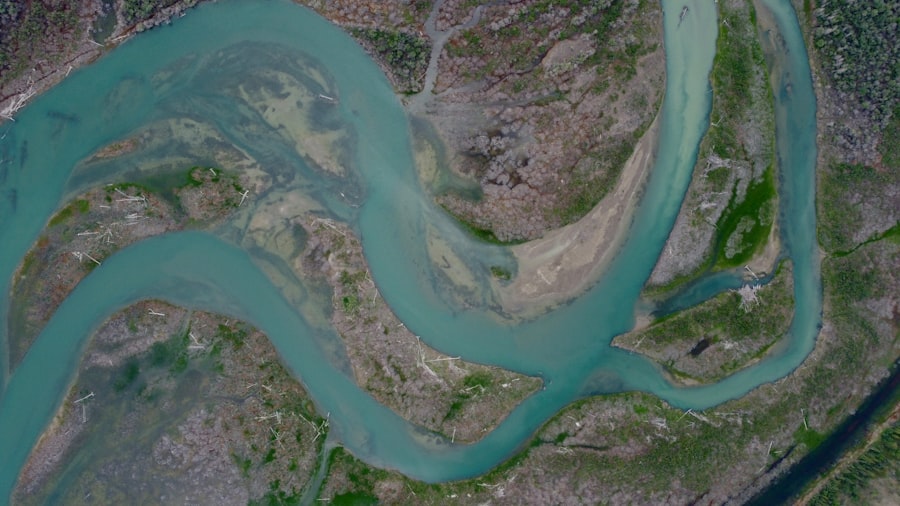
River geomorphology examines the physical characteristics and evolution of river channels. This includes studying landforms such as meanders, oxbow lakes, and floodplains. Sediment transport, the movement of soil, sand, and rock particles by flowing water, is a critical aspect of river geomorphology. It influences channel shape, the formation of deltas, and the ecological health of riverine environments. The ceaseless churning of river water is a sculptor, constantly reshaping the land.
Lakes and Reservoirs: The Stored Depths
Lakes are large bodies of relatively still water, enclosed by land. Reservoirs are artificial lakes created by building dams. Both are crucial water storage systems, providing water for domestic use, irrigation, and hydropower generation. Hydrological studies of lakes and reservoirs focus on factors like water level fluctuations, thermal stratification, water quality, and evaporation rates. Understanding the balance between inflows and outflows is essential for managing these water resources effectively, especially in the face of changing climate conditions.
Lake Dynamics and Stratification
Lakes experience complex dynamics, including mixing due to wind, and thermal stratification, where the water column separates into distinct layers based on temperature. This stratification influences nutrient distribution, oxygen levels, and the overall aquatic ecosystem. Seasonal changes in temperature drive these stratification cycles, impacting water quality throughout the year.
Reservoir Operation and Water Management
The operation of reservoirs involves balancing competing demands for water, such as supply for cities, irrigation for agriculture, and power generation. Hydrologists play a key role in developing operating rules and making informed decisions about water releases, particularly during periods of drought or high flood potential. This involves complex modeling and forecasting to optimize resource utilization.
Groundwater Hydrology: The Hidden Reservoirs
Groundwater hydrology investigates water that permeates the ground and is stored in underground layers of rock and soil, known as aquifers. These hidden reservoirs are a significant source of fresh water for much of the world’s population, often providing a more stable and consistent supply than surface water. Understanding the movement, recharge, and depletion of groundwater is crucial for sustainable water management. It is nature’s silent, vast underground cistern, patiently serving the needs of the planet.
Aquifers and Groundwater Flow
Aquifers are geological formations that can store and transmit significant quantities of groundwater. These can range from porous sand and gravel layers to fractured rock formations. Groundwater flow is typically much slower than surface water flow and is driven by gravity and pressure gradients. This slow, persistent movement means that once an aquifer is contaminated, it can take a very long time to recover.
Types of Aquifers
Aquifers are broadly classified into unconfined aquifers, where the upper surface of the groundwater is exposed to atmospheric pressure and is in direct contact with soil and rock, and confined aquifers, where the groundwater is trapped between two impermeable layers of rock or clay. The behavior and vulnerability of these aquifer types differ significantly.
Darcy’s Law and Groundwater Movement
Darcy’s Law is a fundamental principle in groundwater hydrology that describes the flow of groundwater through a porous medium. It states that the flow rate is proportional to the hydraulic gradient (the change in hydraulic head over a distance) and the permeability of the medium. This law allows hydrologists to predict how quickly groundwater will move and in what direction, forming the basis for groundwater resource modeling.
Groundwater Recharge and Depletion
Groundwater recharge is the process by which groundwater is replenished, primarily through infiltration of precipitation and surface water. Groundwater depletion occurs when water is extracted from aquifers at a rate faster than it can be recharged. This can lead to a lowering of the water table, land subsidence, and saltwater intrusion in coastal areas. Sustainable extraction practices are essential to prevent the exhaustion of these vital resources.
Aquifer Testing and Characterization
To understand aquifer properties and behavior, hydrologists conduct aquifer tests, which involve pumping water from a well and observing the resulting changes in water levels in nearby observation wells. This data allows for the estimation of aquifer parameters such as transmissivity (the ability of an aquifer to transmit water) and storage coefficient (the volume of water released from storage per unit surface area of aquifer per unit decline in head).
Groundwater Contamination and Remediation
Groundwater contamination is a significant environmental concern, arising from sources such as industrial waste, agricultural runoff, and leaking underground storage tanks. Remediation of contaminated groundwater is a complex and expensive process, often involving physical removal of contaminants, biological treatment, or the use of reactive barriers. Protecting groundwater sources from contamination is therefore a far more effective strategy than cleaning them up.
Water Quality and Pollution: The Integrity of the Resource
Water quality is a measure of the suitability of water for a particular use, based on its physical, chemical, and biological characteristics. Pollution refers to the degradation of water quality through the introduction of harmful substances. Ensuring and maintaining good water quality is a cornerstone of hydrology, directly impacting human health, ecosystems, and economic activities. A pristine river is not just beautiful; it is a functional, life-giving system.
Pollutants and Their Sources
Water pollutants can originate from a wide array of sources, both point sources (such as industrial discharge pipes) and non-point sources (diffuse sources like agricultural runoff). Common pollutants include nutrients (nitrogen and phosphorus from fertilizers), pathogens (bacteria and viruses from sewage), heavy metals (from industrial processes), and organic compounds. Each pollutant has its own unique chemical behavior and environmental impacts.
Chemical and Physical Parameters
Key chemical parameters monitored include pH, dissolved oxygen, turbidity, and the concentration of various ions and minerals. Physical parameters involve temperature and suspended solids. These measurements provide a snapshot of the water’s condition and its suitability for different uses. For instance, low dissolved oxygen levels can indicate an unhealthy aquatic ecosystem unable to support life.
Biological Indicators of Water Quality
Biological indicators, such as the presence or absence of specific aquatic organisms, are also used to assess water quality. Certain species are highly sensitive to pollution and their decline can signal a problem. Macroinvertebrates, like insect larvae and crustaceans, are often used as bioindicators due to their sessile nature and varying tolerances to different pollutants.
Water Pollution Control and Treatment
Strategies for controlling and treating water pollution are diverse and depend on the type and source of the pollution. This includes physical, chemical, and biological treatment processes for municipal and industrial wastewater. For non-point source pollution, measures like riparian buffer zones, improved agricultural practices, and urban stormwater management are crucial.
Wastewater Treatment Processes
Municipal wastewater treatment typically involves primary, secondary, and sometimes tertiary treatment stages. Primary treatment removes solids, secondary treatment uses biological processes to remove dissolved organic matter, and tertiary treatment can remove specific pollutants like nutrients or pathogens. Industrial wastewater treatment is often tailored to the specific contaminants present.
Non-point Source Pollution Management
Managing non-point source pollution is challenging due to its diffuse nature. It often requires a watershed-based approach, integrating land management practices to minimize pollutant runoff. This can include conservation tillage in agriculture, minimizing fertilizer and pesticide use, and constructing vegetated filter strips along waterways.
Hydrology, the study of water in the environment, plays a crucial role in understanding various ecological and geological processes. For those interested in exploring this topic further, you might find an insightful article on the relationship between hydrology and climate change at Freaky Science. This resource delves into how shifts in precipitation patterns and water availability can significantly impact ecosystems and human activities.
Hydrologic Modeling and Data Analysis: Understanding and Predicting
| Metric | Description | Unit | Typical Range |
|---|---|---|---|
| Precipitation | Amount of rainfall or snowfall over a specific area | Millimeters (mm) | 0 – 3000 mm/year |
| Evapotranspiration | Sum of evaporation and plant transpiration from the Earth’s surface | Millimeters (mm) | 200 – 1500 mm/year |
| Runoff | Water flow that occurs when soil is saturated or impervious | Millimeters (mm) | 0 – 2000 mm/year |
| Streamflow | Volume of water flowing in a river or stream over time | Cubic meters per second (m³/s) | 0.1 – 5000 m³/s |
| Groundwater Recharge | Amount of water that infiltrates to replenish aquifers | Millimeters (mm) | 10 – 500 mm/year |
| Soil Moisture | Water content held in the soil | Volumetric percentage (%) | 5% – 50% |
| Water Table Depth | Depth at which soil pore spaces are saturated with water | Meters (m) | 0.5 – 50 m |
Hydrologic modeling and data analysis are essential tools for understanding complex water systems and predicting future behavior. These disciplines employ mathematical models and statistical techniques to simulate and analyze hydrologic processes, providing insights that are crucial for decision-making. These models act as digital laboratories, allowing us to experiment with different scenarios without impacting the real world.
Mathematical Hydrologic Models
Mathematical hydrologic models are simplified representations of real-world hydrologic processes. They can range from simple empirical equations to complex physically-based simulations. These models are used to simulate streamflow, groundwater movement, and the impact of land-use changes or climate variability on water resources. The accuracy of these models is highly dependent on the quality of input data and the underlying assumptions.
Types of Hydrologic Models
Models can be broadly categorized as deterministic (producing the same output for the same input) or stochastic (incorporating randomness). They can also be lumped (treating a watershed as a single unit) or distributed (representing spatial variations within a watershed). The choice of model depends on the specific research question and the available data.
Model Calibration and Validation
Model calibration involves adjusting model parameters to match observed historical data. Model validation is then performed using independent data sets to assess the model’s predictive capability. Rigorous calibration and validation are critical to ensure that the model’s outputs are reliable and can be used for practical applications.
Data Acquisition and Management
Accurate and comprehensive data is the bedrock of all hydrologic studies. Data acquisition involves collecting measurements from a variety of sources, including weather stations, stream gauges, groundwater monitoring wells, and remote sensing platforms. Effective data management systems are then required to store, organize, and retrieve this vast amount of information.
Remote Sensing and GIS in Hydrology
Remote sensing technologies, such as satellites and aerial photography, have revolutionized data acquisition in hydrology. They provide spatial data on land cover, soil moisture, snow cover, and water extent. Geographic Information Systems (GIS) are used to manage, analyze, and visualize this spatial data, integrating it with other hydrologic information for effective decision-making.
Statistical Analysis of Hydrologic Data
Statistical methods are employed to analyze hydrologic data for trends, patterns, and relationships. This includes techniques for estimating extreme events (floods and droughts), assessing the uncertainty in hydrologic predictions, and evaluating the significance of observed changes in water systems.
In conclusion, hydrology is a multifaceted and indispensable field that underpins our ability to understand, manage, and protect Earth’s most vital resource. From the microscopic journey of a water droplet to the grand circulation of the global water cycle, the insights gained from hydrological study are fundamental to ensuring a sustainable future for life on our planet. The continuous advancement in tools and techniques, coupled with a growing awareness of the challenges posed by climate change and human activities, ensures that hydrology will remain a critical area of research and application for generations to come.
FAQs
What is hydrology?
Hydrology is the scientific study of the movement, distribution, and quality of water on Earth, including the water cycle, water resources, and environmental watershed sustainability.
Why is hydrology important?
Hydrology is important because it helps us understand water availability, manage water resources, predict floods and droughts, and protect ecosystems and human health.
What are the main components of the hydrological cycle?
The main components of the hydrological cycle include precipitation, evaporation, transpiration, infiltration, runoff, and groundwater flow.
How do hydrologists measure water flow?
Hydrologists measure water flow using instruments such as stream gauges, flow meters, and remote sensing technologies to monitor river discharge, rainfall, and groundwater levels.
What fields use hydrology?
Hydrology is used in fields such as environmental science, civil engineering, agriculture, urban planning, and disaster management to address water-related challenges.