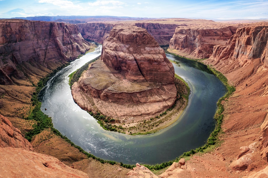
Earth’s crust is a vast, complex tapestry woven from millennia of geological processes. It is a realm of immense beauty and profound power, a testament to the dynamic forces that have shaped our planet for billions of years. To explore these geological wonders is to embark on a journey through time, uncovering the secrets held within towering mountains, sprawling deserts, and the very depths of the oceans. This exploration reveals not just the physical form of our world but also the intricate dance of its internal machinery.
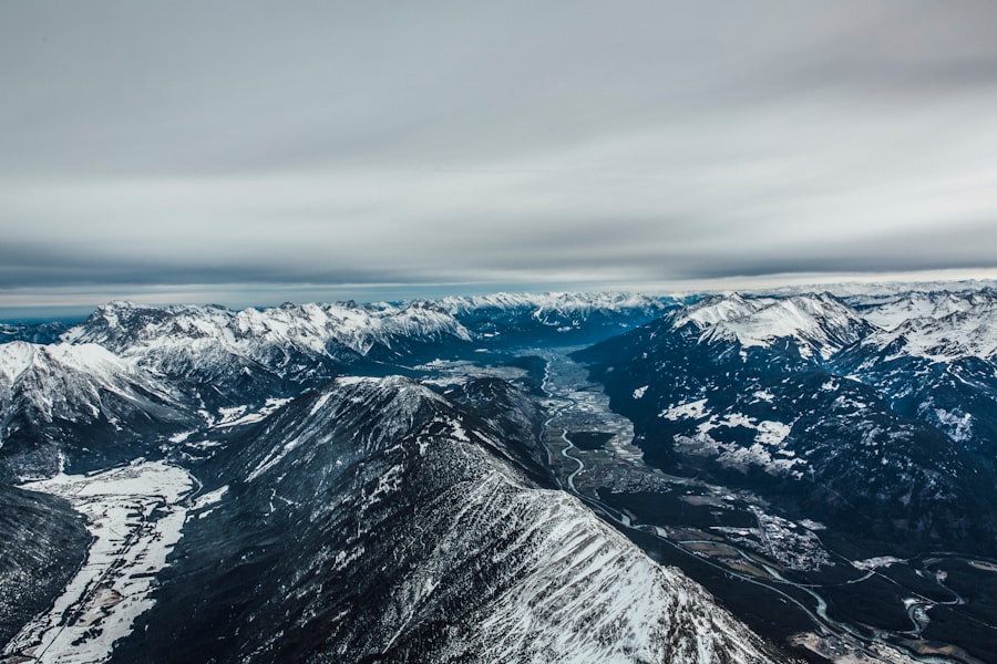
Mountains, the undisputed titans of the terrestrial landscape, stand as silent witnesses to the planet’s ceaseless geological activity. Their existence is a direct consequence of the immense pressures and motions occurring deep beneath our feet, primarily driven by the movement of tectonic plates. These colossal structures are not merely static formations; they are fluid landscapes constantly being molded, eroded, and reformed.
The Grand Collisions: Plate Tectonics and Orogeny
The primary mechanism behind mountain building, or orogeny, is the interaction of Earth’s tectonic plates. These are massive, rigid slabs of rock that make up the lithosphere, our planet’s outermost shell. They float on the semi-fluid asthenosphere beneath, driven by convection currents within the Earth’s mantle.
Convergent Boundaries: Where Continents Collide
When two tectonic plates move towards each other, a convergent boundary is formed. The consequences of such a collision are dramatic and directly responsible for the formation of most of the world’s major mountain ranges.
Continent-Continent Collision: The Himalayas
One of the most iconic examples of continent-continent collision is the formation of the Himalayas. The Indian Plate, once a separate landmass drifting northward, eventually collided with the Eurasian Plate. Because both plates were composed of relatively light continental crust, neither was readily subducted beneath the other. Instead, the immense pressures buckled, folded, and uplifted the crust, thrusting rock layers upon rock layers to create the towering peaks we see today. This ongoing collision continues to push the mountains higher, albeit at a slow, almost imperceptible rate—a geological marathon.
Ocean-Continent Collision: The Andes
In contrast, ocean-continent collisions lead to the formation of mountain ranges along continental margins. Here, the denser oceanic plate is forced beneath the lighter continental plate in a process called subduction. As the oceanic plate descends into the mantle, it melts, generating magma. This molten rock rises to the surface, erupting in a chain of volcanoes that parallel the subduction zone. The Andes Mountains in South America are a prime example, formed by the subduction of the Nazca Plate beneath the South American Plate. The explosive power of these volcanoes is like the planet’s exhalation, releasing pressure and shaping the landscape.
Subduction Zones: Volcanoes and Volcanic Arcs
Subduction zones are hotbeds of volcanic activity, and the mountains formed here are often characterized by their conical shapes and explosive eruptions. These volcanic mountains are fertile ground for geological study, offering insights into the Earth’s internal heat engine.
Island Arcs: Japan and the Aleutians
Where oceanic plates subduct beneath other oceanic plates, volcanic island arcs are formed. Chains of islands, such as Japan and the Aleutian Islands, are essentially underwater mountain ranges that have emerged above sea level due to volcanic activity. These islands are geologically young and highly active, a constant reminder of the dynamic processes at play beneath the ocean’s surface.
Erosive Sculptors: The Slow Work of Weathering and Erosion
While tectonic forces build mountains, erosional forces act as the patient sculptors, gradually wearing them down. Wind, water, ice, and gravity are the relentless agents of erosion, shaping the rugged features of mountain landscapes over vast timescales.
Glacial Sculpting: Fjords and U-Shaped Valleys
In regions subjected to glaciation, glaciers act as powerful erosive agents. As they flow downhill, they carve out distinctive landforms. U-shaped valleys, characteristic of glaciated mountain ranges, are formed as glaciers widen and deepen existing river valleys. Fjords, deep, narrow inlets carved by glaciers and then flooded by the sea, are dramatic examples of glacial erosional power. These frozen rivers, given enough time, can reshape entire landscapes.
Riverine Terraces and Canyon Formation
Rivers, too, play a significant role in mountain erosion. As rivers flow down steep mountain slopes, they are characterized by high energy and erosive power. Over time, they can carve deep canyons into the bedrock. The Grand Canyon, while not strictly a mountain range, showcases the immense erosive power of a river over millions of years. Rivers create terraces along their banks as they repeatedly cut downward and then shift their course, leaving behind stair-like features that mark past water levels.
Geology is a fascinating field that explores the Earth’s structure, composition, and processes over time. For those interested in delving deeper into this subject, a related article can be found at Freaky Science, which discusses various geological phenomena and their implications for understanding our planet’s history. This resource provides valuable insights into the dynamic nature of Earth’s geology and the ongoing research that continues to shape our knowledge in this area.
The Shifting Sands: Deserts and Their Origins
Deserts, often perceived as barren expanses, are in fact dynamic ecosystems shaped by extreme climatic conditions and geological processes. They represent regions where the balance of precipitation is tipped heavily towards aridity, making them unique environments for both life and geological investigation.
Atmospheric Dynamics: The Reign of High Pressure
The formation of most deserts is intrinsically linked to global atmospheric circulation patterns, particularly the presence of persistent high-pressure systems. These systems, characterized by descending air, inhibit cloud formation and precipitation, leading to arid conditions.
The Hadley Cells: Equatorial Lows and Subtropical Highs
The Hadley cells, large-scale atmospheric circulation loops, are instrumental in creating tropical and subtropical deserts. Air rises at the equator, cools, and then descends around 30 degrees latitude north and south. This descending air is dry and warm, creating a rain shadow effect that results in vast desert regions like the Sahara and the Australian Outback. These are the planet’s great sighing breaths, exhaling dryness across vast regions.
Orographic Effects: Rain Shadows
Mountains can also play a significant role in desert formation through orographic effects. As moist air masses encounter mountain ranges, they are forced upward. As the air rises, it cools and condenses, leading to precipitation on the windward side of the mountains. By the time the air descends on the leeward side, it has lost most of its moisture, creating a dry “rain shadow” region—a desert.
Geological Legacies: Ancient Waterways and Arid Landscapes
While current climatic conditions are paramount, the geological history of desert regions also contributes to their unique character. Ancient riverbeds, dry lakebeds, and evidence of past wetter climates can be found scattered across these arid landscapes.
Alluvial Fans and Bajadas: Water’s Transient Touch
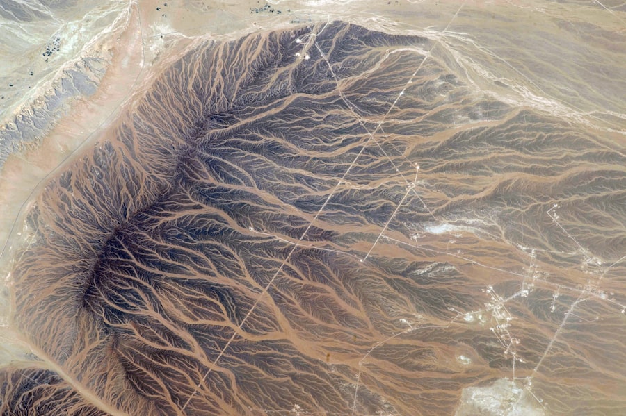
Even in arid regions, infrequent rainfall can lead to flash floods. When these floods occur in mountainous desert areas, they carry sediment from the mountains and deposit it as broad, sloping landforms called alluvial fans at the base of the mountains. Where multiple alluvial fans merge, they form a bajada. These features are like ephemeral veins of water, tracing their past journeys.
Evaporation and Mineral Deposition: Salt Flats and Gypsum Dunes
The intense evaporation characteristic of deserts plays a crucial role in concentrating dissolved minerals. Areas with historical or intermittent water bodies, such as salt flats (playas), are formed by the evaporation of water, leaving behind vast expanses of salt and other minerals. In some desert regions, gypsum, a softer mineral, can be blown into spectacular dune formations, such as those found in White Sands National Park.
The Ever-Shifting Surface: Volcanoes and Their Fiery Nature
Volcanoes are among the most dramatic and awe-inspiring geological formations on Earth. They are direct conduits to the planet’s molten interior, spewing forth lava, ash, and gases in events that can reshape landscapes and impact global climate.
Internal Fires: Magma and Its Ascent
The driving force behind volcanic activity is the presence of magma, molten rock found beneath the Earth’s surface. This magma, heated by radioactive decay and residual heat from Earth’s formation, rises due to its lower density compared to the surrounding solid rock.
Mantle Plumes: Hotspots and Island Chains
Mantle plumes are columns of unusually hot rock that rise from deep within the Earth’s mantle. As a tectonic plate moves over a stationary mantle plume, a chain of volcanoes is formed. The Hawaiian Islands are a classic example of this phenomenon, with the youngest, most active volcano, Kīlauea, currently situated over the hotspot. These plumes are like fiery arteries reaching up from the Earth’s heart.
Subduction Zones: Melting and Magma Generation
As mentioned earlier, subduction zones are also key areas for magma generation. The descending oceanic plate carries water down into the mantle. This water lowers the melting point of the surrounding rock, causing it to melt and form magma. This magma then rises to the surface, erupting to form volcanoes.
Volcanic Landforms: Diversity and Evolution
Volcanoes themselves exhibit a remarkable diversity of shapes and sizes, reflecting the type of magma erupted and the style of eruption.
Shield Volcanoes: Gentle Giants of Lava
Shield volcanoes are characterized by their broad, gently sloping cones, formed by the eruption of highly fluid basaltic lava. This lava flows for long distances before solidifying, creating a shield-like shape. Mauna Loa in Hawaii is the largest shield volcano on Earth. Their eruptions are often effusive, like a slow, molten ooze.
Stratovolcanoes: Conical Architects of Explosions
Stratovolcanoes, also known as composite volcanoes, are typically conical in shape and are built up by alternating layers of lava flows, volcanic ash, and cinders. They are often associated with explosive eruptions, driven by more viscous magma. Mount Fuji in Japan and Mount St. Helens in the United States are prominent examples. These are the dramatic artists, capable of both beauty and destruction.
Calderas: Collapsed Volcanoes
When a large magma chamber beneath a volcano empties during a major eruption, the overlying rock can collapse into the resulting void, forming a large, basin-shaped depression called a caldera. Crater Lake in Oregon is a famous example of a caldera filled with water. These are the scars left behind by immense geological events.
The Earth’s Veins: Rivers and Their Sculpting Power
Rivers are the arterial systems of the Earth’s surface, transporting water and sediment across continents and shaping landscapes through erosion and deposition. They are dynamic forces, constantly evolving and demonstrating the interconnectedness of geological processes.
The Water Cycle: The Engine of Rivers
The existence and flow of rivers are fundamentally driven by the Earth’s water cycle. Precipitation, evaporation, and transpiration continuously redistribute water across the planet, feeding the streams and rivers that carve their paths through the land.
Drainage Basins: The Catchment Areas
Each river system is part of a larger drainage basin, a region where all precipitation drains into a common river network. These basins are defined by the topography, with ridges and divides acting as boundaries. Understanding drainage basins is crucial for managing water resources and studying hydrological processes.
Tributaries and Confluences: The Merging Streams
Rivers are rarely solitary. They are fed by numerous smaller streams and rivers known as tributaries. Where tributaries merge with a larger river, it is called a confluence. This intricate network of waterways forms a complex, interconnected system, each contributing to the larger flow.
###erosive and Depositional Processes: Shaping the Land
Rivers are powerful agents of both erosion and deposition, shaping the land in numerous ways.
Downcutting and Valley Formation
As rivers flow, they erode their beds and banks through processes like abrasion (grinding by sediment) and hydraulic action (the force of the water). This erosion, particularly downcutting, leads to the formation of river valleys. The deeper and wider the valley, the more erosive power the river has exerted over time.
Meanders and Oxbow Lakes: The River’s Dance
In flatter terrain, rivers tend to develop sinuous, winding patterns known as meanders. These meanders are formed by differential erosion and deposition. On the outer banks of a bend, erosion is dominant, while on the inner banks, deposition occurs. Over time, meanders can become so pronounced that a loop of the river becomes cut off from the main channel, forming an oxbow lake. This is the river’s slow, deliberate waltz across the land.
Deltas: The River’s Gift to the Sea
When a river enters a larger body of water, such as a lake or the ocean, its velocity decreases, and it loses its ability to carry its sediment load. This sediment is then deposited at the river mouth, forming a delta. Deltas are often fertile, fan-shaped landforms that can support significant human populations and ecosystems. They are the accumulative offerings of a river’s long journey.
Geology is a fascinating field that explores the Earth’s structure, composition, and processes. For those interested in learning more about the dynamic forces that shape our planet, a related article can be found at Freaky Science, which delves into various geological phenomena and their implications for understanding Earth’s history. This resource provides valuable insights into topics such as plate tectonics, mineral formation, and the impact of natural disasters, making it a great complement to any geology enthusiast’s reading list.
The Hidden Depths: Ocean Floors and Their Geological Significance
| Metric | Description | Typical Values | Units |
|---|---|---|---|
| Rock Density | Mass per unit volume of rock | 2.0 – 3.0 | g/cm³ |
| Porosity | Percentage of void space in rock | 5 – 30 | % |
| Permeability | Ability of rock to transmit fluids | 10⁻¹⁵ – 10⁻¹² | m² |
| Seismic Velocity | Speed of seismic waves through rock | 2.0 – 7.0 | km/s |
| Geothermal Gradient | Rate of temperature increase with depth | 20 – 30 | °C/km |
| Age of Earth | Estimated age of the planet | 4.54 billion | years |
| Plate Tectonic Speed | Movement rate of tectonic plates | 2 – 10 | cm/year |
The ocean floor, covering over 70% of Earth’s surface, is a vast and geologically active realm. It is a frontier of exploration, revealing dramatic underwater mountain ranges, immense trenches, and evidence of the planet’s dynamic geological history.
The Mid-Ocean Ridge System: Earth’s Linear Volcano
The longest mountain range on Earth is not on land but beneath the ocean: the mid-ocean ridge system. This is a vast network of underwater mountains formed by seafloor spreading at divergent plate boundaries. As tectonic plates pull apart, magma rises from the mantle, cools, and solidifies, creating new oceanic crust.
Seafloor Spreading: The Birth of New Crust
Seafloor spreading is the process by which new oceanic crust is continuously created at mid-ocean ridges. This process is central to plate tectonics and is responsible for the movement of continents over geological time. Imagine a conveyor belt of molten rock, constantly replenishing the ocean floor.
Hydrothermal Vents: Oases of Life
At mid-ocean ridges, superheated water, rich in minerals, is released from the Earth’s crust through hydrothermal vents. These vents support unique ecosystems of chemosynthetic organisms, such as tube worms and specialized bacteria, which thrive in the absence of sunlight. These are like miniature ecosystems fueled by the Earth’s internal heat.
Oceanic Trenches: The Deepest Abysses
Oceanic trenches are the deepest parts of the ocean floor, formed at convergent plate boundaries where one oceanic plate subducts beneath another. The Mariana Trench, the deepest known part of any ocean, plunges over 11,000 meters (36,000 feet) below sea level. These trenches are the scars of the planet’s most violent collisions.
Subduction and Seismicity: The Earthquakes’ Cradle
The process of subduction at oceanic trenches is also a major source of earthquakes. As the oceanic plate bends and grinds its way into the mantle, it can generate immense seismic energy. The most powerful earthquakes on Earth often occur in these subduction zones.
Submarine Volcanoes and Seamounts: Hidden Islands
Thousands of submarine volcanoes and seamounts (underwater mountains) dot the ocean floor. Many of these are extinct, remnants of past volcanic activity, while others remain active. These underwater mountains are crucial habitats for marine life and offer valuable insights into the geology of the ocean basins.
Exploring Earth’s geological wonders is a journey of continuous discovery. From the towering peaks of mountains to the silent depths of the ocean trenches, each feature tells a story of immense forces and unimaginable timescales. By understanding these geological marvels, we gain a deeper appreciation for the dynamic planet we inhabit and the intricate processes that have shaped it throughout its history. The Earth is not a static sphere but a living, breathing entity, constantly remaking itself in a grand, geological ballet.
FAQs
What is geology?
Geology is the scientific study of the Earth, including its materials, processes, and history. It involves examining rocks, minerals, and the physical structure of the planet to understand its formation and changes over time.
What are the main branches of geology?
The main branches of geology include mineralogy (study of minerals), petrology (study of rocks), paleontology (study of fossils), sedimentology (study of sedimentary rocks and processes), and structural geology (study of rock formations and tectonics).
How do geologists study the Earth’s history?
Geologists study the Earth’s history by analyzing rock layers (stratigraphy), fossils, radiometric dating, and geological formations. These methods help determine the age of rocks and the sequence of events that shaped the planet.
What role does plate tectonics play in geology?
Plate tectonics is a fundamental concept in geology that explains the movement of Earth’s lithospheric plates. This movement causes earthquakes, volcanic activity, mountain building, and the formation of ocean basins, shaping the Earth’s surface.
Why is geology important for society?
Geology is important because it helps locate natural resources like minerals, oil, and groundwater. It also aids in understanding natural hazards such as earthquakes and landslides, contributing to disaster preparedness and environmental protection.