Tectonic reconstruction, a field dedicated to deciphering the planet’s dynamic history, often focuses on unraveling the complex tapestry of plate movements. While understanding continents drifting apart or colliding is fundamental, a deeper layer of geographical interrogation involves mapping and analyzing “blobs of longitudinal shift.” These enigmatic phenomena represent localized, significant changes in the east-west positioning of crustal blocks, distinct from the broader, more diffuse movements of tectonic plates. To grasp their significance, one must visualize the Earth’s crust not as a rigid, monolithic entity, but as a jigsaw puzzle where pieces don’t just slide past each other, but can also twist, rotate, and even subtly warp their edges over geological timescales. This article delves into the methodological approaches and scientific implications of mapping these longitudinal shifts.
Defining Longitudinal Displacement
Longitudinal shift, in the context of tectonics, refers to the change in longitude of a specific geographic location or geological feature relative to a stable reference frame. Unlike latitudinal shifts, which describe north-south movement, longitudinal shifts directly impact the east-west positioning. These are not always the result of simple, linear plate motion. Instead, they can arise from complex rheological properties of the lithosphere, pre-existing crustal anisotropies, or the interaction with deeper mantle structures. Imagine a raft on a river; it moves downstream (latitudinally), but if the current has eddies or undertows, the raft might also be pushed sideways (longitudinally) in ways not immediately obvious from the main flow.
Distinguishing from Plate Rotation and Orogeny
It is crucial to differentiate longitudinal shifts from other tectonic processes. Plate rotation, while also affecting longitude, typically describes a more uniform rotation of an entire tectonic plate around a specific pole. Longitudinal shifts, on the other hand, can be more localized, creating distinct “blobs” or zones where the eastward or westward displacement is anomalous compared to surrounding regions. Similarly, while orogenic belts (mountain-building regions) involve significant compressional and extensional deformation, the resulting longitudinal shifts within them are often a byproduct of complex crustal shortening and thickening, rather than primary east-west translocation. The mapping of longitudinal shifts aims to isolate these specific east-west vector components, free from the superimposed effects of rotation or broad-scale compression.
Tectonic reconstruction is a fascinating field that explores the movement of Earth’s plates over geological time, and one intriguing aspect of this research involves the study of tectonic reconstruction blobs and their longitudinal implications. For those interested in delving deeper into this topic, a related article can be found at Freaky Science, which discusses various geological phenomena and their impact on our understanding of Earth’s dynamic systems.
Methodological Approaches to Mapping Longitudinal Shifts
Mapping these longitudinal shifts requires a multifaceted approach, drawing upon a diverse toolkit of geological, geophysical, and geodetic techniques. No single method can paint the complete picture; instead, multiple lines of evidence are synthesized to reveal these subtle yet significant movements.
Paleomagnetic Reconstruction: The Fossil Compass
One of the most powerful tools for reconstructing past tectonic positions is paleomagnetism. When rocks solidify from magma or form through sedimentary processes, they can acquire a magnetic signature that aligns with the Earth’s magnetic field at that time. By analyzing the magnetic inclination and declination preserved within these rocks, scientists can determine the paleolatitude and paleolongitude of the location where the rock formed, relative to the magnetic poles.
Analyzing Remanent Magnetization
The process begins with careful rock sampling in the field, ensuring samples are taken from units of known age. Laboratory analysis involves measuring the remanent magnetization, the rock’s inherent magnetic signal. Techniques like alternating field (AF) or thermal demagnetization are used to isolate the primary magnetic signal from secondary overprints acquired later.
Paleolatitude versus Paleolongitude Reconstruction
Paleomagnetic data readily provides paleolatitude by analyzing the magnetic inclination (the angle the magnetic field lines make with the horizontal). However, determining paleolongitude is more challenging. This is because the Earth’s magnetic field is not perfectly aligned with the rotation axis, and its dipole moment can fluctuate. Therefore, paleolongitude reconstructions often rely on comparing the paleomagnetic orientation of nearby rock formations, or by using independent geological markers that constrain relative orientations. The identification of specific “blobs” of longitudinal shift is often revealed when paleomagnetic data from a defined region consistently deviates from the expected paleolongitude predicted by larger-scale plate motion models.
Geodetic Measurements: The Modern Snapshot
In the present day, geodetic techniques provide unprecedented precision in measuring crustal movements. Global Navigation Satellite Systems (GNSS), such as the Global Positioning System (GPS), are the workhorses of modern geodesy. By tracking the precise positions of ground-based receivers over time, scientists can detect minute changes in longitude, latitude, and elevation.
GNSS Network Densification and Data Analysis
Densifying GNSS networks in tectonically active or geologically enigmatic regions is crucial. These networks act as the eyes and ears of geoscientists, continuously recording the subtle dance of the Earth’s surface. Sophisticated data processing algorithms are employed to filter out noise and atmospheric effects, isolate tectonic signals, and resolve velocities in three dimensions.
Identifying Anomalous Longitudinal Velocity Vectors
When analyzing GNSS data, anomalies in the longitudinal component of the velocity vectors are particularly illuminating. Regions where the observed eastward or westward drift significantly deviates from predictions based on known plate boundaries or regional stress fields can be indicative of underlying longitudinal shifts. These deviations can highlight areas where strain is being accommodated in complex, non-uniform ways, leading to the formation of these localized “blobs.”
Seismic Tomography: Peering into the Earth’s Interior
Seismic tomography, a technique analogous to medical CAT scans, uses seismic waves generated by earthquakes to image the Earth’s interior. Variations in the speed at which seismic waves travel reveal differences in temperature, density, and composition within the mantle and crust. These variations are often linked to tectonic processes, including the dynamics that drive longitudinal shifts.
Mapping Asthenospheric Flow and Mantle Anomalies
The asthenosphere, a semi-fluid layer beneath the lithosphere, plays a critical role in plate tectonics. Mantle plumes, regions of upwelling hot material, and subducting slabs, which are descending cold material, create heterogeneities within the mantle. These heterogeneities can exert forces on the overlying lithosphere, influencing its movement. Seismic tomography allows scientists to map these anomalies and infer the direction of asthenospheric flow.
Coupling Between Mantle Dynamics and Lithospheric Motion
The inference of longitudinal shifts from seismic tomography relies on understanding the coupling between mantle dynamics and lithospheric motion. If seismic data indicates that a particular lithospheric block is being dragged or pushed eastward or westward by anomalous mantle flow, this provides a direct link to the mechanism driving the longitudinal shift. The “blobs” of longitudinal shift might correspond to areas where this coupling is particularly strong or localized.
Geological Evidence for Longitudinal Shift Zones
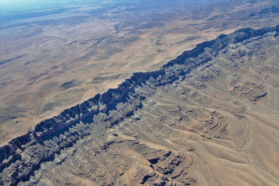
Beyond geophysical and geodetic methods, the direct imprint of longitudinal shifts can be found within the geological record itself, etched into the landscape and rock formations.
Strain Markers and Fault Systems
The deformation of rocks provides tangible evidence of past movements. Faults, cracks in the Earth’s crust where rocks have moved past each other, are a primary manifestation of tectonic strain. The orientation and type of faulting, along with associated geological structures, can reveal the direction and magnitude of displacement.
Strike-Slip Faults and Rotational Deformation
Strike-slip faults, where the dominant motion is horizontal and parallel to the fault strike, are particularly relevant to longitudinal shifts. The presence of extensive strike-slip fault systems that exhibit a consistent component of east-west displacement can delineate zones of significant longitudinal strain. Furthermore, evidence of rotational deformation, such as drag folds or imbricate thrust slices, can indicate localized twisting of crustal blocks, contributing to anomalous longitudinal positions.
Offset Geological Features
Another key indicator is the offset of recognizable geological features. Formations like volcanic dikes, sedimentary layers with distinctive marker beds, or even ancient river systems, can be traced and then found to be displaced horizontally. By measuring the amount and direction of this offset, geologists can map out the cumulative longitudinal shift that has occurred over geological time. These offset features can form the boundaries or delineate the extent of these longitudinal shift “blobs.”
Sedimentary Basins and Paleogeographic Reconstruction
The history of sedimentary basins can serve as a passive recorder of tectonic activity. The location, size, and sediment fill of these basins are influenced by the underlying tectonic regime, including subsidence and uplift, which are often tied to horizontal movements.
Subsidence Patterns and Sediment Provenance
Changes in the rate and location of subsidence within a sedimentary basin can indicate periods of crustal extension or compression, which can be associated with longitudinal shift. The provenance of sedimentary grains – the source rocks from which they originate – can also reveal information about the relative positions of source areas and depositional sites over time. If paleogeographic reconstructions based on sediment provenance consistently show a particular region migrating eastward or westward at a faster rate than predicted, this points to a longitudinal shift.
Paleocurrent Analysis and Paleoenvironmental Reconstruction
Analyzing paleocurrents (ancient flow directions preserved in sedimentary structures), fossil assemblages, and other paleoenvironmental indicators can help reconstruct past landscapes and geographical configurations. If reconstructions consistently reveal that what was once a continuous feature has been longitudinally separated, or that a landmass has experienced a distinct eastward or westward swing in its position relative to stable cratons, it signifies longitudinal displacement.
Interpreting the Causes: Mantle Dynamics and Crustal Anisotropies
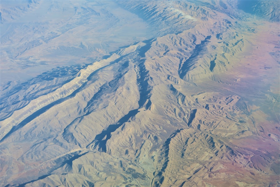
Understanding why these longitudinal shifts occur is as important as mapping them. The driving forces are often rooted in deep geological processes, interacting with the inherent structural fabric of the Earth’s crust.
Mantle Convection and Ridge Push
The convective forces within the Earth’s mantle are the ultimate engine of plate tectonics. Upwelling hot material at mid-ocean ridges generates a force known as “ridge push,” which drives plates apart. However, the complex patterns of mantle convection, including plumes and slabs, can also exert localized shear forces on the overlying lithosphere.
Shear Stresses from Mantle Flow
Mantle flow, though largely horizontal on the scale of plates, can exhibit localized variations in velocity and direction. Where these variations create significant shear stresses at the base of the lithosphere, they can induce longitudinal motion in specific crustal blocks. These “blobs” might represent areas where this coupling between the convecting mantle and the rigid lithosphere is particularly pronounced, perhaps due to thinner lithosphere or the presence of pre-existing weakness zones.
Slab Pull and Subduction Zone Influences
Slab pull, the force exerted by a dense, subducting oceanic plate sinking into the mantle, is another powerful driver of plate motion. While primarily responsible for latitudinal movement, the complex geometry of subduction zones and the interaction of the slab with the mantle can also generate torques and shear forces that contribute to longitudinal shifts in overriding plates or adjacent blocks.
Pre-existing Crustal Weaknesses and Anisotropies
The Earth’s crust is not uniform; it possesses inherent structural complexities and varying rheological properties that can influence how it responds to tectonic forces. Pre-existing fault systems, variations in rock composition and temperature, and the overall fabric of the lithosphere can act as zones of weakness.
Inheritance of Ancient Structures
Ancient rift zones, suture zones where continents have collided, and other major tectonic boundaries often leave behind lithospheric weaknesses that can be reactivated by subsequent stress fields. A “blob” of longitudinal shift might form where a strong regional stress field interacts with such an inherited zone of weakness, causing differential east-west movement along this pre-existing fabric. It’s like bending a piece of paper; it will crease most easily along lines where it’s already been folded.
Rheological Variations in the Lithosphere
The strength and ductility of the lithosphere vary significantly across the Earth’s surface. Regions with hotter, weaker lithosphere will deform more readily than colder, stronger regions. These rheological variations can lead to differential longitudinal movements, creating localized zones of enhanced eastward or westward displacement. The mapping of these “blobs” can therefore provide valuable insights into the subsurface rheology of the lithosphere.
Tectonic reconstruction is a fascinating field that explores the movement of Earth’s plates over geological time. One intriguing aspect of this research involves the study of tectonic reconstruction blobs, which are large, localized regions of the mantle that can influence plate movements. For a deeper understanding of this topic, you might find the article on tectonic reconstruction and its implications for geological processes particularly enlightening. You can read more about it in this related article. This resource provides valuable insights into how these blobs affect the longitude and latitude of tectonic plates throughout Earth’s history.
Implications and Future Directions
| Blob ID | Longitude (°) | Latitude (°) | Age (Ma) | Plate Name | Reconstruction Model | Confidence Level |
|---|---|---|---|---|---|---|
| BLOB001 | 45.2 | -12.5 | 150 | Pacific Plate | GPlates v2.0 | High |
| BLOB002 | 120.7 | 5.3 | 200 | Indo-Australian Plate | GPlates v2.0 | Medium |
| BLOB003 | -75.4 | 30.1 | 100 | South American Plate | GPlates v1.5 | High |
| BLOB004 | 10.0 | -45.0 | 250 | African Plate | GPlates v2.0 | Low |
| BLOB005 | 85.3 | 20.0 | 300 | Eurasian Plate | GPlates v1.5 | Medium |
The accurate mapping of longitudinal shifts has profound implications for our understanding of plate tectonics, seismic hazard assessment, and the geological evolution of our planet.
Refining Plate Tectonic Models
Current plate tectonic models primarily describe the movement of large lithospheric plates. The identification and mapping of localized longitudinal shifts highlight the need for more nuanced models that incorporate the complex interactions between mantle dynamics, crustal heterogeneities, and localized deformation. These “blobs” represent deviations from the expected bulk plate motion, demanding a finer resolution in our tectonic reconstructions.
Understanding Intraplate Deformation
Many longitudinal shifts occur away from plate boundaries, within the interior of tectonic plates. Mapping these shifts is crucial for understanding the mechanisms of intraplate deformation, which can be driven by forces transmitted from plate margins, mantle dynamics, or stress inheritance. The “blobs” are often the most visible manifestations of these otherwise subtle intraplate processes.
Characterizing Plate Boundary Complexity
Even at plate boundaries, the geometry of deformation is rarely simple. Longitudinal shifts can occur as a component of oblique convergence or divergence, or due to the presence of complex fault networks. Mapping these shifts helps to refine our understanding of how plate boundaries accommodate plate motion and how stress is partitioned along these zones.
Seismic Hazard Assessment and Earthquake Prediction
Longitudinal shifts are often associated with areas of significant tectonic stress accumulation. The movement and deformation within these zones can increase the likelihood of earthquakes.
Identifying Zones of Strain Accumulation
By mapping the magnitude and rate of longitudinal shifts, geoscientists can identify regions where strain is being built up along strike-slip faults or other shear zones. This information is critical for assessing seismic hazard and prioritizing areas for further monitoring. The “blobs” highlight areas where the Earth’s crust is being twisted and stretched in specific ways, potentially leading to future seismic events.
Improving Earthquake Forecasting
While predicting earthquakes remains a significant challenge, understanding the kinematics of crustal movement, including longitudinal shifts, provides essential input for probabilistic seismic hazard assessments and earthquake forecasting models. Identifying anomalous rates of longitudinal shift in a region could serve as a subtle warning sign of increased seismic activity.
Understanding Regional Geological Evolution
The long-term accumulation of longitudinal shifts has played a significant role in shaping the geological history of continents. The formation of mountain ranges, the opening and closing of basins, and the overall distribution of geological features are all influenced by these movements.
Reconstructing Paleogeography and Ocean Basins
Mapping past longitudinal shifts allows for more accurate reconstructions of ancient continental positions, the opening and closing of ocean basins, and the formation of supercontinents. This is vital for understanding global biogeography, climate history, and the evolution of life on Earth. If a particular landmass has been consistently shifting eastward over tens of millions of years, this has had profound implications for the dispersal of species and the formation of unique ecosystems.
Source of Ore Deposits and Hydrocarbon Reservoirs
The tectonic processes that create longitudinal shifts can also create favorable geological settings for the formation of mineral deposits and hydrocarbon reservoirs. The fracturing and deformation associated with these movements can create pathways for fluid migration and the trapping of valuable resources. Thus, understanding these zones can also have economic implications.
In conclusion, the study of “blobs of longitudinal shift” represents an exciting frontier in Earth sciences. By employing a diverse array of methodological tools, from the ancient whispers of paleomagnetism to the precise readings of modern geodesy, scientists are steadily piecing together the intricate puzzle of our planet’s tectonic history. The implications of this research extend far beyond academic curiosity, offering vital insights into the forces that shape our world and the hazards it presents. As our observational capabilities improve and our theoretical models become more sophisticated, we can expect to uncover even more profound truths about the dynamic ballet of tectonic reconstruction.

SHOCKING: The Deep-Core “Blobs” Are Hacking Reality
FAQs
What is tectonic reconstruction?
Tectonic reconstruction is the scientific process of piecing together the past positions and movements of Earth’s tectonic plates. It involves analyzing geological, geophysical, and paleomagnetic data to understand how continents and ocean basins have shifted over millions of years.
What are “blobs” in the context of tectonic reconstruction?
In tectonic studies, “blobs” often refer to visual markers or data points used in mapping and modeling plate movements. They can represent specific geological features, data clusters, or anomalies that help scientists track the historical positions of tectonic plates.
How is longitude used in tectonic reconstruction?
Longitude is a geographic coordinate that specifies the east-west position of a point on Earth’s surface. In tectonic reconstruction, longitude helps determine the past locations of tectonic plates and geological features, allowing researchers to map their movements accurately over time.
Why is understanding tectonic reconstruction important?
Understanding tectonic reconstruction is crucial for comprehending Earth’s geological history, including the formation of continents, mountain ranges, and ocean basins. It also aids in predicting geological hazards, exploring natural resources, and studying past climate changes linked to plate movements.
What tools and data are commonly used in tectonic reconstruction?
Scientists use a combination of tools and data, including paleomagnetic records, fossil distributions, radiometric dating, seismic tomography, and computer modeling software. These resources help reconstruct the positions and interactions of tectonic plates through geological time.